MyTopo
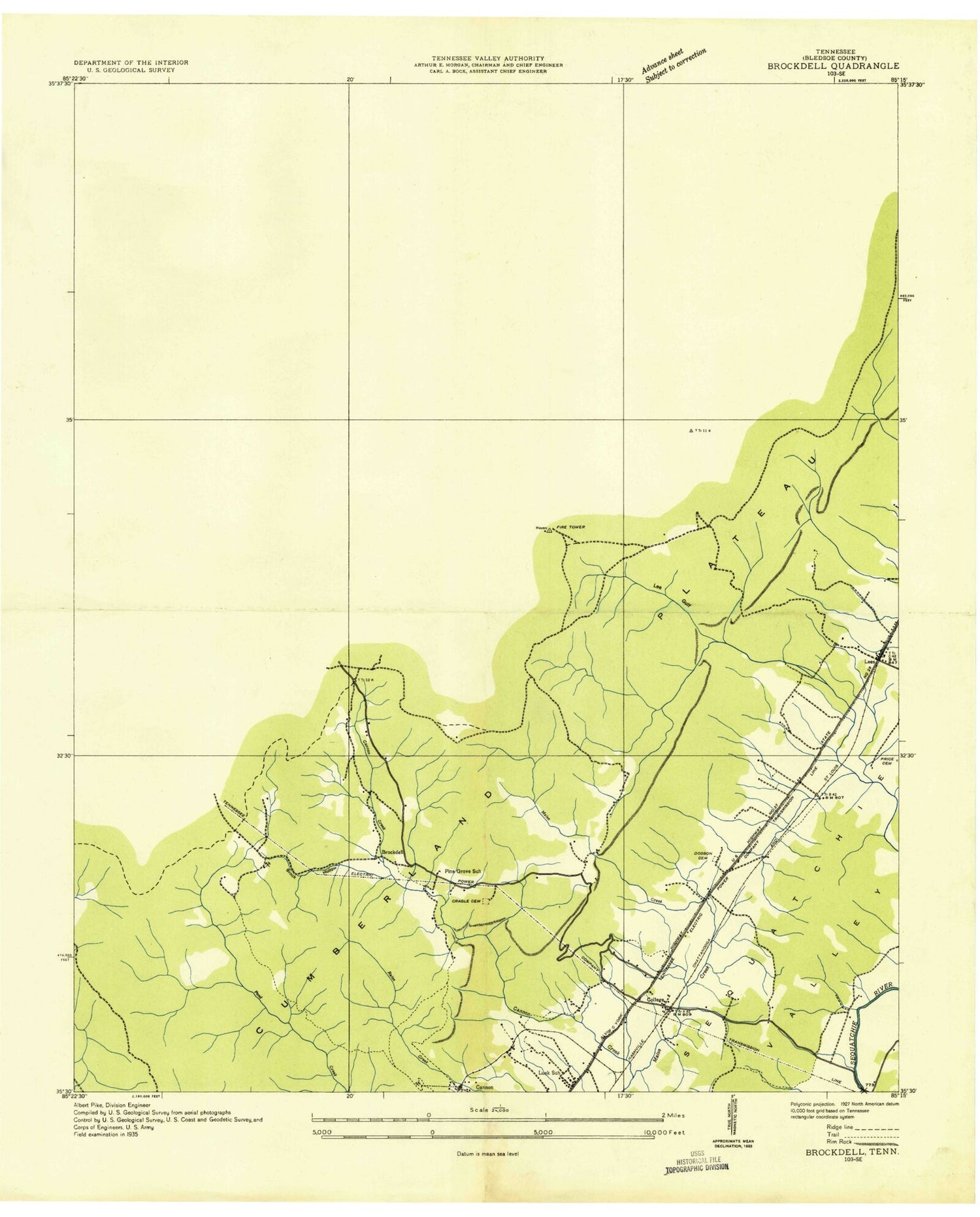
Classic USGS Brockdell Tennessee 7.5'x7.5' Topo Map
Couldn't load pickup availability
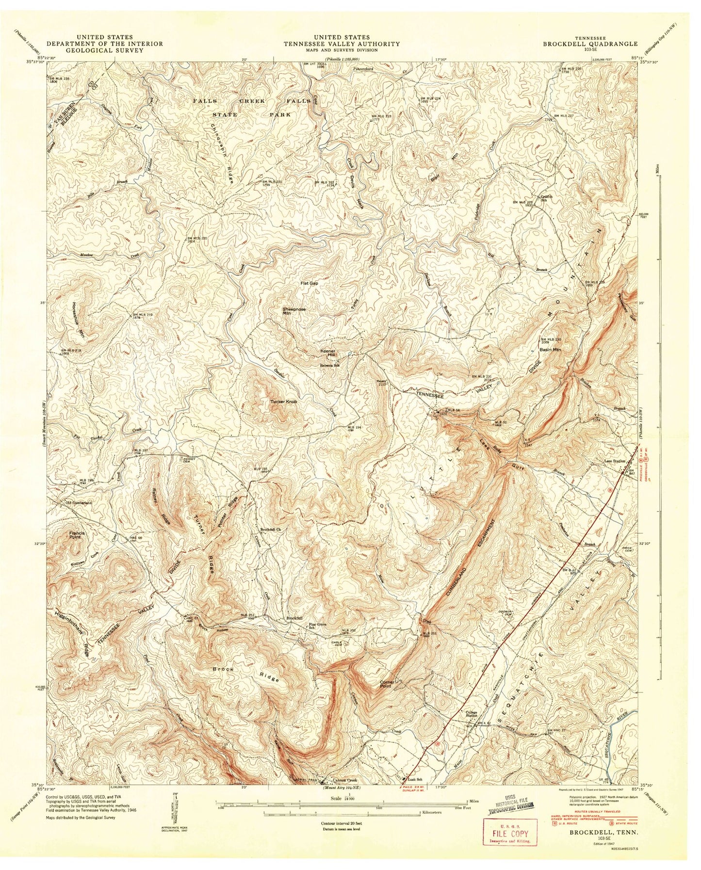
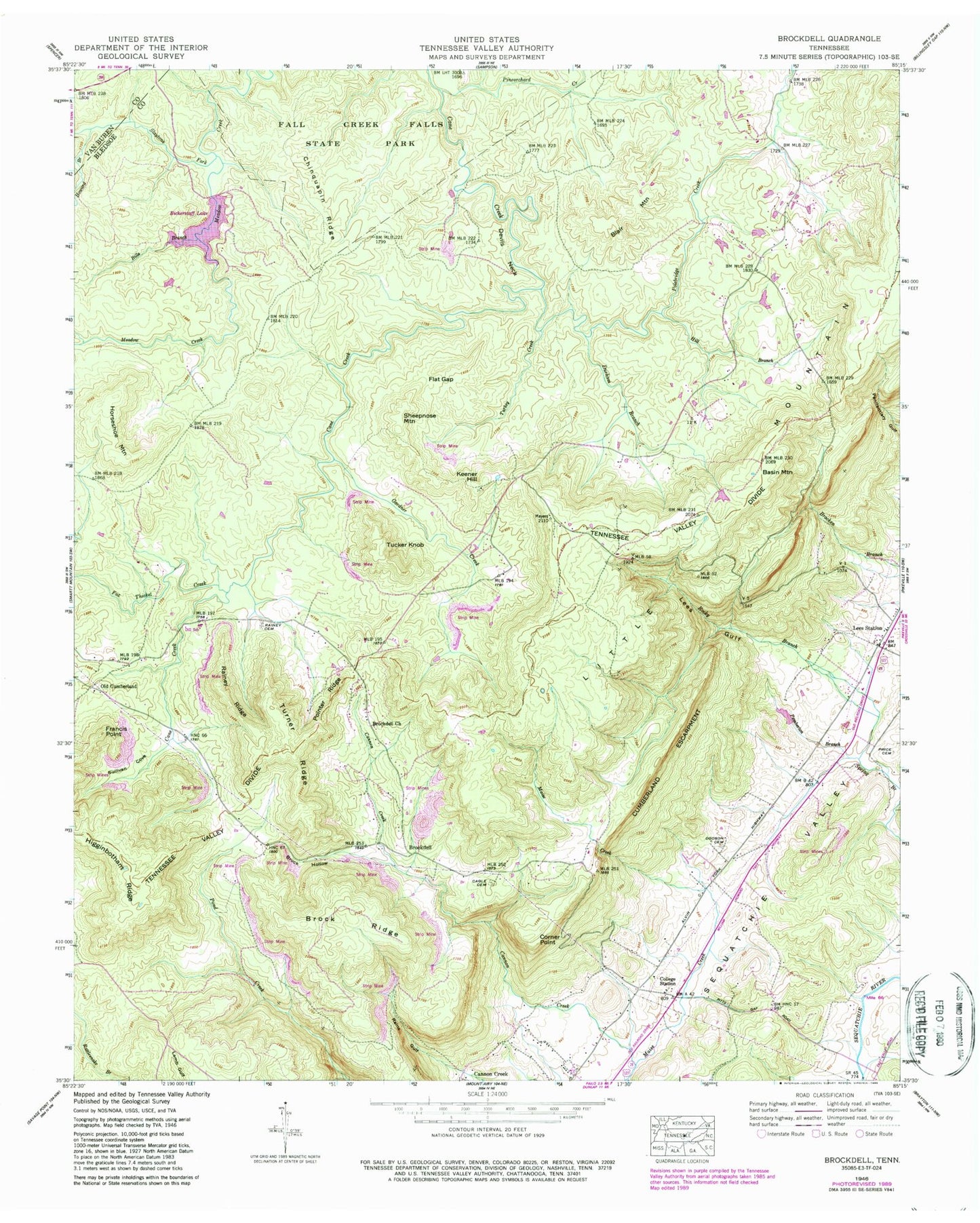
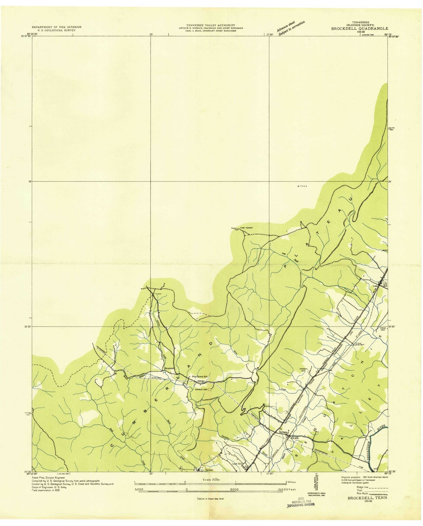
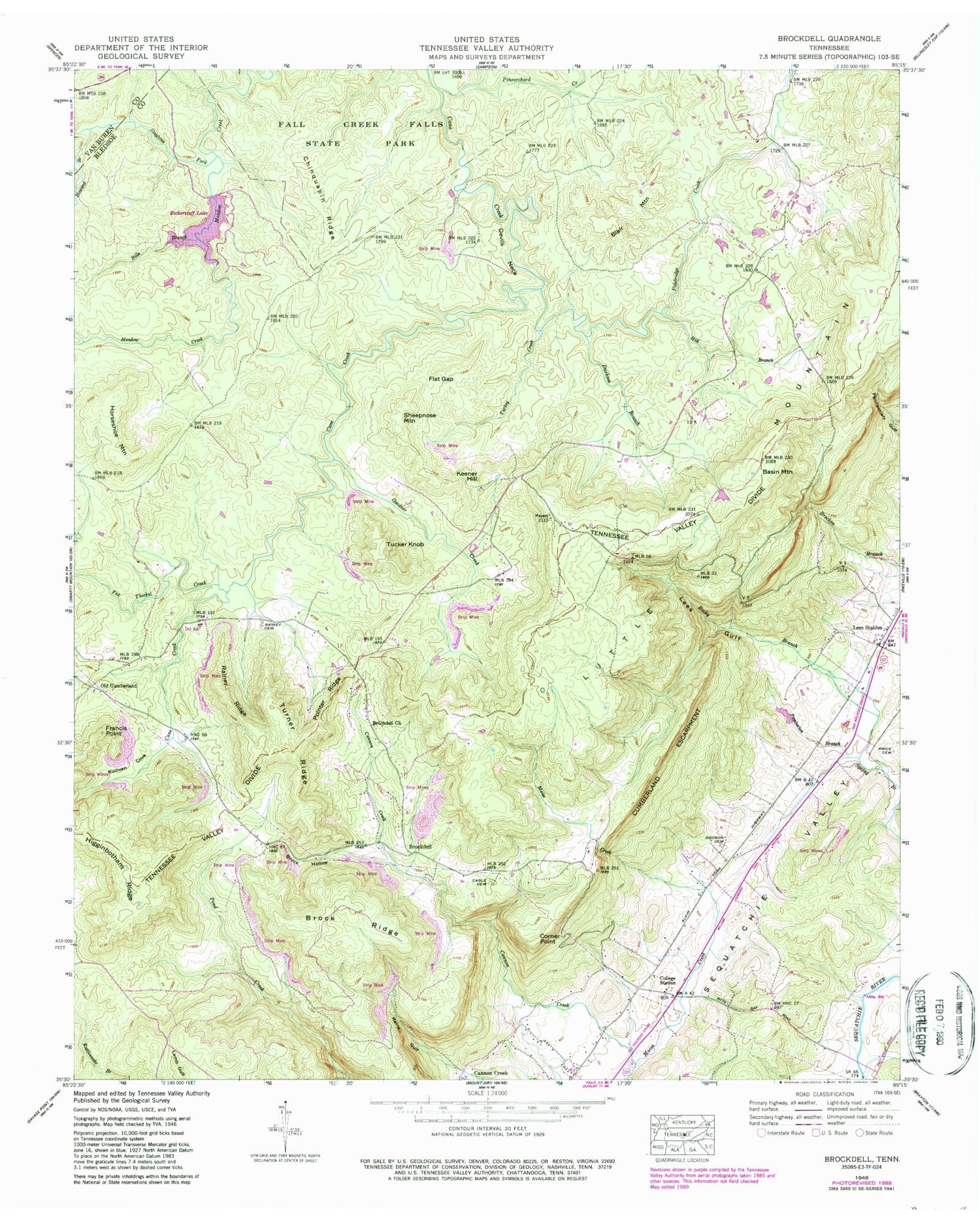
Historical USGS topographic quad map of Brockdell in the state of Tennessee. Typical map scale is 1:24,000, but may vary for certain years, if available. Print size: 24" x 27"
This quadrangle is in the following counties: Bledsoe, Van Buren.
The map contains contour lines, roads, rivers, towns, and lakes. Printed on high-quality waterproof paper with UV fade-resistant inks, and shipped rolled.
Contains the following named places: Little Mountain, Sheepnose Mountain, Slaytons Fork, Sullivan Cove, Tucker Knob, Turkey Creek, Turner Ridge, Basin Mountain, Bills Branch, Blair Mountain, Brock Hollow, Brock Ridge, Brockdell Church, Cagle Cemetery, Chinquapin Ridge, Corner Point, Devils Neck, Dodson Cemetery, Durham Branch, Flat Gap, Flat Rock Branch, Fox Thicket Creek, Francis Point, Gardner Creek, Griffith School, Higginbotham Ridge, Hill Branch, Horseshoe Mountain, Howard Branch, Keener Hill, Lees Gulf, Lees Station, Lusk School, Maise Creek, Pemberton Branch, Pine Grove School, Pineorchard Creek, Pointer Ridge, Polebridge Creek, Price Cemetery, Rainey Ridge, Rains Gulf, Rebecca School, Rocky Branch, Bickerstaff Lake, Meadow Creek Dam, Sequatchie College, Brockdell, Old Cumberland, Atpontly Mine, Bickford Mines, Colvard Mine, Dillard and Anderson Mines, Elliston Mine, Elson Mine, Johnson Mines, Keener Mines, Merriman Mine, Merriman Mine, Rainey Mine, Recupsido Mine, Robinson Cross Roads, Russell Mines, Smith Mine, Staggs Mine, Staggs Mine, Walters Mine, Whitlow Mine, Dill, Griffith, Lusk, Dill Elementary School, Commissioner District 1, Lusk Volunteer Fire Department, Brockdell Volunteer Fire Department, Little Mountain, Sheepnose Mountain, Slaytons Fork, Sullivan Cove, Tucker Knob, Turkey Creek, Turner Ridge, Basin Mountain, Bills Branch, Blair Mountain, Brock Hollow, Brock Ridge, Brockdell Church, Cagle Cemetery, Chinquapin Ridge, Corner Point, Devils Neck, Dodson Cemetery, Durham Branch, Flat Gap, Flat Rock Branch, Fox Thicket Creek, Francis Point, Gardner Creek, Griffith School, Higginbotham Ridge, Hill Branch, Horseshoe Mountain, Howard Branch, Keener Hill, Lees Gulf, Lees Station, Lusk School, Maise Creek, Pemberton Branch, Pine Grove School, Pineorchard Creek, Pointer Ridge, Polebridge Creek, Price Cemetery, Rainey Ridge, Rains Gulf, Rebecca School, Rocky Branch, Bickerstaff Lake, Meadow Creek Dam, Sequatchie College, Brockdell, Old Cumberland, Atpontly Mine, Bickford Mines, Colvard Mine, Dillard and Anderson Mines, Elliston Mine, Elson Mine, Johnson Mines, Keener Mines, Merriman Mine, Merriman Mine, Rainey Mine, Recupsido Mine, Robinson Cross Roads, Russell Mines, Smith Mine, Staggs Mine, Staggs Mine, Walters Mine, Whitlow Mine, Dill, Griffith, Lusk, Dill Elementary School, Commissioner District 1, Lusk Volunteer Fire Department, Brockdell Volunteer Fire Department