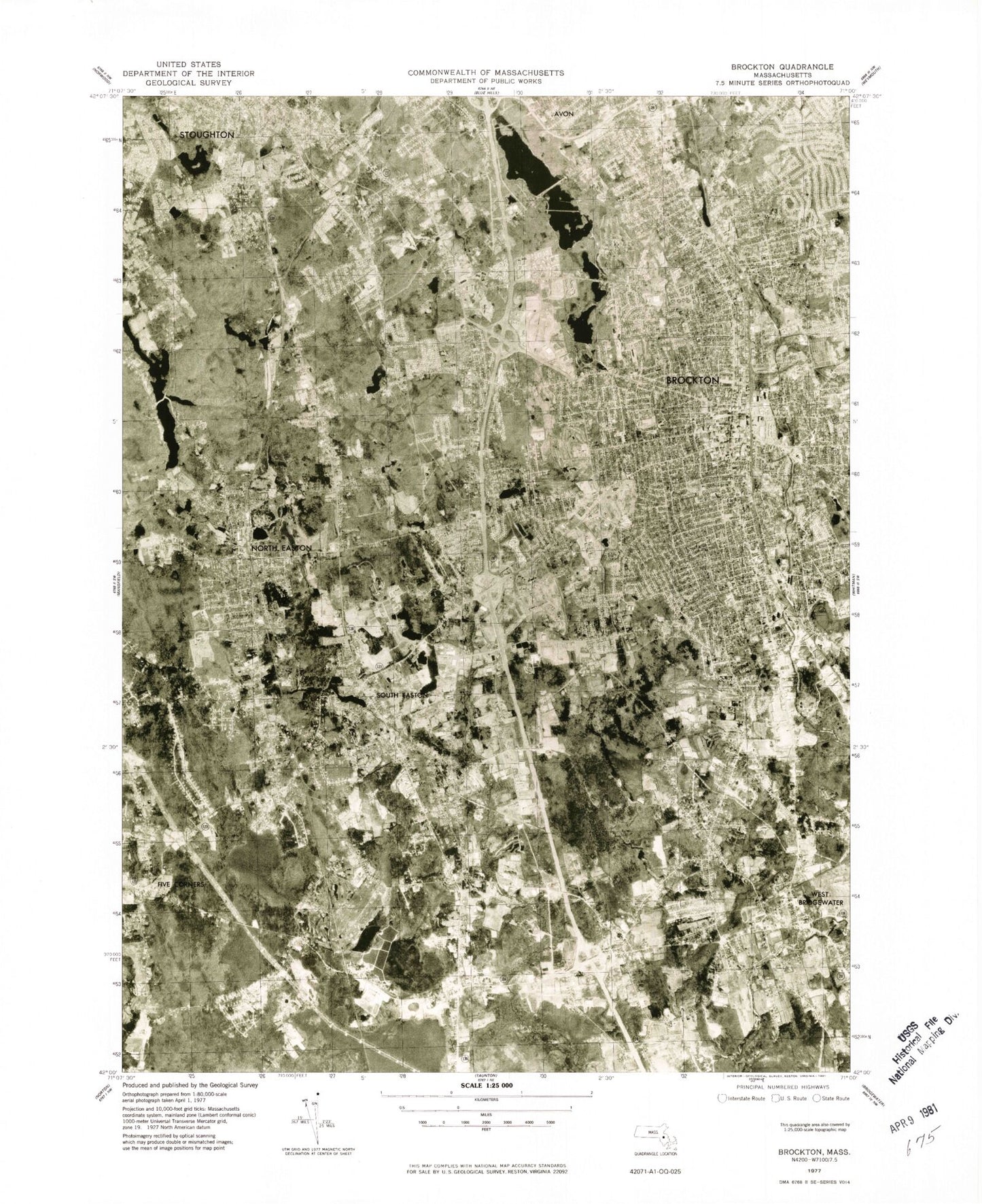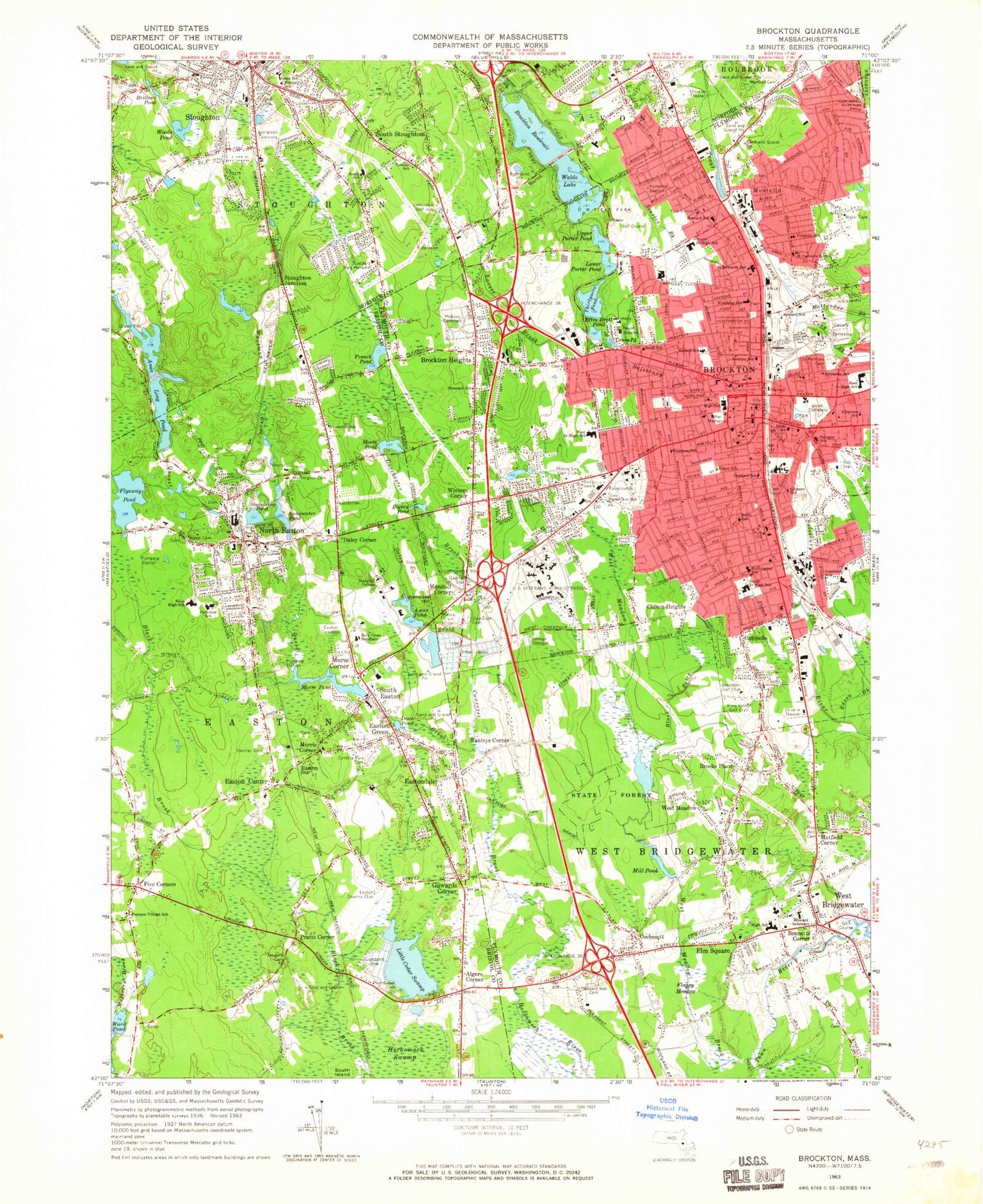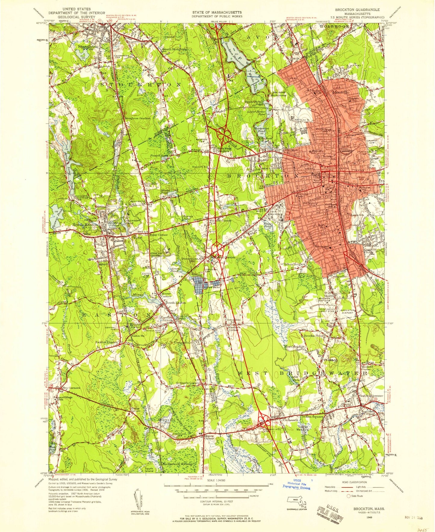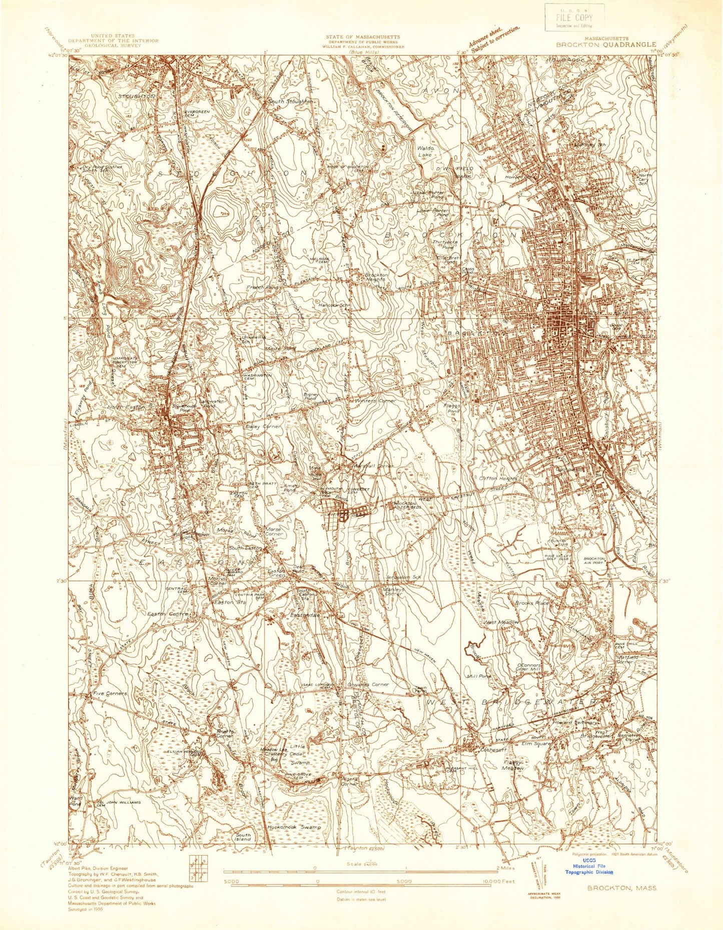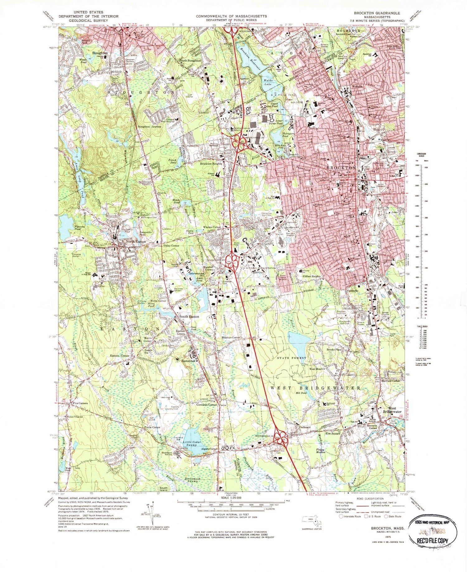

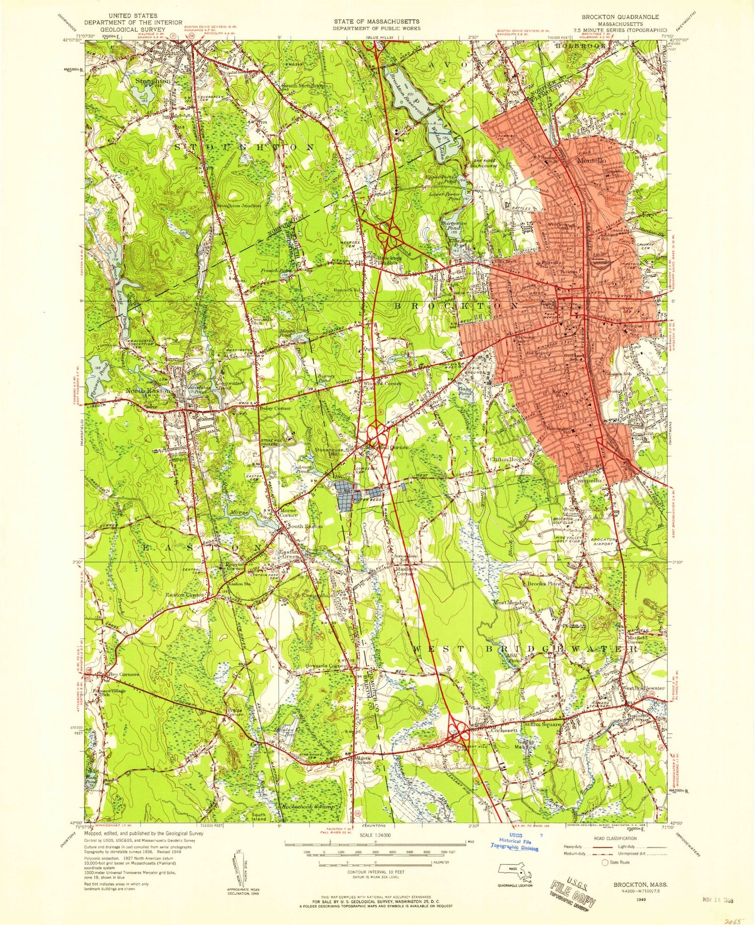
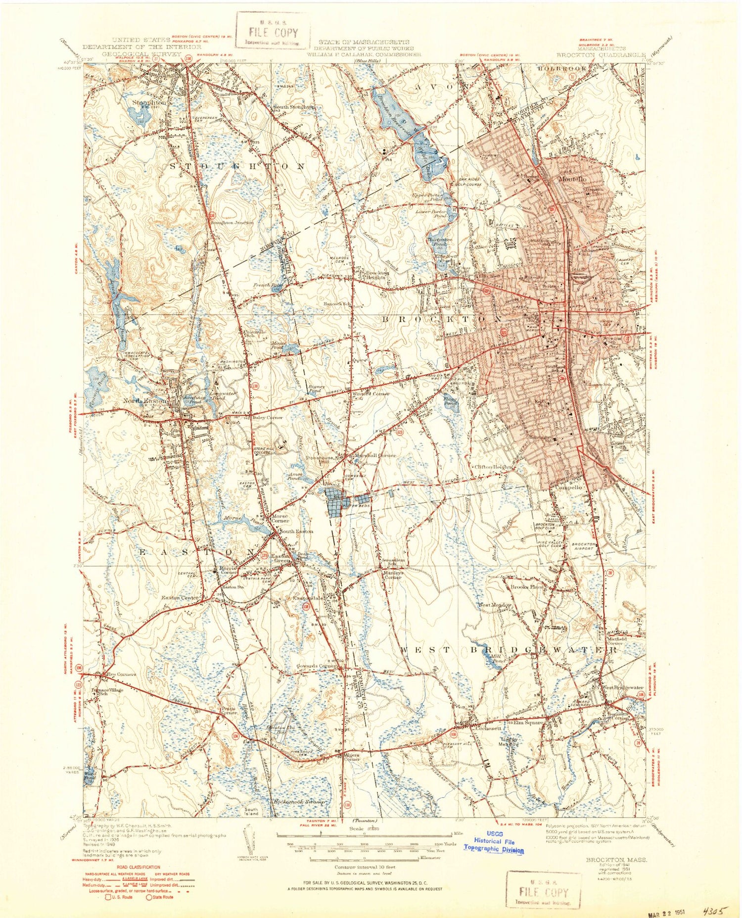

MyTopo
Classic USGS Brockton Massachusetts 7.5'x7.5' Topo Map
Couldn't load pickup availability
Historical USGS topographic quad map of Brockton in the state of Massachusetts. Typical map scale is 1:24,000, but may vary for certain years, if available. Print size: 24" x 27"
This quadrangle is in the following counties: Bristol, Norfolk, Plymouth.
The map contains contour lines, roads, rivers, towns, and lakes. Printed on high-quality waterproof paper with UV fade-resistant inks, and shipped rolled.
Contains the following named places: West Bridgewater, Wellington Bridge, Evergreen Cemetery, Edwin A Jones School, Kimball School, South Elementary School, Goddard Memorial Hospital, Wendell Cemetery, Butler Elementary School, Tolman School, Easton Townhall, Unionville School, Washington Street Cemetery, Easton Junior High School, Parkview Elementary School, Ames High School, South Easton Cemetery, Holy Cross Seminary, Cynthia Drake Cemetery, Central Cemetery, Holy Cross Church, Easton Country Club, Stonehill College, Furnace Village School, Elijah Howard Cemetery, Pine Grove Cemetery, Joseph H Gibbons School, D W Field Park, Cardinal Cushing Hospital, Melrose Cemetery, Hancock School, West Junior High School, Thorny Lea Golf Club, Forest Avenue School, Brockton High School, United States Veterans Administration Hospital, Chevra Tilum Cemetery, Coweeset Cemetery, Pleasant Hill Cemetery, West Bridgewater High School, Howard Seminary, Rose L MacDonald School, Pine Hill Cemetery, Pine Valley Golf Club, Brockton Golf Club, John F Kennedy School, Copeland School, South Junior High School, Huntington School, Gilmore School, Keith School, Marciano Stadium, Goddard School, Edgar School, Whitman School, Paine School, Union Cemetery, Brockton City Hall, Doctor W Arnone Community School, Saint Patricks Cemetery, East Junior High School, Perkins School, Russell School, Ellis Brett School, Calvary Cemetery, Ashland School, Winthrop School, Saint Edwards School, Franklin School, North Junior High School, Oscar F Raymond School, Howard School, Brookfield School, Southeastern Technical Institute, South Easton Station (historical), Wheelers Pond (historical), Sequassett Station (historical), Montello Station (historical), Campello Station (historical), West Bridgewater Station (historical), Cochesett Station (historical), The Village Mall, Center Shopping Plaza, Southgate Plaza, Points West Plaza, East Ashland Shopping Plaza, Cary Hill Plaza, Westgate Mall, Village Stores Shopping Center, Mill Pond Dam, West Meadow Brook Pond, West Meadow Brook Dam, Morse Pond Dam, Ames Pond Dam, Bigney Pond Dam, Longwater Pond Dam, Shovelshop Pond Dam, Monte Pond Dam, French Pond Dam, Lower Porter Pond Dam, Upper Porter Pond Dam, Waldo Lake Dam, Brockton Reservoir Dam, John F Kennedy Library and Museum, Manleys Corner, Algers Corner, Ames Long Pond, Ames Pond, Beaver Brook, Bennetts Corner, Bigney Pond, Black Betty Brook, Brittons Pond, Brockton Reservoir, Brooks Place, Brockton Heights, Campello, Cary Brook, Clifton Heights, Cochesett, Coweeset Brook, Cross Pond, Daley Brook, Daley Corner, Dean Pond, Dorchester Brook, Easton Center, Eastondale, Easton Green, Easton Station, Edson Brook, Ellis Brett Pond, Elm Square, Five Corners, Flaggy Meadow, Flyaway Pond, French Brook, French Pond, Gowards Corner, Little Cedar Swamp, Longwater Pond, Lovett Brook, Lower Porter Pond, Malfardar Brook, Marshall Corner, Matfield Corner, Mill Pond, Montello, Monte Pond, Morris Corner, Morse Corner, Morse Pond, Mulberry Brook, North Easton, Pratts Corner, Queset Brook, Salisbury Brook, Searles Brook, Shovelshop Pond, South Easton, South Island, South Stoughton, Stonehouse Hill, Stoughton Junction, Thirtyacre Pond, Upper Porter Pond, Waldo Lake, Ward Pond, West Meadow, West Meadow Brook, Whitman Brook, Winters Corner, Woods Pond, Brockton, Town of Stoughton, Town of West Bridgewater, South Easton Post Office (historical), Eastondale Post Office (historical), Brockton Post Office (historical), Brockton Station Post Office (historical), Campello Post Office (historical), West Bridgewater Post Office (historical), Cochesett Post Office (historical), Goddard Hospital Heliport, Veracka Heliport (historical), Brockton US Army Reserve Center Heliport, Town of Easton, City of Brockton, WMSX-AM (Brockton), WBET-AM (Brockton), WBET-AM (Brockton), WCAV-FM (Brockton), WSHL-FM (Easton), Brockton Airport (historical), Campanelli Industrial Park, Cedar Hill Golf Course, Center School, Copeland School (historical), D W Field Park, Flagg Pond, Immaculate Conception Cemetery, Jerusalem School (historical), North Cary School (historical), North Easton Grammar School, Pine Valley Golf Club (historical), Smith School (historical), Town Farm (historical), Westgate Shopping Center, First Congregational Church, Stoughton Public Library, Trinity Episcopal Church, Annunciation Greek Orthodox Church, Bethel Church of the Nazarene, Bickley Playground, Brockton Assembly of God Church, Brockton Country Club, Brockton French Seventh Day Adventist Church, Brockton Haitian Church, Brockton Law Library, Brockton Post Office, Brockton Public Library, Veterans Affairs Boston Healthcare System Brockton Division, Campello Post Office, Brockton Fire Department Station 1 Tactical Support Unit, Christ Congregational Church, Church of God of Prophecy, Cochesett United Methodist Church, D W Field Golf Course, Davis Square, Department of Veterans Affairs Medical Center Library, Easton Town Hall, Faith Christian Fellowship, First Baptist Church, First Church, First Church of the Nazarene, First Lutheran Church