
MyTopo
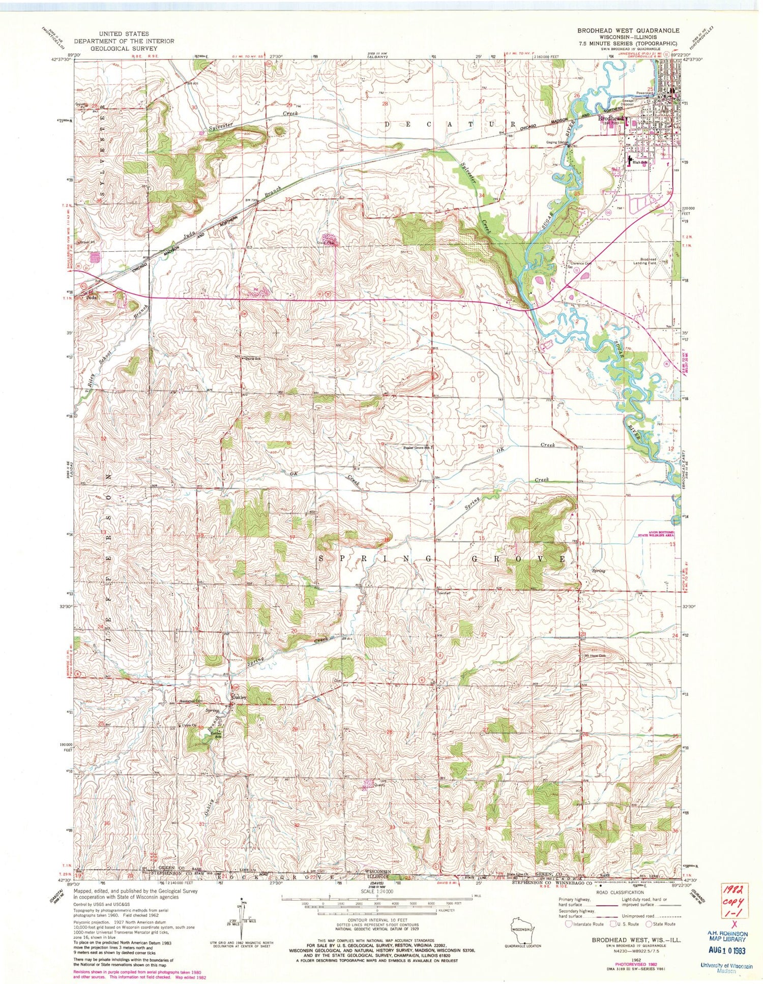
Classic USGS Brodhead West Wisconsin 7.5'x7.5' Topo Map
Couldn't load pickup availability
Historical USGS topographic quad map of Brodhead West in the states of Wisconsin, Illinois. Map scale may vary for some years, but is generally around 1:24,000. Print size is approximately 24" x 27"
This quadrangle is in the following counties: Green, Stephenson, Winnebago.
The map contains contour lines, roads, rivers, towns, and lakes. Printed on high-quality waterproof paper with UV fade-resistant inks, and shipped rolled.
Contains the following named places: Basswood Cemetery, Boeke Farm, Brodhead, Brodhead Airport, Brodhead Area Emergency Medical Services, Brodhead Fire District, Brodhead High School, Brodhead Middle School, Brodhead Police Department, Brodhead Post Office, Brodhead Wastewater Treatment Facility, Cardinal Crest, Church of the Nazarene, City of Brodhead, Clarence, Clarence Cemetery, Davis School, Figi Valley Farms, Happy Hollow, Juda Branch, Mount Hope Cemetery, Oakley, Oakley Branch, Oakley School, OK Creek, Poplar Grove School, Riley School Branch, Ronald Albrecht Elementary School, Saint Rose of Lima Catholic Church, Spring Creek, State Line Cemetery, State Line Church, Sylvester Creek, Town of Spring Grove, Union Church, Weir White Oaks State Natural Area, ZIP Code: 53550


