MyTopo
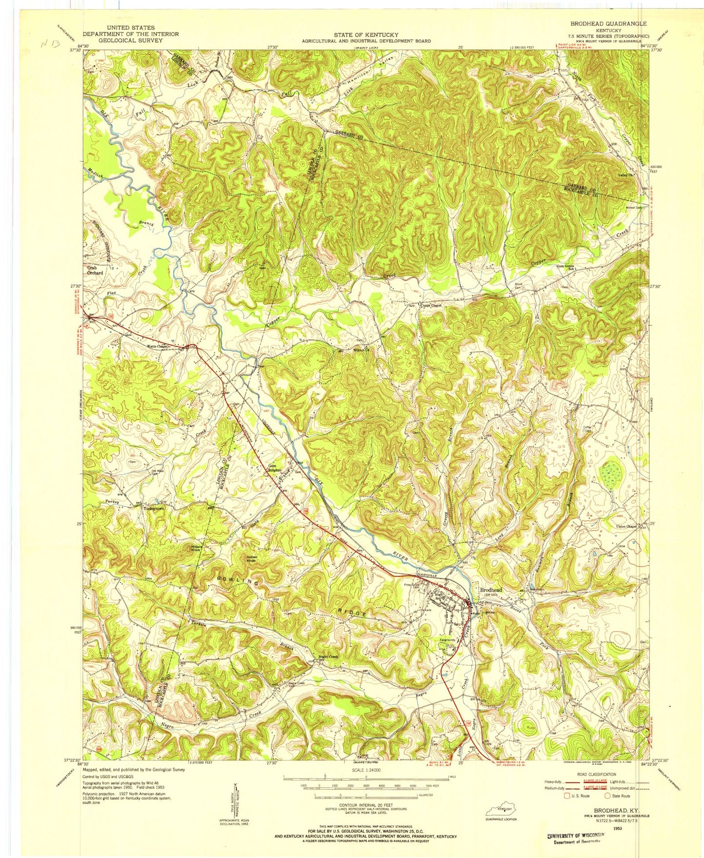
Classic USGS Brodhead Kentucky 7.5'x7.5' Topo Map
Couldn't load pickup availability
Historical USGS topographic quad map of Brodhead in the state of Kentucky. Map scale may vary for some years, but is generally around 1:24,000. Print size is approximately 24" x 27"
This quadrangle is in the following counties: Garrard, Lincoln, Rockcastle.
The map contains contour lines, roads, rivers, towns, and lakes. Printed on high-quality waterproof paper with UV fade-resistant inks, and shipped rolled.
Contains the following named places: Albright Graveyard, Boone Fork, Bowling Ridge, Bowman Branch, Brock Cemetery, Brodhead, Brodhead Fire Department, Brodhead Post Office, Brodhead Railroad Station, Christian Assembly Campground, City of Brodhead, Copper Creek, Copper Creek School, Cupps Chapel, Dripping Spring Post Office, Dripping Spring Resort, Fall Lick, Flax Creek, Gentontown, Grassy Branch, Gum Grove School, Gum Sulpher Post Office, Gum Sulpher Railroad Station, Gum Sulphur, Hamilton Valley, Holdams Mill, Indian Branch, Indian Knob, Long Branch, Maywood, Millers Knob, Negro Creek, Negro Creek Cemetery, Negro Creek School, Old Moss Cemetery, Piney Grove Cemetery, Slaty Branch, Stigalls Stand, Tarkin Branch, Thompson Store, Turkey Creek, Turkeytown, Turkeytown School, Union Chapel, Valley Church, Watts Chapel Baptist Church, Watts Chapel School, Wilmot Cemetery, Wilmot Church, ZIP Code: 40419