MyTopo
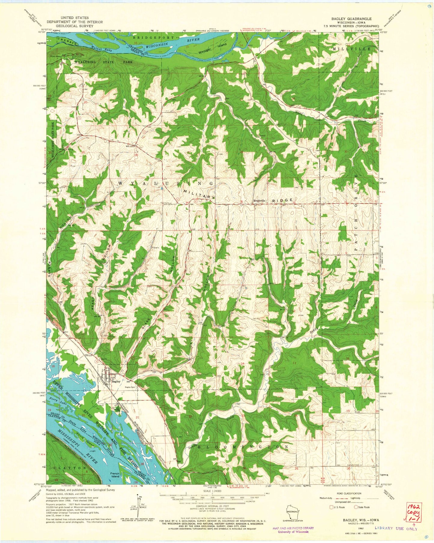
Classic USGS Brodtville Wisconsin 7.5'x7.5' Topo Map
Couldn't load pickup availability
Historical USGS topographic quad map of Brodtville in the states of Wisconsin, Iowa. Map scale may vary for some years, but is generally around 1:24,000. Print size is approximately 24" x 27"
This quadrangle is in the following counties: Clayton, Crawford, Grant.
The map contains contour lines, roads, rivers, towns, and lakes. Printed on high-quality waterproof paper with UV fade-resistant inks, and shipped rolled.
Contains the following named places: Bagley, Bagley Cemetery, Bagley Post Office, Bagley Volunteer Fire Department, Bagley Wastewater Treatment Facility, Brodtville, Clarks Branch, Dry Hollow, Ferry Lake, Flint Cemetery, Gasner Hollow, Gasner Hollow Prairie State Natural Area, Glass Hollow, Hoosier Lake, Hovie Island, Jays Lake, Lane Creek, Ready Hollow, State Line Slough, Town of Bloomington, Town of Wyalusing, Village of Bagley, Walnut Eddy, Weniger Island, Wyalusing Hardwood Forest State Natural Area, Wyalusing State Park, Wyalusing Walnut Forest State Natural Area, ZIP Code: 53801