MyTopo
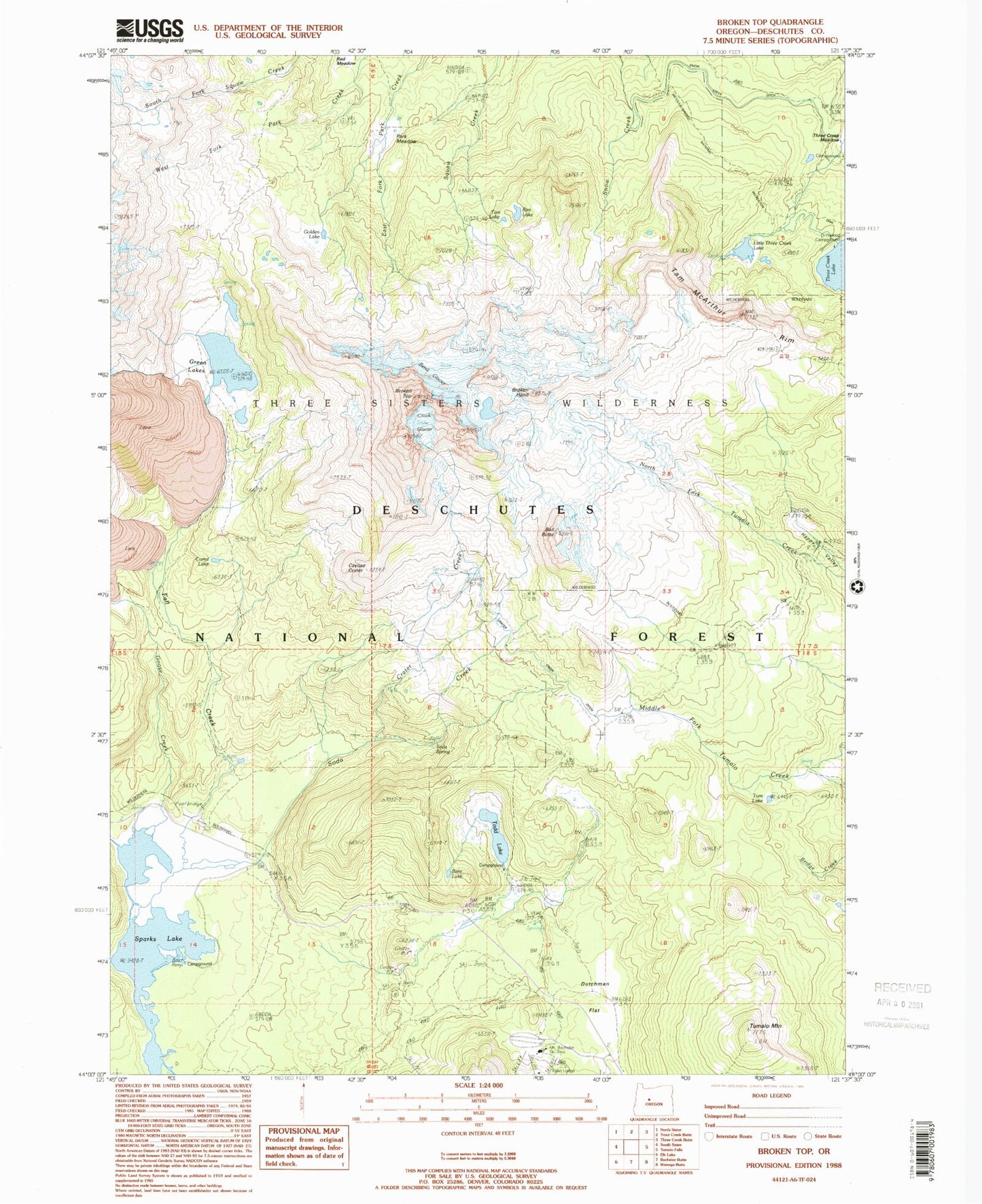
USGS Classic Broken Top Oregon 7.5'x7.5' Topo Map
Couldn't load pickup availability
Historical USGS topographic quad map of Broken Top in the state of Oregon. Scale: 1:24000. Print size: 24" x 27"
This quadrangle is in the following counties: Deschutes.
The map contains contour lines, roads, rivers, towns, lakes, and grids including latitude / longitude and UTM / MGRS. Printed on high-quality waterproof paper with UV fade-resistant inks.
Contains the following named places: Mud Lake Trail, Ball Butte, Bare Lake, Bend Glacier, Broken Top, Broken Top Trail, Cayuse Crater, Corral Lake, Crater Creek, Crater Creek Ditch, Crook Glacier, Ditch Cabin, Driftwood Recreation Site, Dutchman Flat, Egan Memorial Lodge (historical), Fall Creek, Fall Creek Cabin, Golden Lake, Goose Creek, Green Lakes, Little Three Creek Lake, Park Meadow, Rim Lake, Soda Creek, Soda Creek Recreation Site, Soda Spring, Sparks Lake, Tam Lake, Tam McArthur Rim, Three Creek Lake Trail, Todd Lake, Tum Lake, Tumalo Mountain, Little Crater Creek, Broken Hand, Three Creek Meadow, Three Creek Lake, Little Three Creek Lake Dam, Sparks Lake Recreation Site, Trapper Meadow Camp (historical), Todd Lake Recreation Site, Dutchman Sno-Park, Todd Horse Camp, West Village Lodge, Nordic Center, Sparks Lake Boat Ramp, Prowell Springs