MyTopo
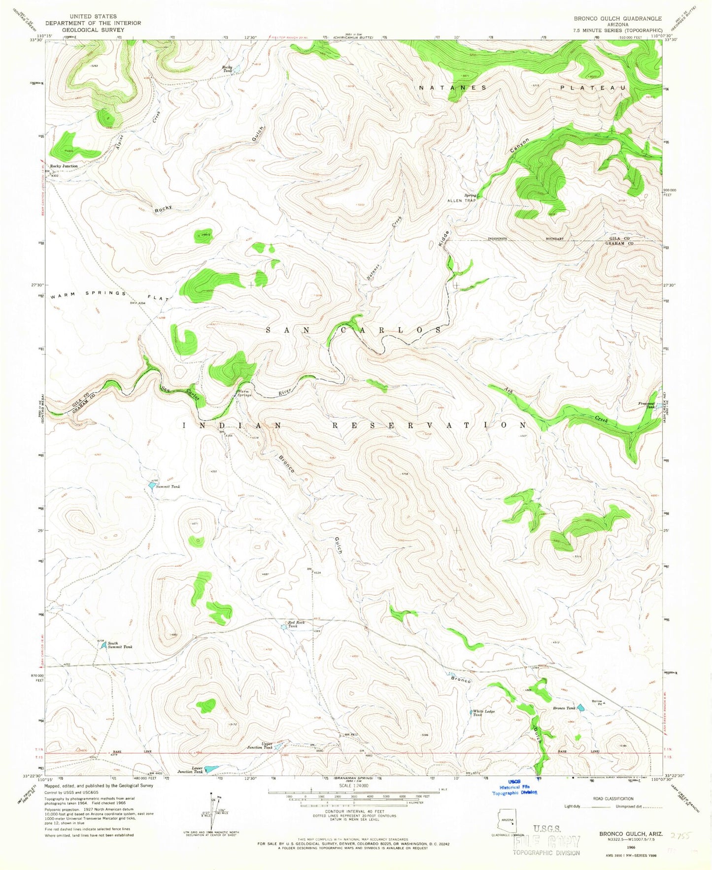
Classic USGS Bronco Gulch Arizona 7.5'x7.5' Topo Map
Regular price
$16.95
Regular price
Sale price
$16.95
Unit price
per
Couldn't load pickup availability
Historical USGS topographic quad map of Bronco Gulch in the state of Arizona. Map scale may vary for some years, but is generally around 1:24,000. Print size is approximately 24" x 27"
This quadrangle is in the following counties: Gila, Graham.
The map contains contour lines, roads, rivers, towns, and lakes. Printed on high-quality waterproof paper with UV fade-resistant inks, and shipped rolled.
Contains the following named places: Allen Trap, Alpine Creek, Ash Creek, Bronco Gulch, Bronco Tank, Freezeout Tank, Kidde Canyon, Lower Junction Dam, Lower Junction Tank, Natanes Creek, Red Rock Tank, Rocky Junction, Rocky Tank, South Summit Tank, Summit Tank, Upper Junction Tank, Warm Springs, White Ledge Tank