MyTopo
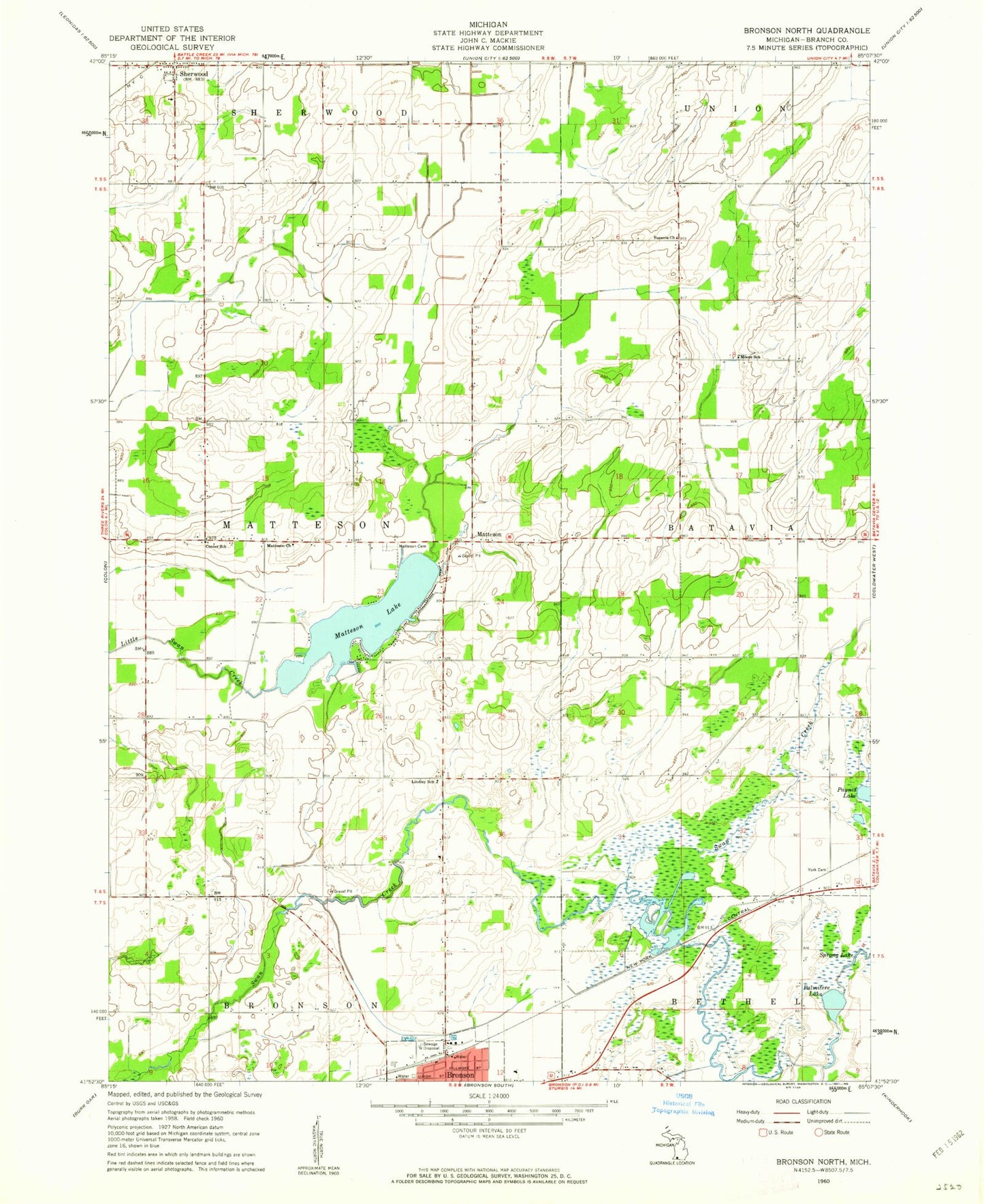
Classic USGS Bronson North Michigan 7.5'x7.5' Topo Map
Couldn't load pickup availability
Historical USGS topographic quad map of Bronson North in the state of Michigan. Map scale may vary for some years, but is generally around 1:24,000. Print size is approximately 24" x 27"
This quadrangle is in the following counties: Branch.
The map contains contour lines, roads, rivers, towns, and lakes. Printed on high-quality waterproof paper with UV fade-resistant inks, and shipped rolled.
Contains the following named places: Bassett Lake, Batavia Church, Bronson Station, Center School, Dorsey Lake, Indian Cove Estates Mobile Home Park, Lindley School, Matteson, Matteson Cemetery, Matteson Church, Matteson Lake, Mattison Post Office, Moore School, Palmitere Lake, Sherwood Free Methodist Church, Township of Matteson, Village of Sherwood, York Cemetery