MyTopo
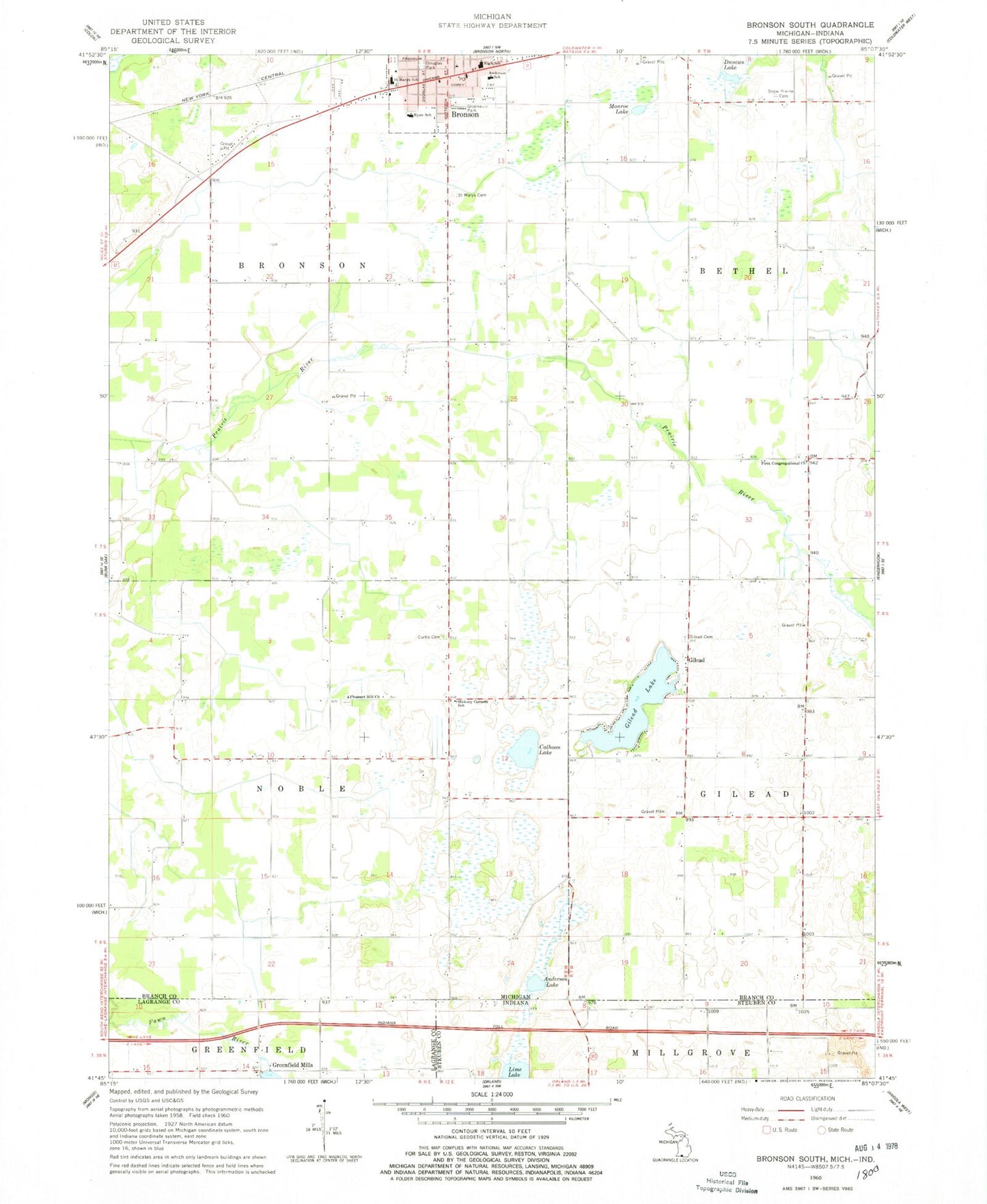
Classic USGS Bronson South Michigan 7.5'x7.5' Topo Map
Couldn't load pickup availability
Historical USGS topographic quad map of Bronson South in the states of Michigan, Indiana. Map scale may vary for some years, but is generally around 1:24,000. Print size is approximately 24" x 27"
This quadrangle is in the following counties: Branch, LaGrange, Steuben.
The map contains contour lines, roads, rivers, towns, and lakes. Printed on high-quality waterproof paper with UV fade-resistant inks, and shipped rolled.
Contains the following named places: Anderson Lake, Anderson School, Bronson, Bronson Cemetery, Bronson Family Health Center, Bronson Fire Department, Bronson Junior Senior High School, Bronson Police Department, Bronson Post Office, Bronson Public Library, Bronson Public Library Historical Marker, Calhoon Lake, Chicago Road Historical Marker, Chicago Street School, Church of Christ at Bronson, City of Bronson, Curtis Cemetery, Douglas Park, Duncan Lake, First Baptist Church, First Congregational Church, First United Methodist Church, Gilead, Gilead Lake, Gilead Post Office, Greenfield Mills, Greenfield Reservoir, Greenfield Reservoir Dam, Greenwald Park, Haight Cemetery, Hickory Corners School, Lime Lake, Monroe Lake, Noble Post Office, North Gilead Cemetery, Pleasant Hill Cemetery, Pleasant Hill Church, Prairie River Golf Club, Ryan School, Saint Marys Cemetery, Saint Marys School, Snow Prairie Cemetery, South Gilead Hoopingerner Cemetery, Township of Bronson, Township of Noble, Westbrook Home, ZIP Code: 49028