MyTopo
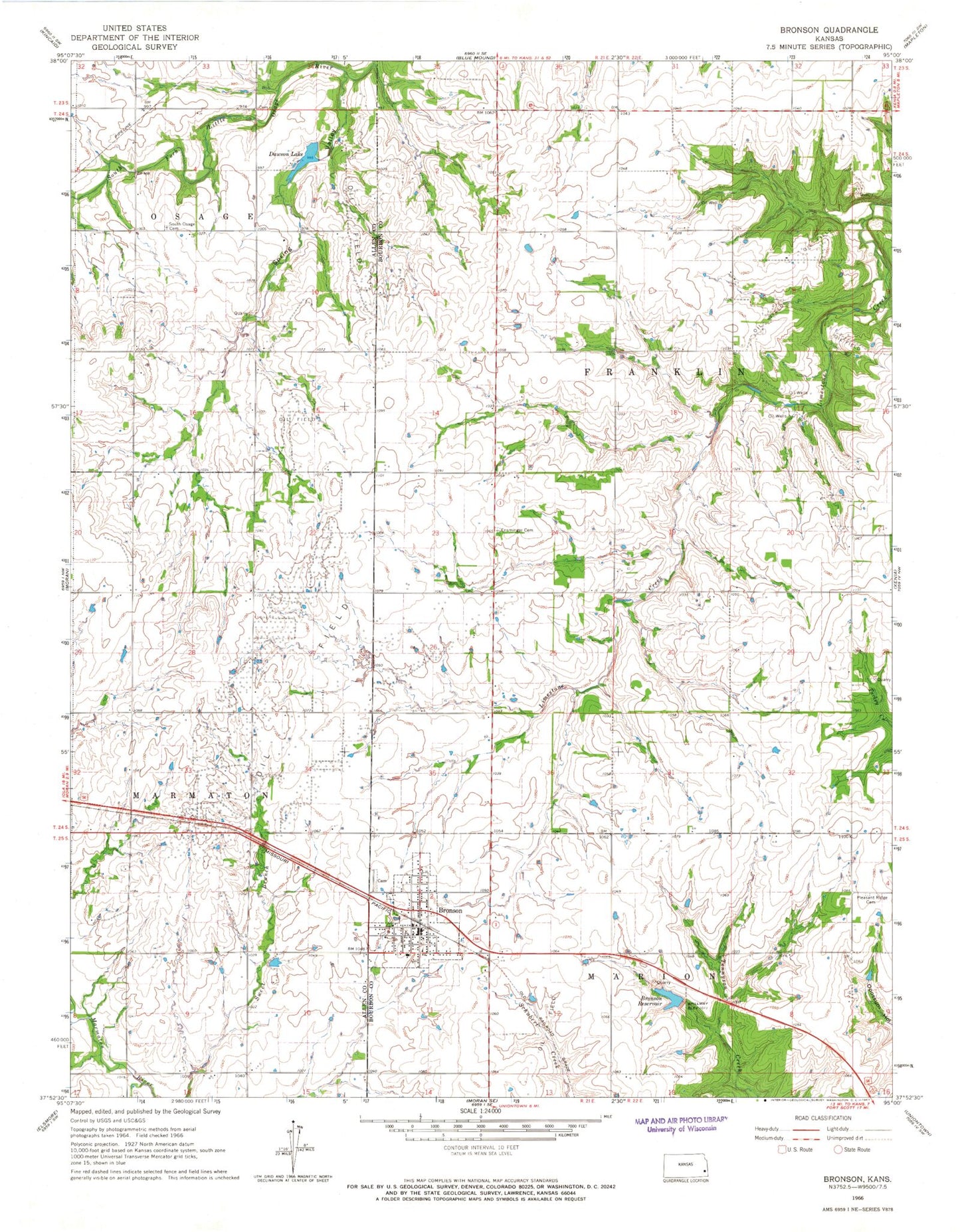
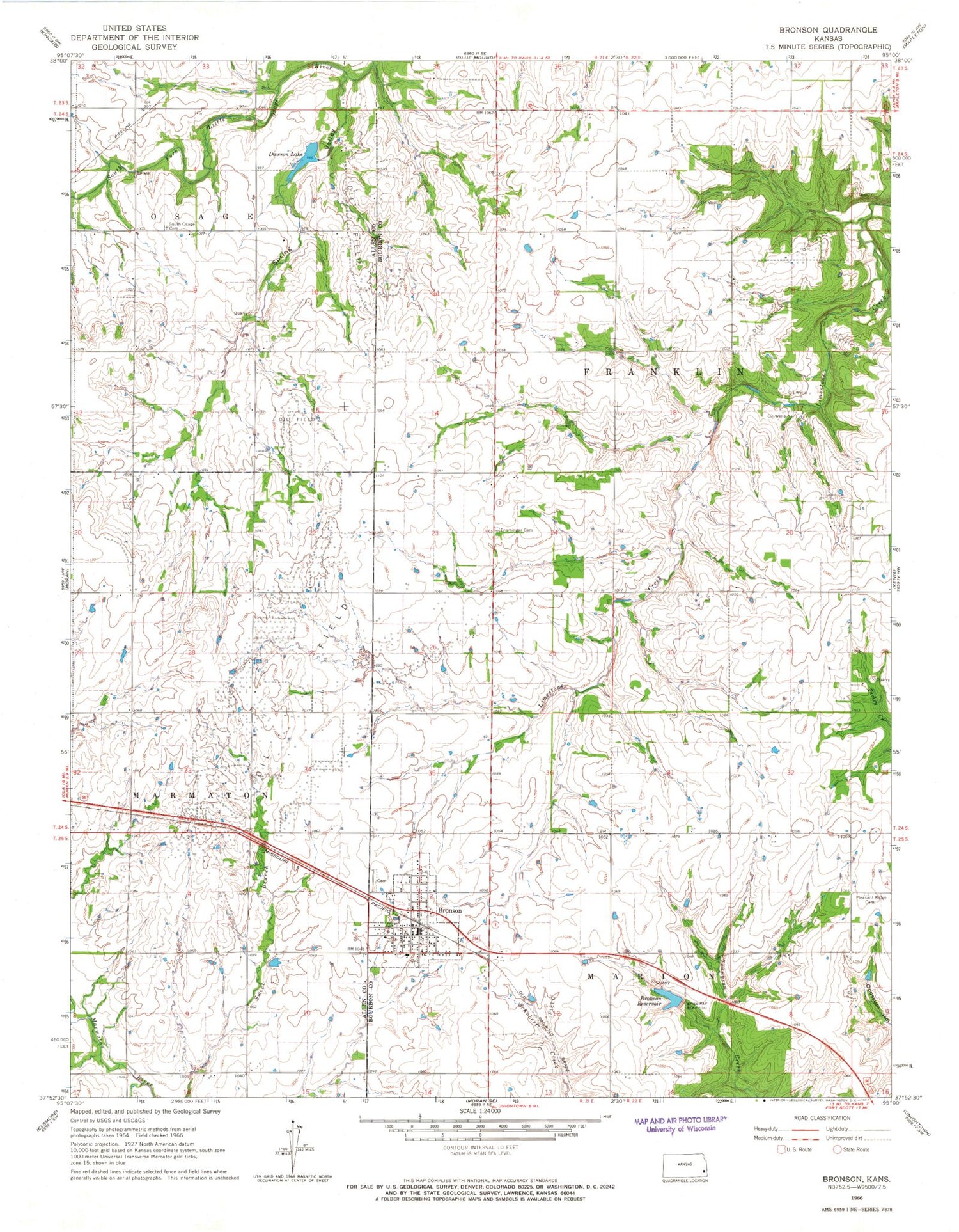
Classic USGS Bronson Kansas 7.5'x7.5' Topo Map
Couldn't load pickup availability
Historical USGS topographic quad map of Bronson in the state of Kansas. Map scale may vary for some years, but is generally around 1:24,000. Print size is approximately 24" x 27"
This quadrangle is in the following counties: Allen, Bourbon.
The map contains contour lines, roads, rivers, towns, and lakes. Printed on high-quality waterproof paper with UV fade-resistant inks, and shipped rolled.
Contains the following named places: Beachner Grain Elevator Number 5, Bourbon County Fire District 3 Station 8, Bronson, Bronson Baptist Church, Bronson Cemetery, Bronson City Hall, Bronson Police Department, Bronson Post Office, Bronson Public Library, Bronson Reservoir, Bronson Sewer Treatment Plant, Bronson United Methodist Church, Bronson Water Storage Dam, City of Bronson, Dawson Lake, Dawson Lake Dam, East Maple Grove School, Ensminger Cemetery, Gillham Cemetery, Hope Chapel Assembly of God Church, Limestone School, New Hope School, North Fairview School, Osage Valley School, Pleasant Ridge School, Pleasant View Cemetery, Spring Valley, Spring Valley School, Stony Point School, Township of Franklin, ZIP Code: 66716