MyTopo
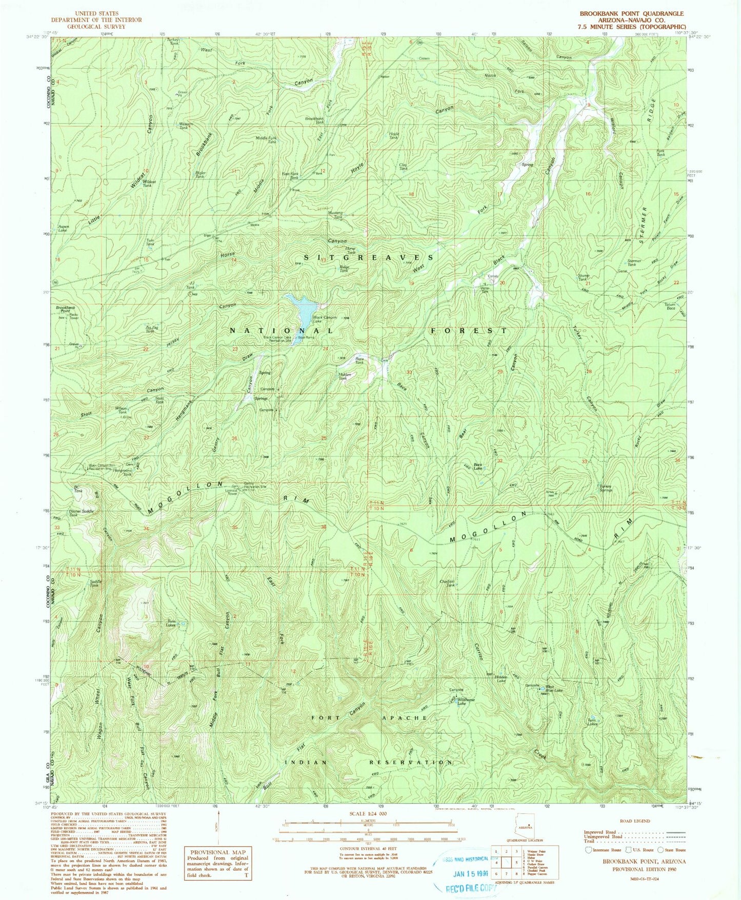
Classic USGS Brookbank Point Arizona 7.5'x7.5' Topo Map
Couldn't load pickup availability
Historical USGS topographic quad map of Brookbank Point in the state of Arizona. Typical map scale is 1:24,000, but may vary for certain years, if available. Print size: 24" x 27"
This quadrangle is in the following counties: Navajo.
The map contains contour lines, roads, rivers, towns, and lakes. Printed on high-quality waterproof paper with UV fade-resistant inks, and shipped rolled.
Contains the following named places: Baca Canyon, Baca Lake, Baca Ranch, Bear Canyon, Big Canyon, Bigler Tank, Brookbank Point, East Fork Brookbank Canyon, Gentry Canyon, Gibson Ranch, Hidden Tank, Horse Canyon, Hoyle Canyon, Jersey Canyon, Middle Fork Brookbank Canyon, North Fork Black Canyon, Saloon Canyon, Stermer Ridge, Stott Canyon, Tatum Baca, Turkey Canyon, Turkey Springs, Twin Lakes, Twin Lakes, Twin Springs, West Blue Lake, West Fork Black Canyon, West Fork Brookbank Canyon, West Holcomb Trail, Wildhorse Lake, Wilford Canyon, Wilford Spring, Baca Cemetery, Baca Tank, Black Canyon Campground, Black Canyon Dam, Black Canyon Lake, Black Canyon Rim Campground, Blue Lake Campground, Chediski Tank, East Fork Tank, Gentry Campground, Horse Tank, Hoyle Tank, Jersey Tank, Middle Fork Tank, Stermer Tank, Twin Tank, Wildcat Tank, Wildhorse Lake Campground, B.C. Tank, Black Canyon Lake Recreation Site, Brookbank Tank, Clay Tank, Dinner Saddle Tank, Fork Tank, Gentry Lookout Tower, Gentry Recreation Site, Hangmans Tank, J.J. Tank, Turkey Tank, Middle Fork Bull Flat Canyon, Mustang Tank, Ridge Tank, Saddle Tank, Stump Tank, Western Tank, Wilson Tank, Zig Zag Tank, Hangmans Draw, Bull Flat Ridge, Ellsworth Ranch, North Fork Trick Tank, Jersey Tank, Brookbank Electronic Site, Canyon Creek, Stott Tank, Black Canyon Lake Boat Launch, Baca Meadow, Hangmans Trail, Hangmans Trailhead, East Fork Bull Flat Canyon, Rock Bluff Trail, Three Oak Trail, West Buckskin Trail