
MyTopo
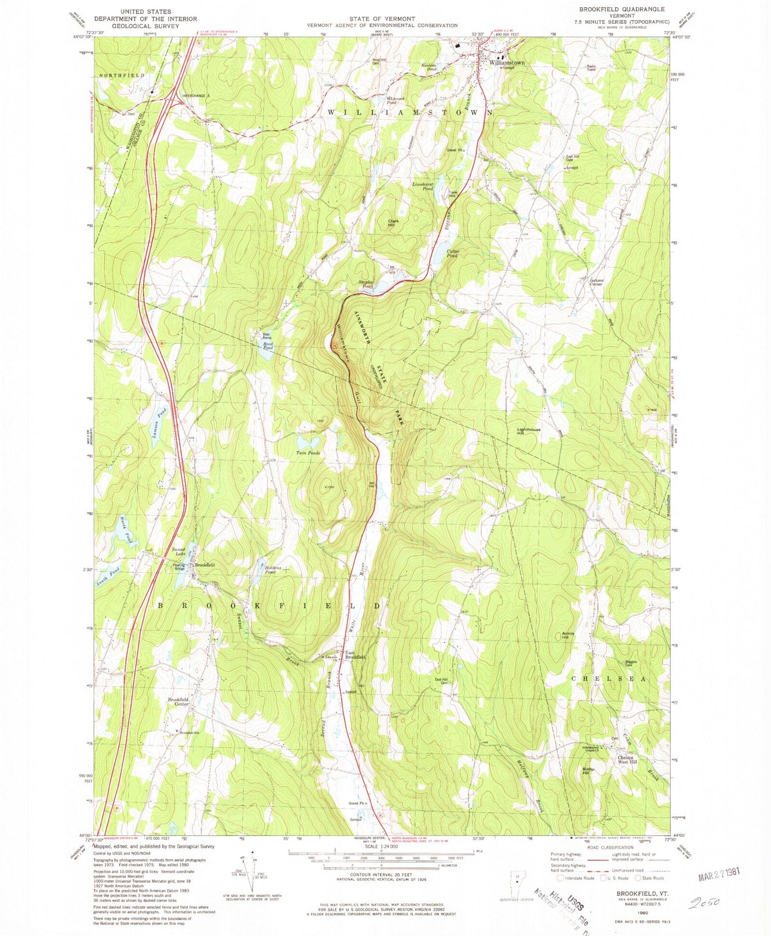
Classic USGS Brookfield Vermont 7.5'x7.5' Topo Map
Couldn't load pickup availability
Historical USGS topographic quad map of Brookfield in the state of Vermont. Typical map scale is 1:24,000, but may vary for certain years, if available. Print size: 24" x 27"
This quadrangle is in the following counties: Orange, Washington.
The map contains contour lines, roads, rivers, towns, and lakes. Printed on high-quality waterproof paper with UV fade-resistant inks, and shipped rolled.
Contains the following named places: Ainsworth State Park, Annis Hill, Baptist Street School, Bixby Hill, Boyce School, Brookfield, Brookfield Center, Center Cemeteries, Chelsea West Hill, Clark Hill, Clogston School, Cutter Pond, East Brookfield, East Hill Cemetery, Edwards School, Lamson Pond, Lamson School, Lighthouse Hill, Limehurst Pond, Number 12 School, North Branch School, North Pond, Rood Pond, South Branch School, South Pond, Staples Pond, Sunset Brook, Sunset Lake, Twin Ponds, Vatters Pond, West Hill Cemetery, Wiggins Cemetery, Williamstown, Williamstown Gulf, Jackson Corner, Town of Brookfield, Town of Williamstown, Sunset Lake Dam, Patterson and Holden Dam, Robinson Cemetery, Adams Lot Cemetery, Brookfield Center New Cemetery, Brookfield Center Old Cemetery, Brookfield Elementary School, Brookfield Floating Bridge, Brookfield Historic District, Brookfield Post Office, East Brookfield Cemetery, Flint Cemetery, Goodridge Cemetery, Holdens Pond, Independent Gospel Church, Limehurst Lake Campground, Spiller Cemetery, West Hill, West Hill Baptist Church, West Hill Cemetery, Williamstown Elementary School, Williamstown Post Office, Williamstown Fire Department, Brookfield Volunteer Fire Department, Orange North Supervisory Union, Williamstown Ambulance, Williamstown Census Designated Place


