MyTopo
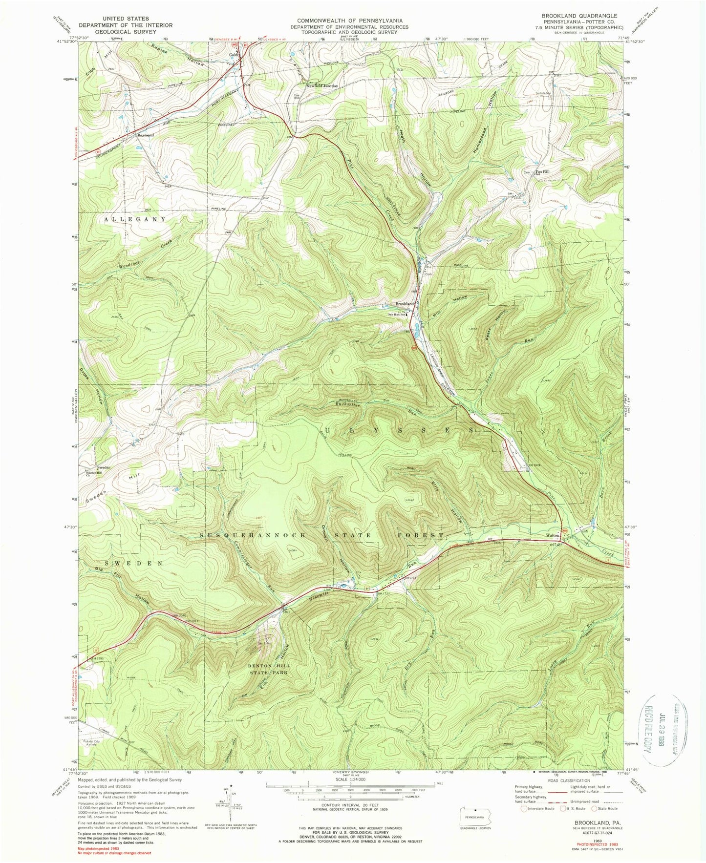
Classic USGS Brookland Pennsylvania 7.5'x7.5' Topo Map
Couldn't load pickup availability
Historical USGS topographic quad map of Brookland in the state of Pennsylvania. Typical map scale is 1:24,000, but may vary for certain years, if available. Print size: 24" x 27"
This quadrangle is in the following counties: Potter.
The map contains contour lines, roads, rivers, towns, and lakes. Printed on high-quality waterproof paper with UV fade-resistant inks, and shipped rolled.
Contains the following named places: Barn Brook, Big Fill Hollow, Brown Trail, Buckseller Run, Buckseller Run Trail, Commissioner Run, Commissioner Run Trail, Crowell Hollow, Denton Hill State Park, Dry Run, Ellis Hollow, Elm Hollow, Elm Hollow Trail, Heath Hollow, Homestead Hollow, Jones Run, Losey Trail, Mill Hollow, Ninemile Run, Oak Hall School, Raplee Hollow, Reese Hollow, Ridge Trail, Sweden Hill Church, Township Trail, Potato City Airport (historical), Fox Hill School, Reese Hollow, Triple Divide, Brookland, Fox Hill, Gold, Newfield Junction, Raymond, Sweden, Walton, Denton Hill Ski Area, Crowell Hollow Trail, Big Fill Hollow Trail, Pennsylvania Lumber Museum, Storey Trail, Gaffnee Post Office (historical), Township of Ulysses, Pennsylvania Conservation and Natural Resources District 15 Susquehannock, Pennsylvania State Police Troop F Coudersport Station