MyTopo
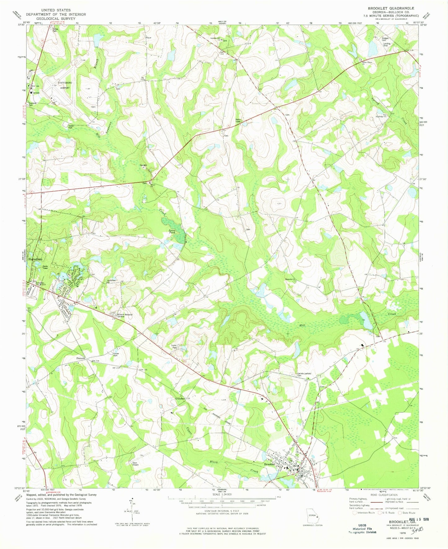
Classic USGS Brooklet Georgia 7.5'x7.5' Topo Map
Couldn't load pickup availability
Historical USGS topographic quad map of Brooklet in the state of Georgia. Map scale may vary for some years, but is generally around 1:24,000. Print size is approximately 24" x 27"
This quadrangle is in the following counties: Bulloch.
The map contains contour lines, roads, rivers, towns, and lakes. Printed on high-quality waterproof paper with UV fade-resistant inks, and shipped rolled.
Contains the following named places: Beasley Cemetery, Bethlehem Church, Bible Baptist Church, Brannen School, Brians Chase, Brooklet, Brooklet Airpark, Brooklet Cemetery, Brooklet Elementary School, Brooklet Police Department, Brooklet Post Office, Brooklet United Methodist Church, Brooklet Volunteer Fire Department, Bulloch County, Bulloch County Historical Museum, Bulloch Memorial Gardens Cemetery, City of Brooklet, Colonial Heights, Corinth - Leefield Cemetery, Corinth Church, Elmer Church, Elmer Church Cemetery, Grimshaw, Grove Lakes, Grove Lakes South, Hodges Cemetery, Jones Pond, Kingdom Hall of Jehovahs Witnesses, Lee Cemetery, Lee Pond, Lee Pond Dam, Magnolia Church, Martin Pond, Merrywood, Mill Creek, Mill Creek Church, Miller Grove Church, Miller Grove Church Cemetery, Moore Cemetery, New Sandridge Church, Newsome Branch, Plantation Mobile Home Estates, Pretoria, Pretoria School, Sand Hill Ford School, Snapp School, Statesboro Army Air Field, Statesboro Free Will Church, Statesboro-Bulloch County Airport, Summer Hill Church, Trinity Presbyterian Church, Windfield, Youngblood Pond, Youngblood Pond Dam