
MyTopo
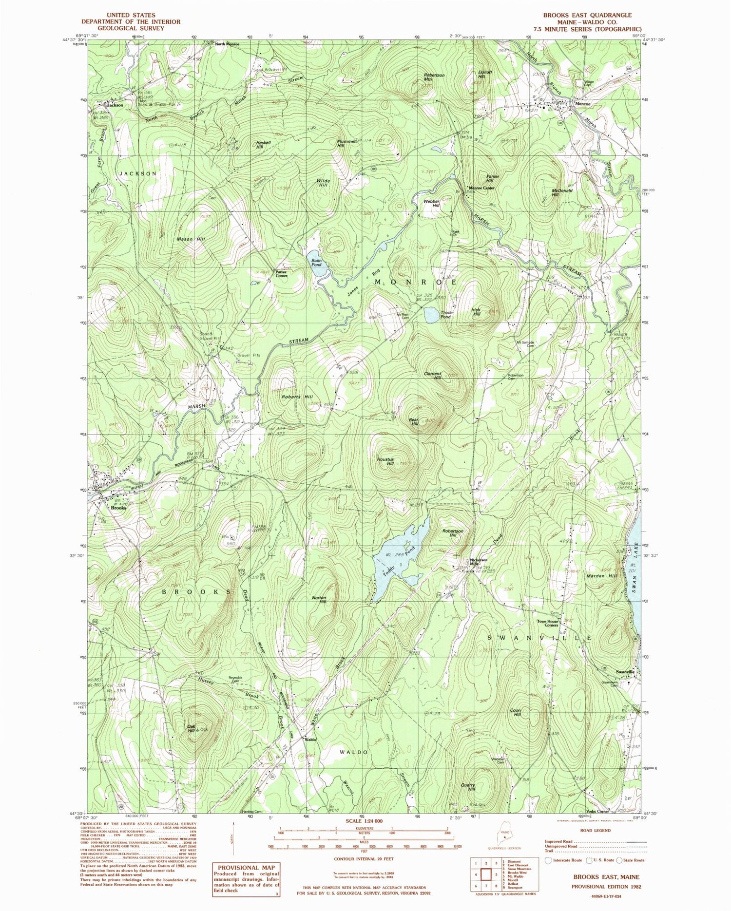
Classic USGS Brooks East Maine 7.5'x7.5' Topo Map
Couldn't load pickup availability
Historical USGS topographic quad map of Brooks East in the state of Maine. Map scale may vary for some years, but is generally around 1:24,000. Print size is approximately 24" x 27"
This quadrangle is in the following counties: Waldo.
The map contains contour lines, roads, rivers, towns, and lakes. Printed on high-quality waterproof paper with UV fade-resistant inks, and shipped rolled.
Contains the following named places: Basin Pond, Bear Hill, Brooks, Brooks Ambulance Service, Brooks Post Office, Brooks Volunteer Fire Department, Camp Fair Haven, Clark School, Clement Hill, Coon Hill, Dead Brook, Dolloff Hill, Dow School, Faith Church, Great Farm Brook, Greely School, Greenlawn Cemetery, Harding Cemetery, Haskell Hill, Houstus Hill, Hussey Brook, Irish Hill, Jackson, Jones Bog, Kermit Nickerson Elementary School, Land of Rest Cemetery, Marden Hill, Mason Hill, McDonald Hill, Monroe, Monroe Center, Monroe Community Library, Monroe Elementary School, Monroe Post Office, Monroe Volunteer Fire Station, Mount Rest Cemetery, Mount Solitude Cemetery, Nickerson Mills, North Monroe, Norton Hill, Oak Hill, Parker Hill, Pattee Corner, Plummer Hill, Quarry Hill, Reynolds Cemetery, Roberts Hill, Robertson Cemetery, Robertson Hill, Robertson Mountain, Thistle Pond, Toddy Pond, Town House Corners, Town of Brooks, Town of Monroe, Town of Swanville, Waldo, Webber Hill, Webster - Knowlton Cemetery, White Brook, Wilde Hill, ZIP Code: 04951


