
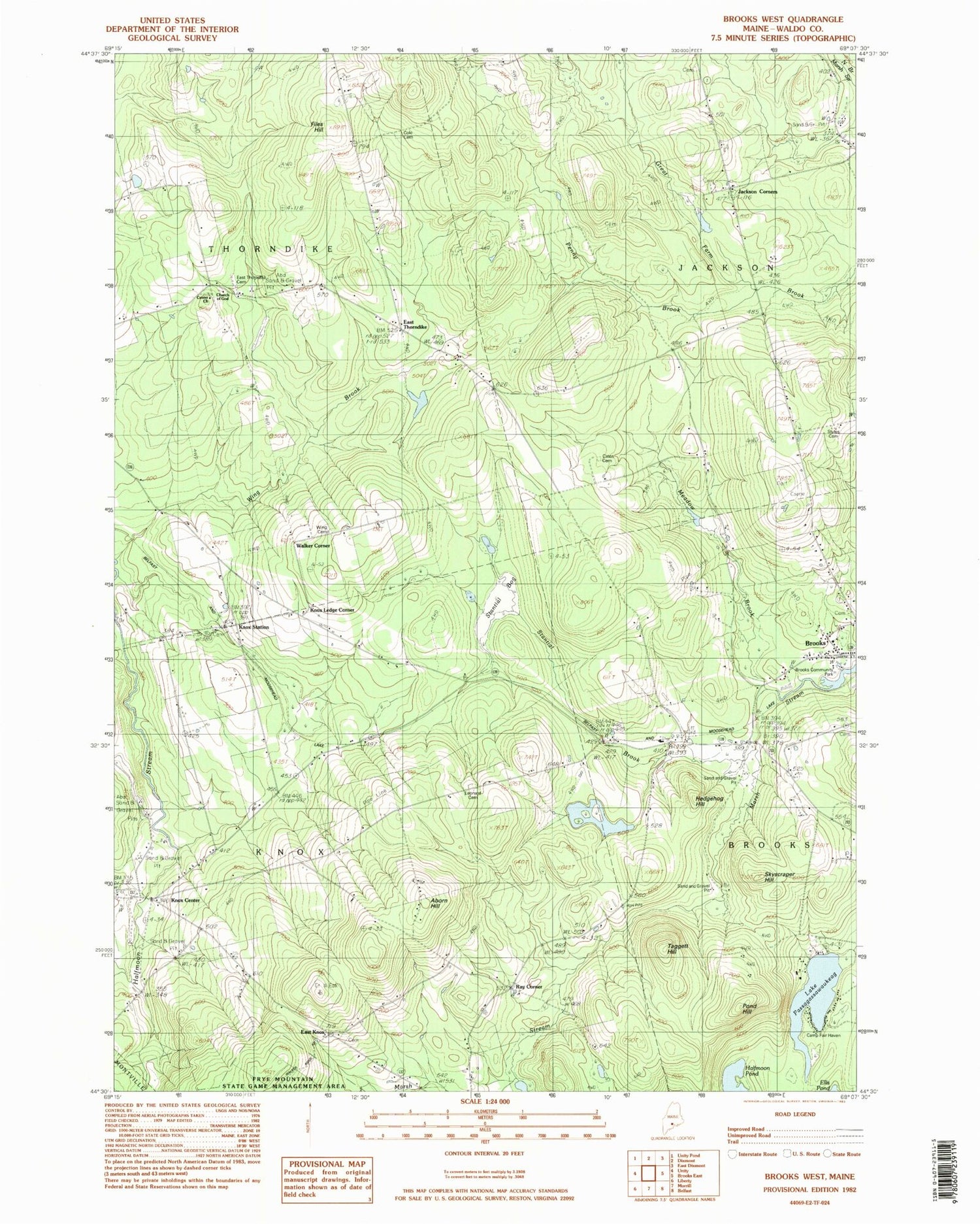
MyTopo
Classic USGS Brooks West Maine 7.5'x7.5' Topo Map
Couldn't load pickup availability
Historical USGS topographic quad map of Brooks West in the state of Maine. Map scale may vary for some years, but is generally around 1:24,000. Print size is approximately 24" x 27"
This quadrangle is in the following counties: Waldo.
The map contains contour lines, roads, rivers, towns, and lakes. Printed on high-quality waterproof paper with UV fade-resistant inks, and shipped rolled.
Contains the following named places: Aborn Hill, Camp Paysock, Cates Cemetery, Center Cemetery, Center Church, Cole Cemetery, East Knox, East Knox Cemetery, East Thorndike, Files Hill, Halfmoon Pond, Hedgehog Hill, Jackson Corners, Jackson Fire Department, Knox Center, Knox Ledge Corner, Knox Station, Knox Station Cemetery, Lake Passagassawakeag, Leonard Cemetery, Meadow Brook, Morse Memorial Elementary School, Penny Brook, Pond Hill, Ray Corner, Skyscraper Hill, Stantial Bog, Stantial Brook, Stiles Cemetery, Taggett Hill, Town of Jackson, Town of Knox, Town of Thorndike, Walker Corner, Wing Brook, Wing Cemetery, ZIP Codes: 04921, 04986


