MyTopo
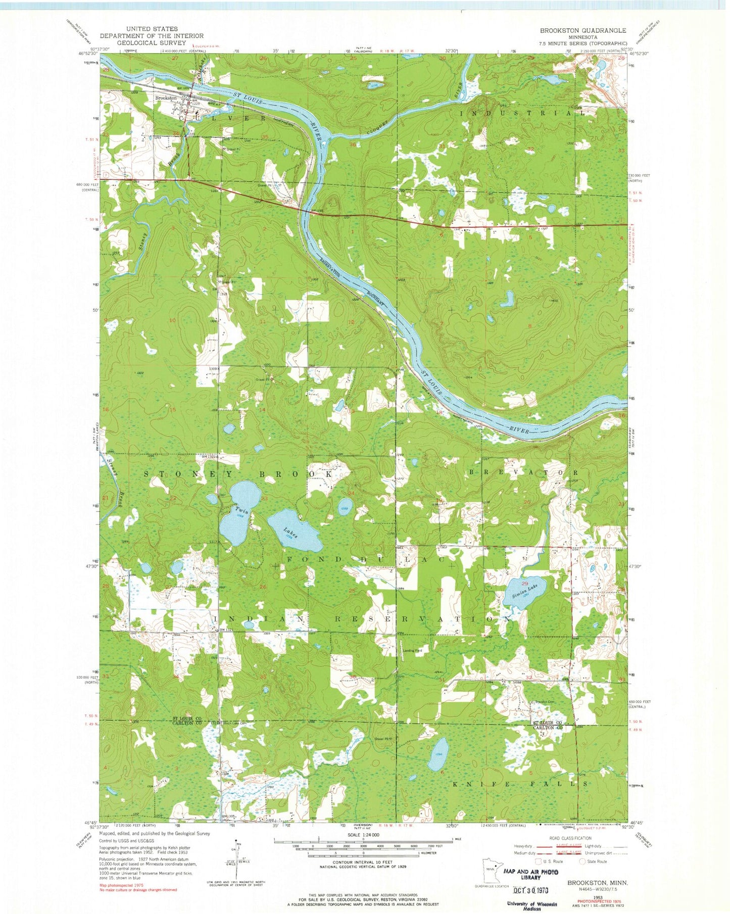
Classic USGS Brookston Minnesota 7.5'x7.5' Topo Map
Couldn't load pickup availability
Historical USGS topographic quad map of Brookston in the state of Minnesota. Map scale may vary for some years, but is generally around 1:24,000. Print size is approximately 24" x 27"
This quadrangle is in the following counties: Carlton, St. Louis.
The map contains contour lines, roads, rivers, towns, and lakes. Printed on high-quality waterproof paper with UV fade-resistant inks, and shipped rolled.
Contains the following named places: Artichoke River, Birch Lake Cemetery, Brevator Cemetery, Brevator Fire Department West Hall, Brevator Post Office, Brevator Station, Brookston, Brookston Post Office, Brookston School, Brookston Station, City of Brookston, Cloquet River, Fond du Lac Reservation, Immanuel Lutheran Church, Mahnomen Census Designated Place, Martin Branch, Simian Lake, Stoney Brook, Township of Stoney Brook, Twin Lakes, ZIP Code: 55720