MyTopo
Classic USGS Brooksville Georgia 7.5'x7.5' Topo Map
Couldn't load pickup availability
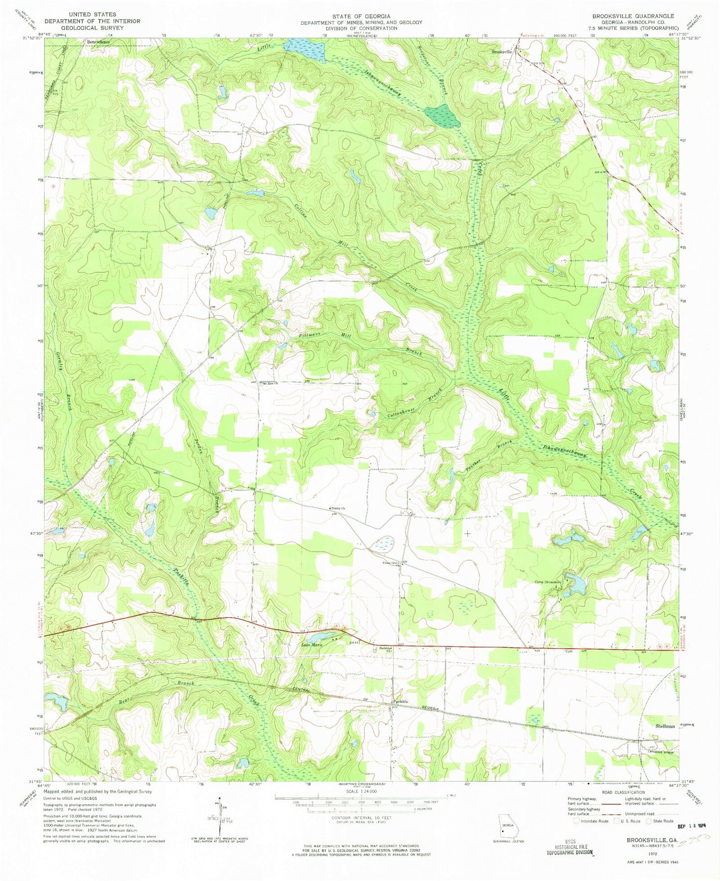
Historical USGS topographic quad map of Brooksville in the state of Georgia. Map scale may vary for some years, but is generally around 1:24,000. Print size is approximately 24" x 27"
This quadrangle is in the following counties: Randolph.
The map contains contour lines, roads, rivers, towns, and lakes. Printed on high-quality waterproof paper with UV fade-resistant inks, and shipped rolled.
Contains the following named places: Bear Branch, Binions Mill, Brooksville, Bynum Airport, Camp Okitayakani, Collins Mill Creek, Cottonhouse Branch, Crittenden Mill, Flint River Girl Scout Lake, Flint River Girl Scout Lake Dam, Gormley Branch, Jackson Lake, Jackson Lake Dam, Jordan Branch, Lake Marie, Lake Marie Dam, Margus Cemetery, Merritt Lake, Merritt Lake Dam, Millers Mill, Mount Olive Church, Mount Zion Church, Pachitla, Pachitla Church, Panther Branch, Pitman Mill, Pittmans Mill Branch, Sammons Airport, Shellhouse Lake, Shellhouse Lake Dam, Soapstone Branch, Trinity Church, Union Grove Church, Water Pipe, Wheely Lake, Wheely Lake Dam