MyTopo
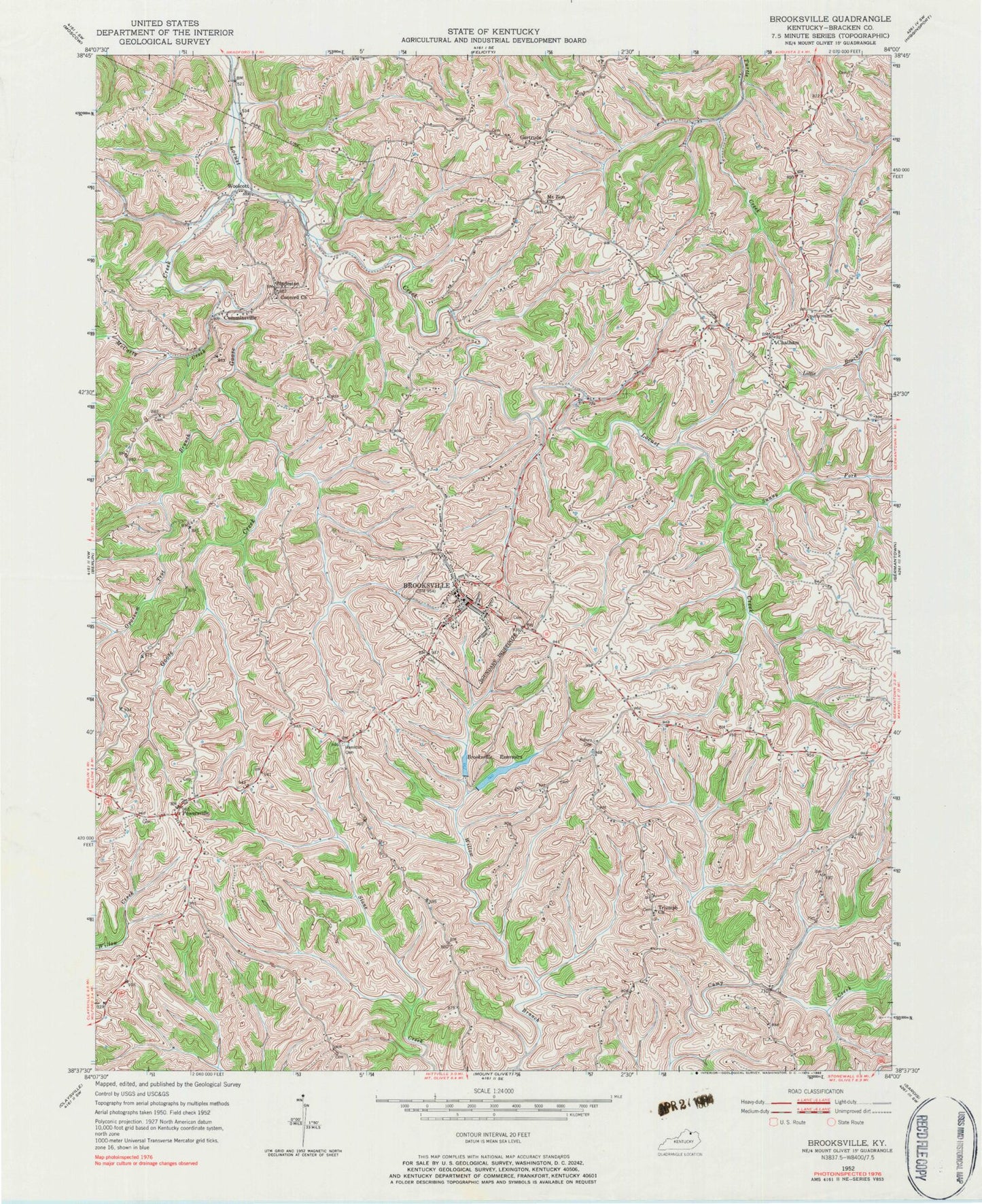
Classic USGS Brooksville Kentucky 7.5'x7.5' Topo Map
Couldn't load pickup availability
Historical USGS topographic quad map of Brooksville in the state of Kentucky. Map scale may vary for some years, but is generally around 1:24,000. Print size is approximately 24" x 27"
This quadrangle is in the following counties: Bracken.
The map contains contour lines, roads, rivers, towns, and lakes. Printed on high-quality waterproof paper with UV fade-resistant inks, and shipped rolled.
Contains the following named places: Asbury, Asbury Cemetery, Augusta Division, Bladeston, Bladeston Post Office, Bracken County, Bracken County Emergency Medical Services, Bracken County Sheriff's Office, Brooksville, Brooksville Division, Brooksville Police Department, Brooksville Post Office, Brooksville Reservoir, Brooksville Volunteer Fire Department, Chatham, Chatham Church of Christ, Chatham Post Office, City of Brooksville, Concord Church, Cumminsville, Gertrude, Gertrude Post Office, Goose Creek, Hamilton Cemetery, McCarty Creek, McKanes Run, Mount Zion Church, Norris Run, Opossum Trot Branch, Parina, Parina Post Office, Pleasant Valley School, Pleasant View School, Poe Creek, Powersville, Powersville Post Office, School Number Nineteen, School Number Thirteen, School Number Twenty-seven, School Number Twenty-six, Sunny Fork Locust Creek, Triumph Church, Triumph School, Walcott Covered Bridge, Watson Chapel, Wilcox Branch, Woolcott, ZIP Code: 41004