MyTopo
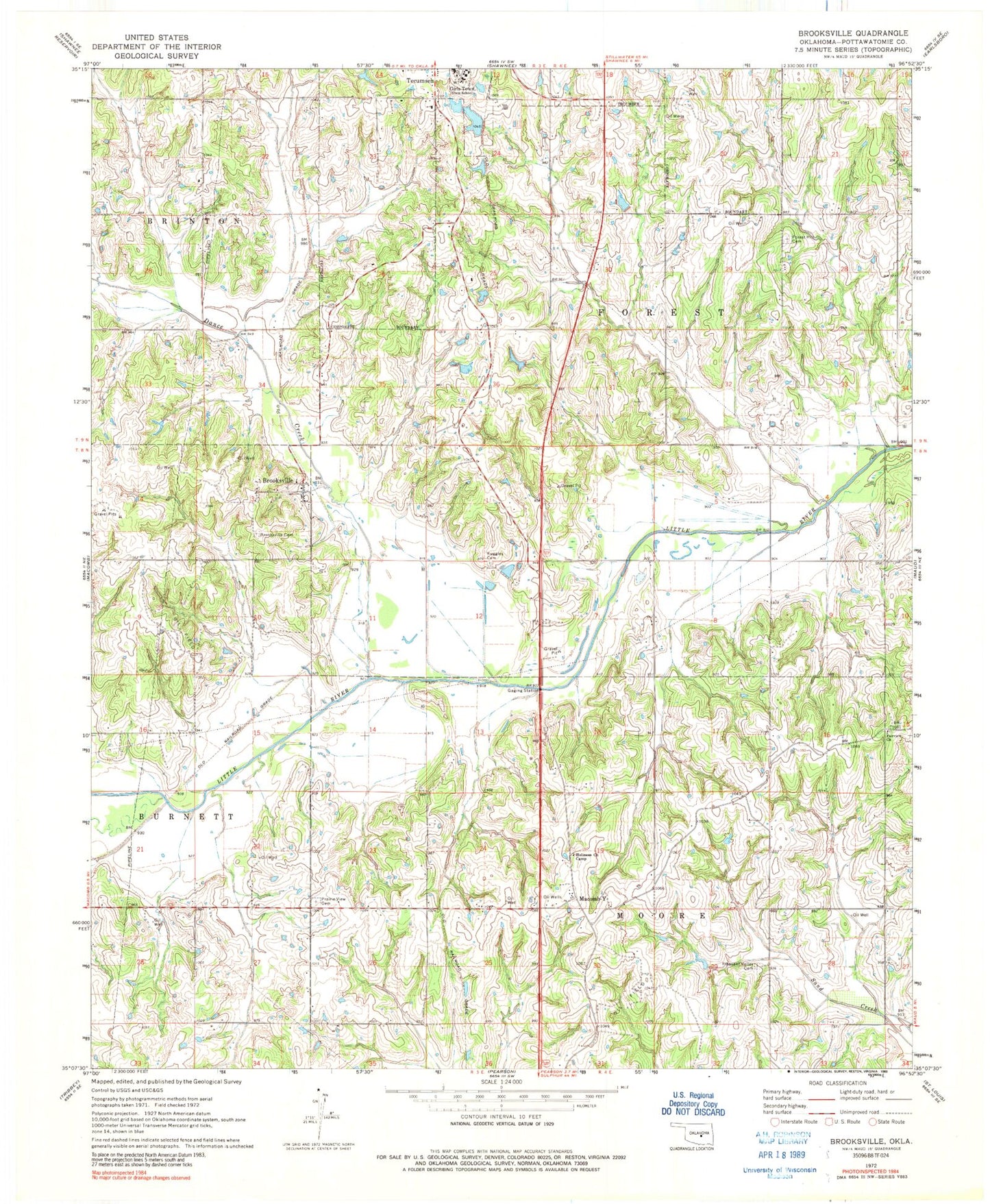
Classic USGS Brooksville Oklahoma 7.5'x7.5' Topo Map
Couldn't load pickup availability
Historical USGS topographic quad map of Brooksville in the state of Oklahoma. Map scale may vary for some years, but is generally around 1:24,000. Print size is approximately 24" x 27"
This quadrangle is in the following counties: Pottawatomie.
The map contains contour lines, roads, rivers, towns, and lakes. Printed on high-quality waterproof paper with UV fade-resistant inks, and shipped rolled.
Contains the following named places: Audrey Crown Dam, Audrey Crown Reservoir, Brooksville, Brooksville Cemetery, Brooksville Volunteer Fire Department, Chisney, Dance Creek, E T Cope Dam, E T Cope Reservoir, Fairview Church, Forest Hill Cemetery, Glen Nix Dam, Glen Nix Reservoir, Holiness Church Camp, Jesse McGaha Dam, Jesse McGaha Reservoir, Macomb-Y, North Deer Creek Lake, Oknoname 12501 Dam, Oknoname 12501 Reservoir, Oknoname 12502 Dam, Oknoname 12502 Reservoir, Oknoname 12503 Dam, Oknoname 12503 Reservoir, Oknoname 12504 Dam, Oknoname 12504 Reservoir, Oknoname 12505 Dam, Oknoname 12505 Reservoir, Oknoname 12506 Dam, Oknoname 12506 Reservoir, Pleasant Valley Cemetery, Pottawatomie County, Prairie View Cemetery, Ruggles Cemetery, Town of Brooksville, Township of Forest, Township of Moore, ZIP Code: 74873