
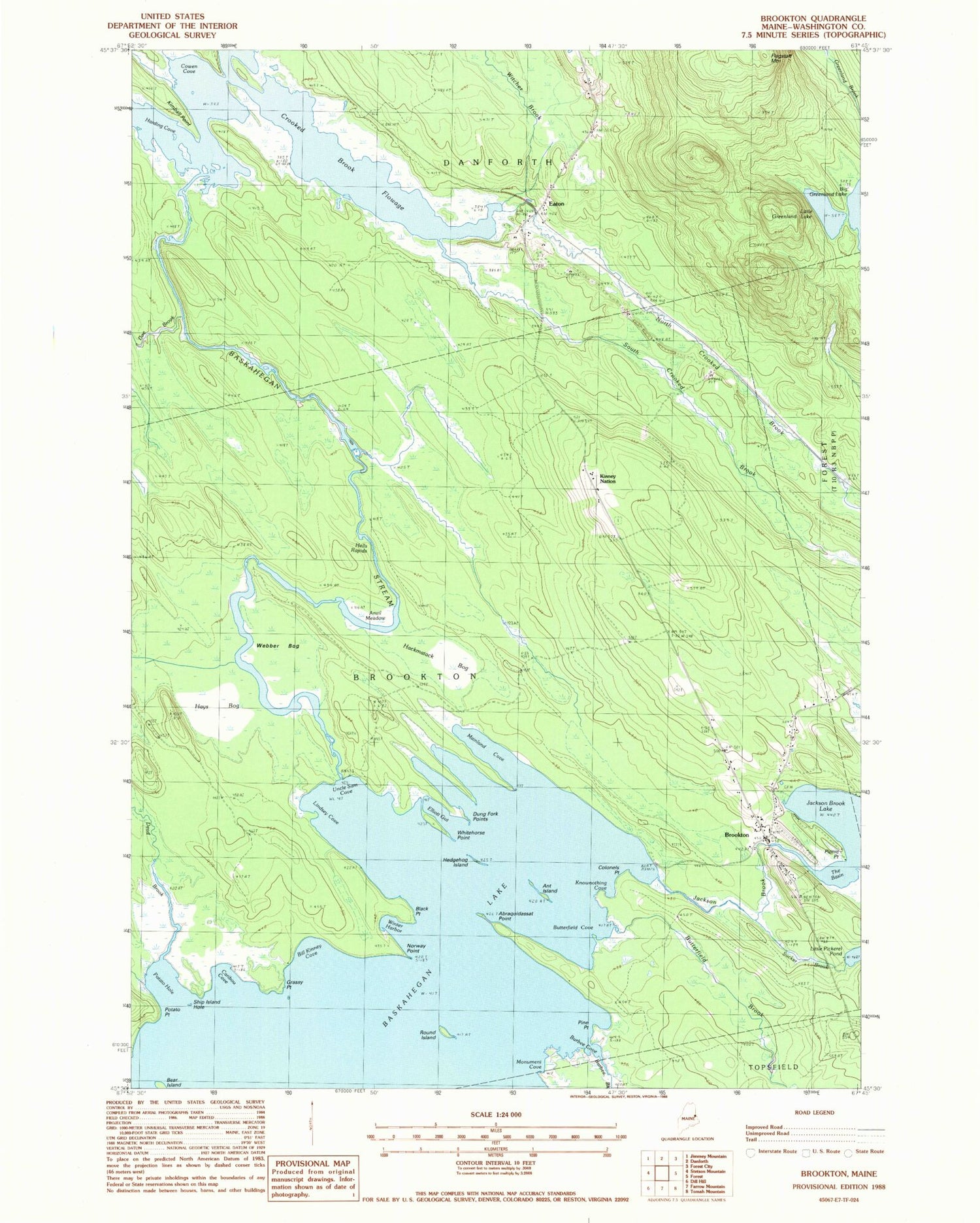
MyTopo
Classic USGS Brookton Maine 7.5'x7.5' Topo Map
Couldn't load pickup availability
Historical USGS topographic quad map of Brookton in the state of Maine. Typical map scale is 1:24,000, but may vary for certain years, if available. Print size: 24" x 27"
This quadrangle is in the following counties: Washington.
The map contains contour lines, roads, rivers, towns, and lakes. Printed on high-quality waterproof paper with UV fade-resistant inks, and shipped rolled.
Contains the following named places: Abraquidassat Point, Ant Island, Anvil Meadow, Baskahegan Lake, Bear Island, Bill Kinney Cove, Black Point, Brookton, Brookton Cemetery, Burbee Cove, Burbee Brook, Butterfield Brook, Butterfield Cove, Caribou Cove, Colonels Point, Cowen Cove, Crooked Brook Flowage, Dead Brook, Doe Brook, Dung Fork Points, Eaton, Eaton Cemetery, Elliott Gut, Flagstaff Mountain, Grassy Point, Hackmatack Bog, Harding Cove, Hays Bog, Hedgehog Island, Hell Rapids, Huff Camp (historical), Jackson Brook, Kimball Point, Kinney Nation, Knownothing Cove, Lincoln School, Lindsey Cove, Little Greenland Lake, Mainland Cove, Monument Cove, North Crooked Brook, Norway Point, Picnic Point, Pine Point, Potato Hole, Potato Point, Round Island, Ship Island Hole, South Crooked Brook, Sucker Brook, Uncle Sam Cove, Webber Bog, Whitehorse Point, Winter Harbor, Witcher Brook, Brookton Post Office


