
MyTopo
Classic USGS Brookville Illinois 7.5'x7.5' Topo Map
Couldn't load pickup availability
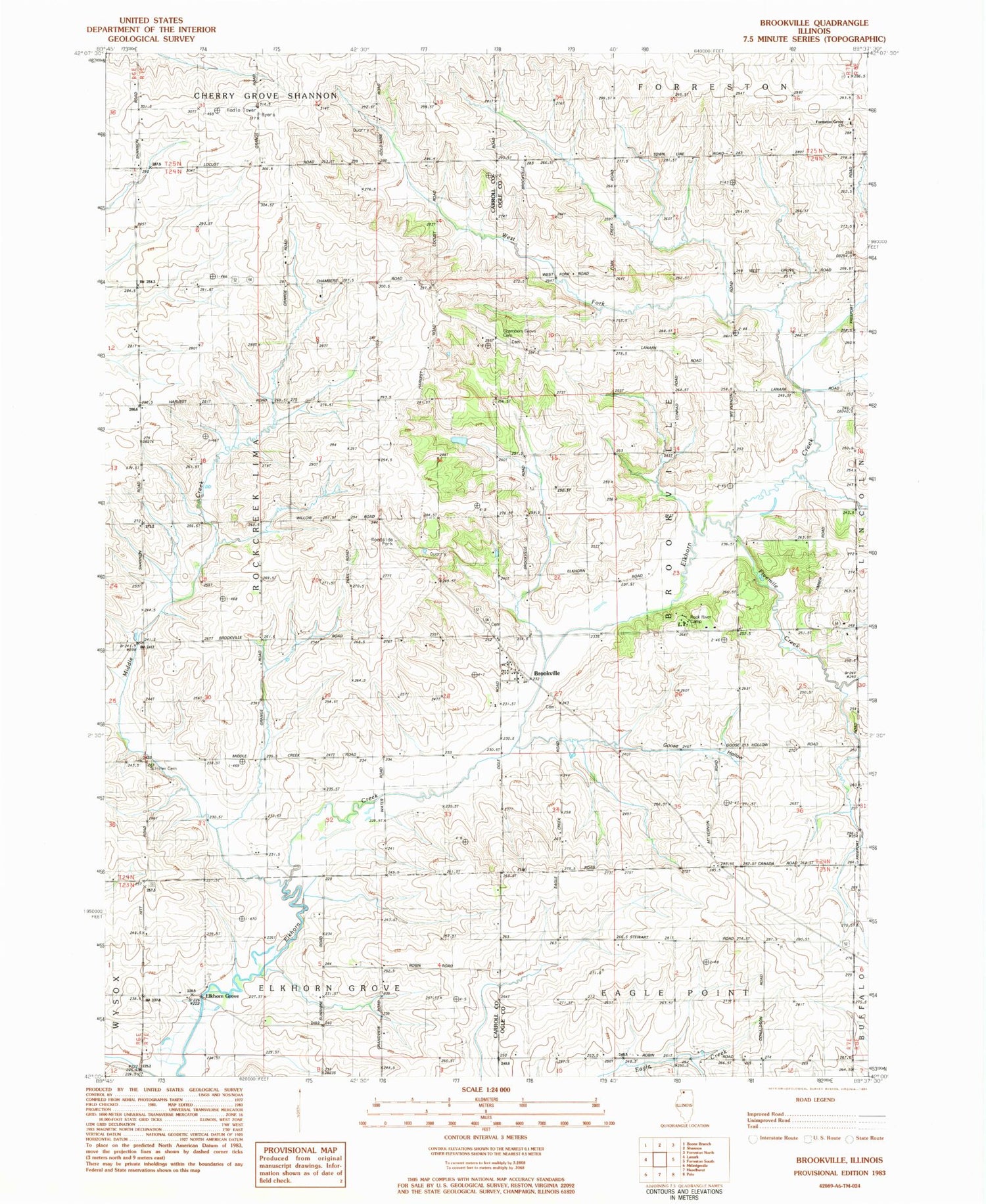
Historical USGS topographic quad map of Brookville in the state of Illinois. Map scale may vary for some years, but is generally around 1:24,000. Print size is approximately 24" x 27"
This quadrangle is in the following counties: Carroll, Ogle.
The map contains contour lines, roads, rivers, towns, and lakes. Printed on high-quality waterproof paper with UV fade-resistant inks, and shipped rolled.
Contains the following named places: Brookville, Brookville Lutheran Cemetery, Brookville Lutheran Cemetery Prairie Nature Preserve, Brookville Quarry, Brookville Township Cemetery, Burr Oak School, Canada School, Chambers Grove Cemetery, Chambers Grove School, Cowen School, Elkhorn Grove, Fivemile Creek, Folkers Farm, Forreston Grove Cemetery, Forreston Grove Church, Genter Hill School, Good School, Goose Hollow, Middle Creek, Middle Creek Church, Miller School, Mount Vernon School, Rock River Camp, Schriner Cemetery, Stewart School, Township of Brookville, West Fork Elkhorn Creek


