
MyTopo
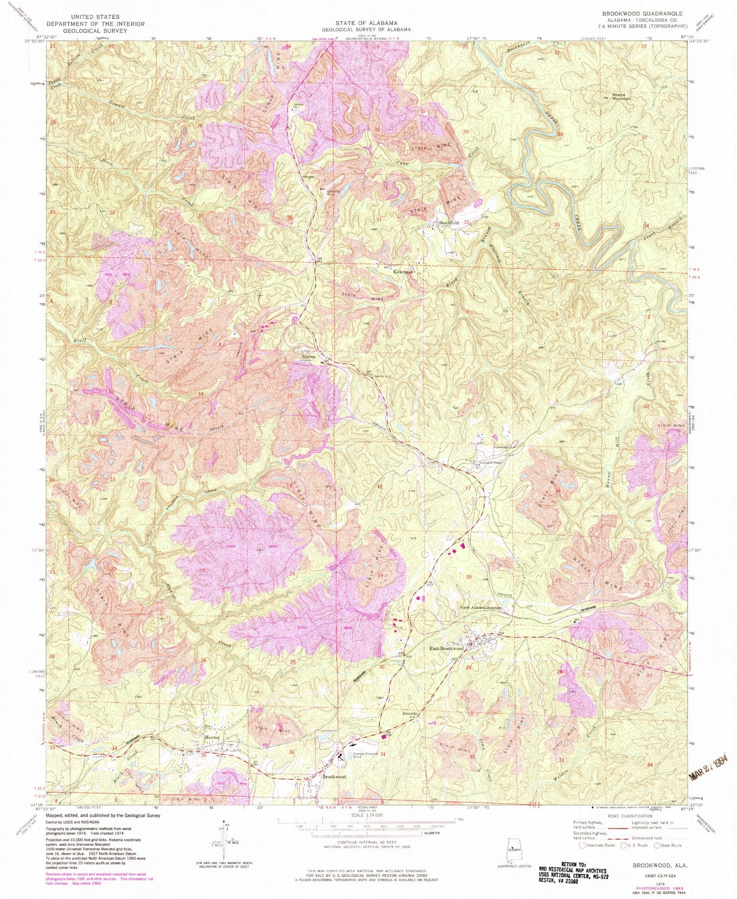
Classic USGS Brookwood Alabama 7.5'x7.5' Topo Map
Couldn't load pickup availability
Historical USGS topographic quad map of Brookwood in the state of Alabama. Map scale may vary for some years, but is generally around 1:24,000. Print size is approximately 24" x 27"
This quadrangle is in the following counties: Tuscaloosa.
The map contains contour lines, roads, rivers, towns, and lakes. Printed on high-quality waterproof paper with UV fade-resistant inks, and shipped rolled.
Contains the following named places: Antioch Church, Antioch Missionary Baptist Church Cemetery, Antioch School, Battles Spring, Billy Joe Young Field, Black Branch, Brookwood, Brookwood Division, Brookwood Elementary School, Brookwood High School, Brookwood Medical Clinic, Brookwood Methodist Church, Brookwood Police Department, Brookwood Post Office, Brookwood Volunteer Fire Department, Burchfield, Burnside Creek, Cane Creek, Cedar Cove Mine, Central City, Christian Union Cemetery, Christian Union Church, Clark Branch, Daniels Creek Shoal, Day Number 1 Mine, East Brookwood, East Brookwood Free Will Baptist Church, East Brookwood Mine, East Brookwood Missionary Baptist Church, East Kellerman Church, Etna, Flatrock Branch, Friendship Baptist Church, Friendship Baptist Church Cemetery, Hanna Mill Creek, Howton, Kellerman, Kellerman Mine, Kellerman Number 1 Mine, Kellerman Number 2 Mine, Kellerman Post Office, Klondike, Little Hurricane Baptist Church, Little Hurricane Cemetery, Martha Washington Mountain, Midway Church, Muddy Branch School, New Slope Mine, North Alabama Junction, Oswall Creek, Pleasant Grove Church, Rockhouse Creek, Round Mountain, Searles, Searles Slope Mine, Sellers Creek, Valley Drift Mine, West Brookwood Church Cemetery, West Brookwood True Gospel Church, ZIP Code: 35444


