MyTopo
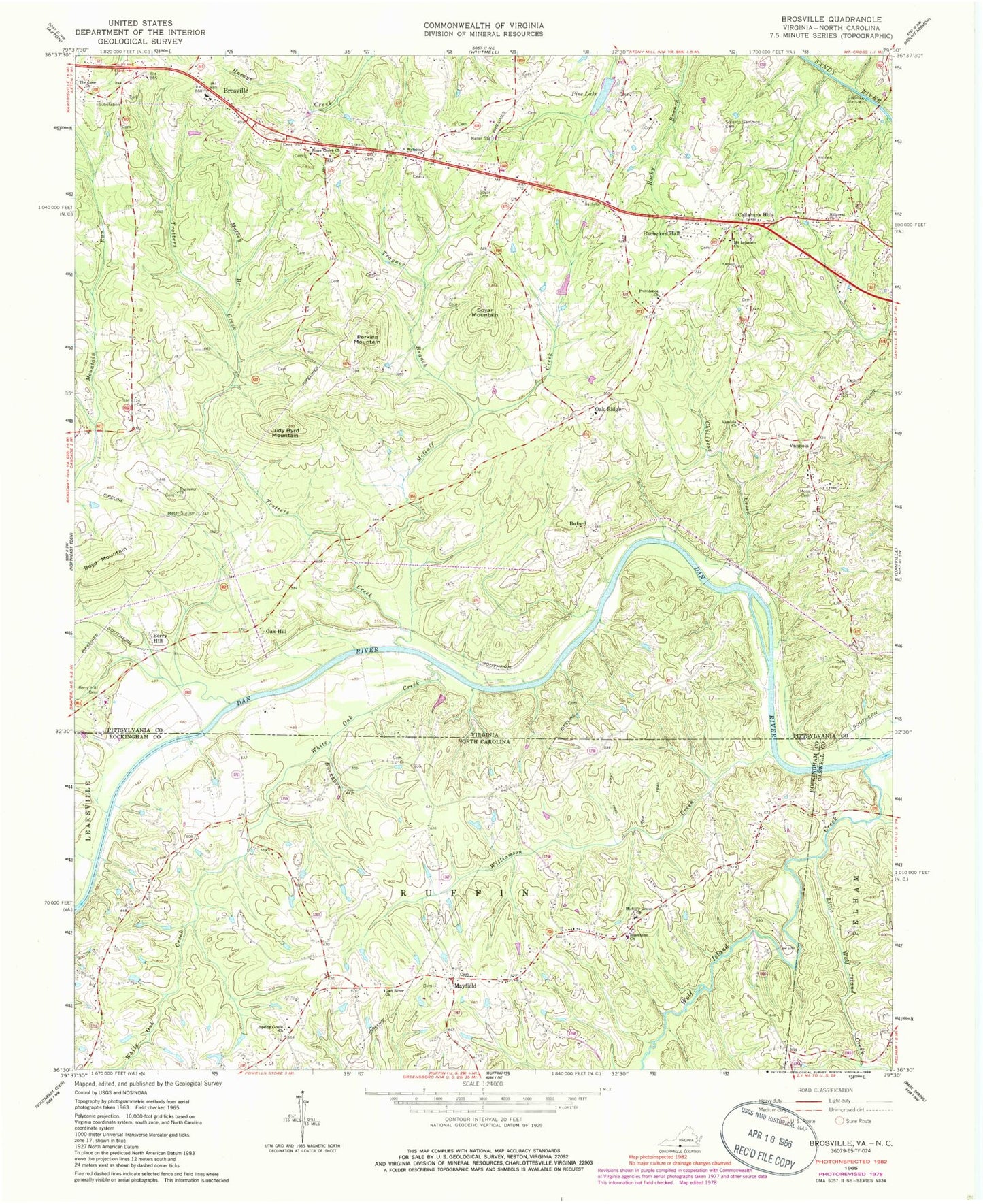
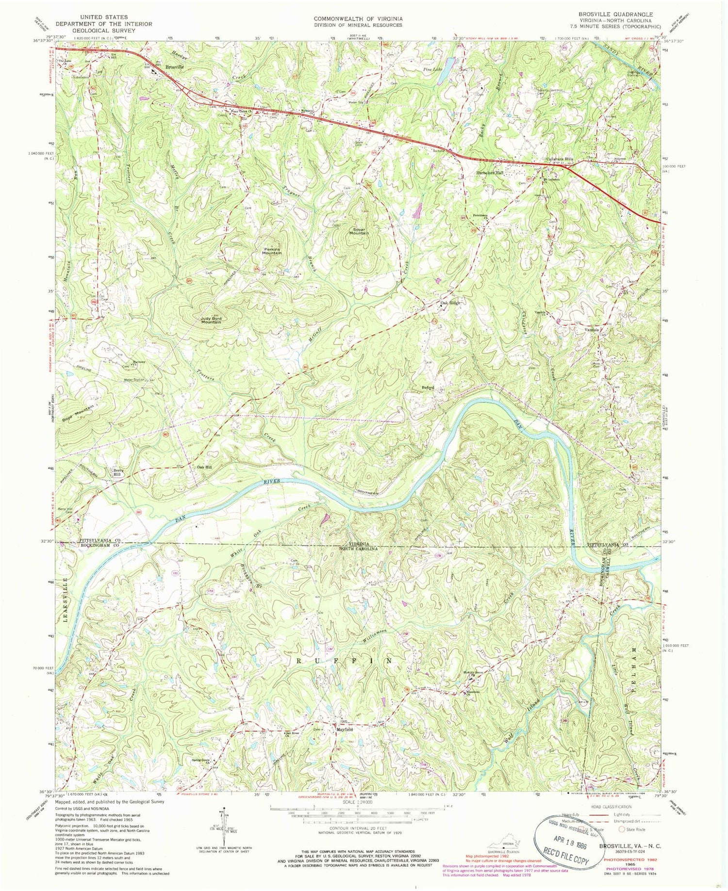
Classic USGS Brosville Virginia 7.5'x7.5' Topo Map
Couldn't load pickup availability
Historical USGS topographic quad map of Brosville in the states of Virginia, North Carolina. Map scale is 1:24000. Print size is approximately 24" x 27"
This quadrangle is in the following counties: Caswell, Danville (city), Pittsylvania, Rockingham.
The map contains contour lines, roads, rivers, towns, and lakes. Printed on high-quality waterproof paper with UV fade-resistant inks, and shipped rolled.
Contains the following named places: Bachelors Hall, Bachelors Hall Volunteer Fire Department, Berry Hill, Berry Hill Cemetery, Bethel School (historical), Bluestone Baptist Church, Boyd Mountain, Briarfield (historical), Brosville, Brosville Community Volunteer Fire Department, Brosville Elementary School, Buckhorn Branch, Buford, Callahans Hills, Childress Creek, Dan River Primitive Baptist Church, Deep River School (historical), Dicks School (historical), Harmony Church, Hickory Forest Creek, Hickory Grove, Hickory Grove United Methodist Church, Hillcrest Church, Judy Byrd Mountain, Little Wolf Island Creek, Mayfield, McGuff Creek, Moore Dam, Moss Cemetery, Motley Branch, Mount Lebanon Church, Oak Hill, Oak Hill Station (historical), Oak Ridge, Perkins Mountain, Pine Dam, Pine Lake, Piney Grove Church, Piney Grove School (historical), Powell (historical), Providence Church, Pumphouse Branch, Saint Matthews School (historical), Scearce Gammon Cemetery, Soyar Cemetery, Soyar Mountain, Spring Grove Presbyterian Church, Tardy Branch, The Lone Church, Trayner Branch, Trotters Creek, Vandola, Vandola Church, Vandola Church (historical), Vandola School (historical), Welcome Church, Wenonda School (historical), Westover District, White Oak Creek, Williamson Creek, Wolf Island Creek