MyTopo
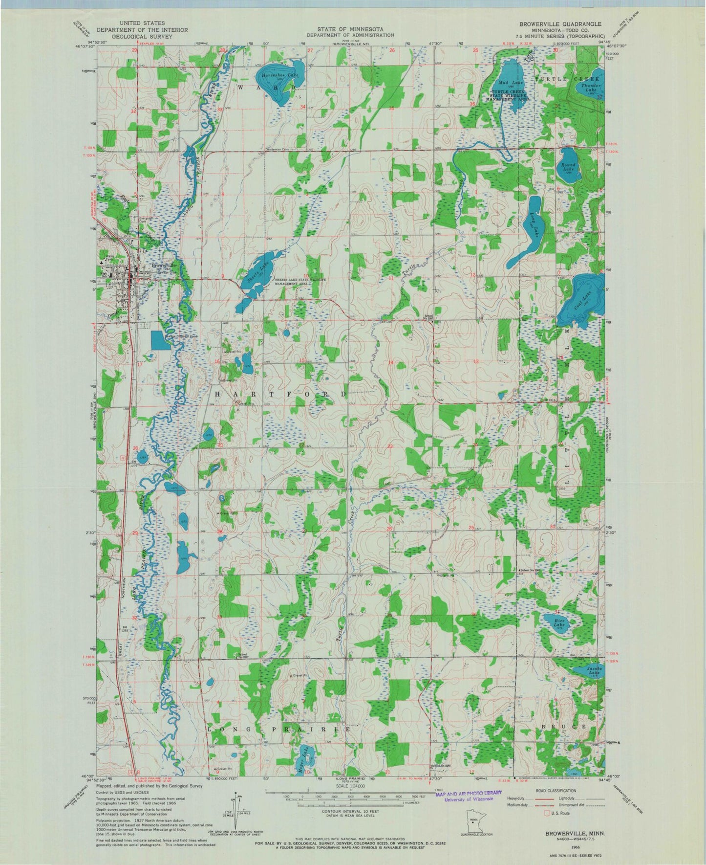
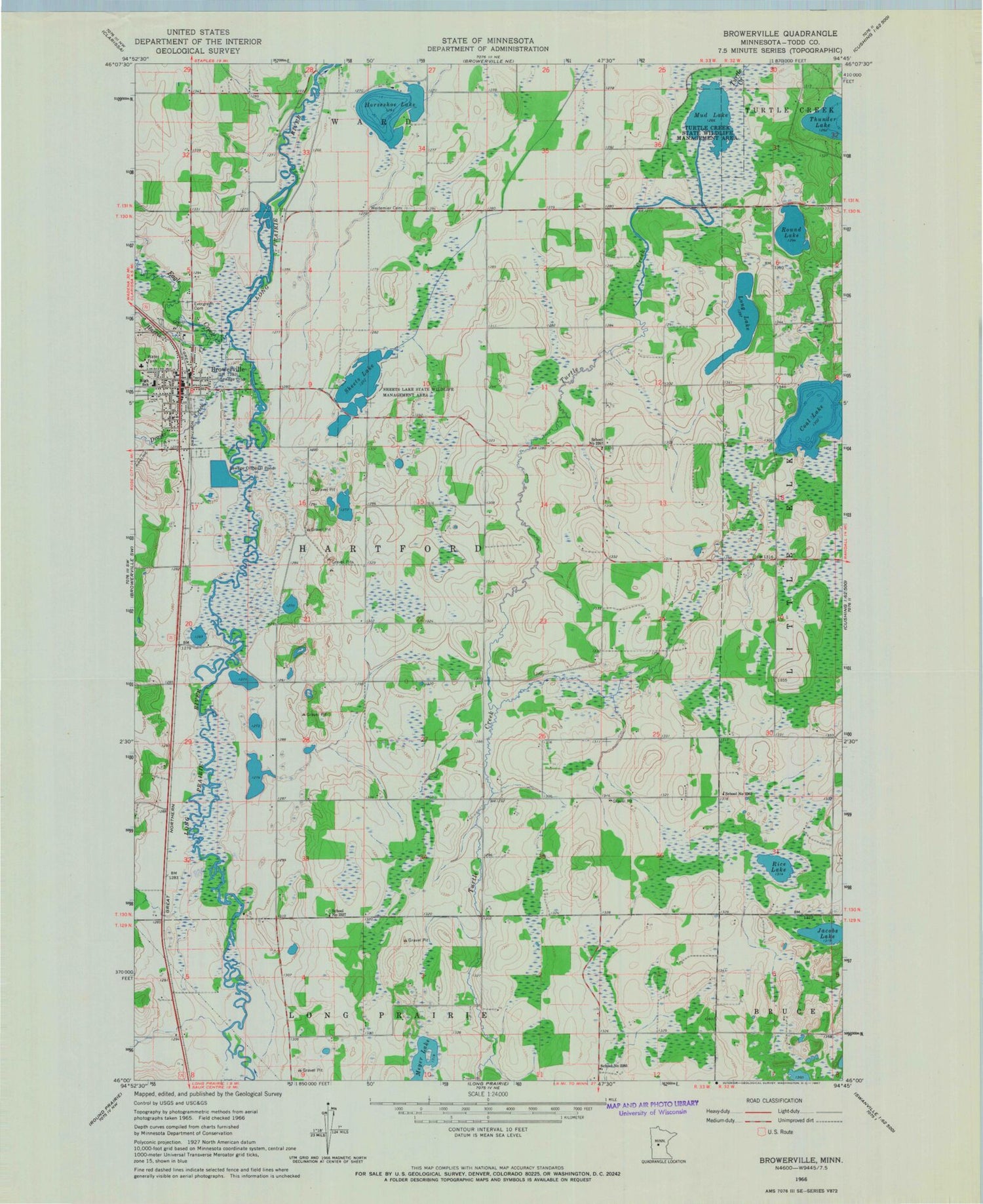
Classic USGS Browerville Minnesota 7.5'x7.5' Topo Map
Couldn't load pickup availability
Historical USGS topographic quad map of Browerville in the state of Minnesota. Map scale may vary for some years, but is generally around 1:24,000. Print size is approximately 24" x 27"
This quadrangle is in the following counties: Todd.
The map contains contour lines, roads, rivers, towns, and lakes. Printed on high-quality waterproof paper with UV fade-resistant inks, and shipped rolled.
Contains the following named places: Browerville, Browerville Ambulance, Browerville City Hall, Browerville Fire Department, Browerville High School, Browerville Police Department, Browerville Post Office, Christ the King Church, Christ the King School, City of Browerville, Coal Lake, Drayer Creek, Eagle Creek, Evergreen Cemetery, Harris Creek, Horseshoe Lake, Jacobs Lake, KXDL-FM (Browerville), Lakewood Clinic, Long Lake, Meyer Lake, Mud Lake, Rice Lake, Round Lake, School Number 2267, School Number 2285, School Number 2327, School Number 2362, Sheet Lake, Sheets Lake State Wildlife Management Area, Township of Hartford, Turtle Creek State Wildlife Management Area, Weitemier Cemetery, Zion Lutheran Church