MyTopo
Classic USGS Brown City Michigan 7.5'x7.5' Topo Map
Couldn't load pickup availability
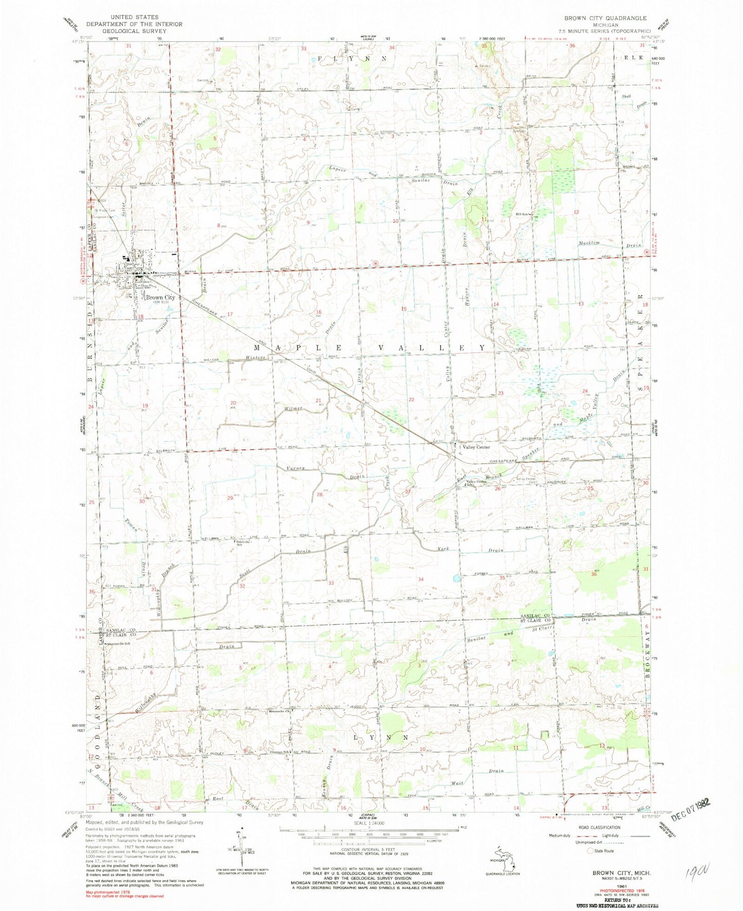
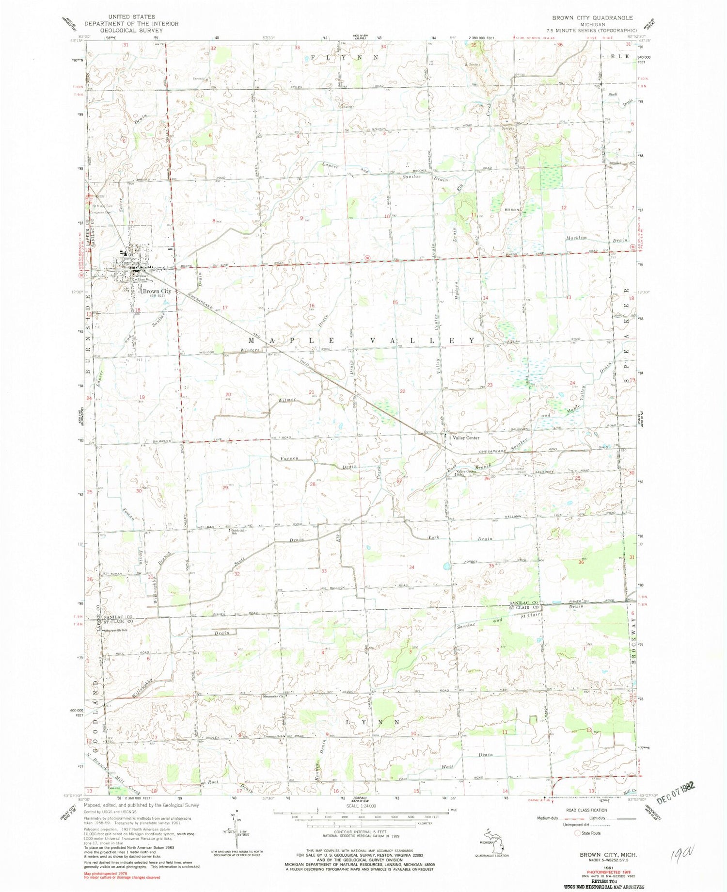
Historical USGS topographic quad map of Brown City in the state of Michigan. Map scale may vary for some years, but is generally around 1:24,000. Print size is approximately 24" x 27"
This quadrangle is in the following counties: Lapeer, Sanilac, St. Clair.
The map contains contour lines, roads, rivers, towns, and lakes. Printed on high-quality waterproof paper with UV fade-resistant inks, and shipped rolled.
Contains the following named places: Brown City, Brown City Banner Historical Marker, Brown City Community School, Brown City Community Schools Historical Marker, Brown City Family Health Care, Brown City Fire Department, Brown City Hall, Brown City Health Center, Brown City Police Department, Brown City Post Office, Brown City Public Library, Brown City Station, Brown City United Methodist Church, City of Brown City, Drennan School, Evergreen Cemetery, Faith Baptist Church, Hill School, Hydorn Drain, Immanuel Revival Church, Kenney Drain, Lapeer and Sanilac Drain, Macklem Drain, Mapleview Estates Mobile Home Park, Mennonite Church, Missionary Church, Odelville School, Sacred Heart Catholic Church, Sacred Heart Cemetery, Scott Drain, Sharpsville Post Office, Sharpsville School, Toman Drain, Township of Maple Valley, Trinity Lutheran Church, Valley Center, Valley Center Cemetery, Valley Center Drain, Valley Center Post Office, Valley Center School, Valley Center Station, Varney Drain, Wait Drain, Willoughby Branch, Willoughby Drain, Winters Drain, Witmer Drain, York Drain, ZIP Code: 48416