
MyTopo
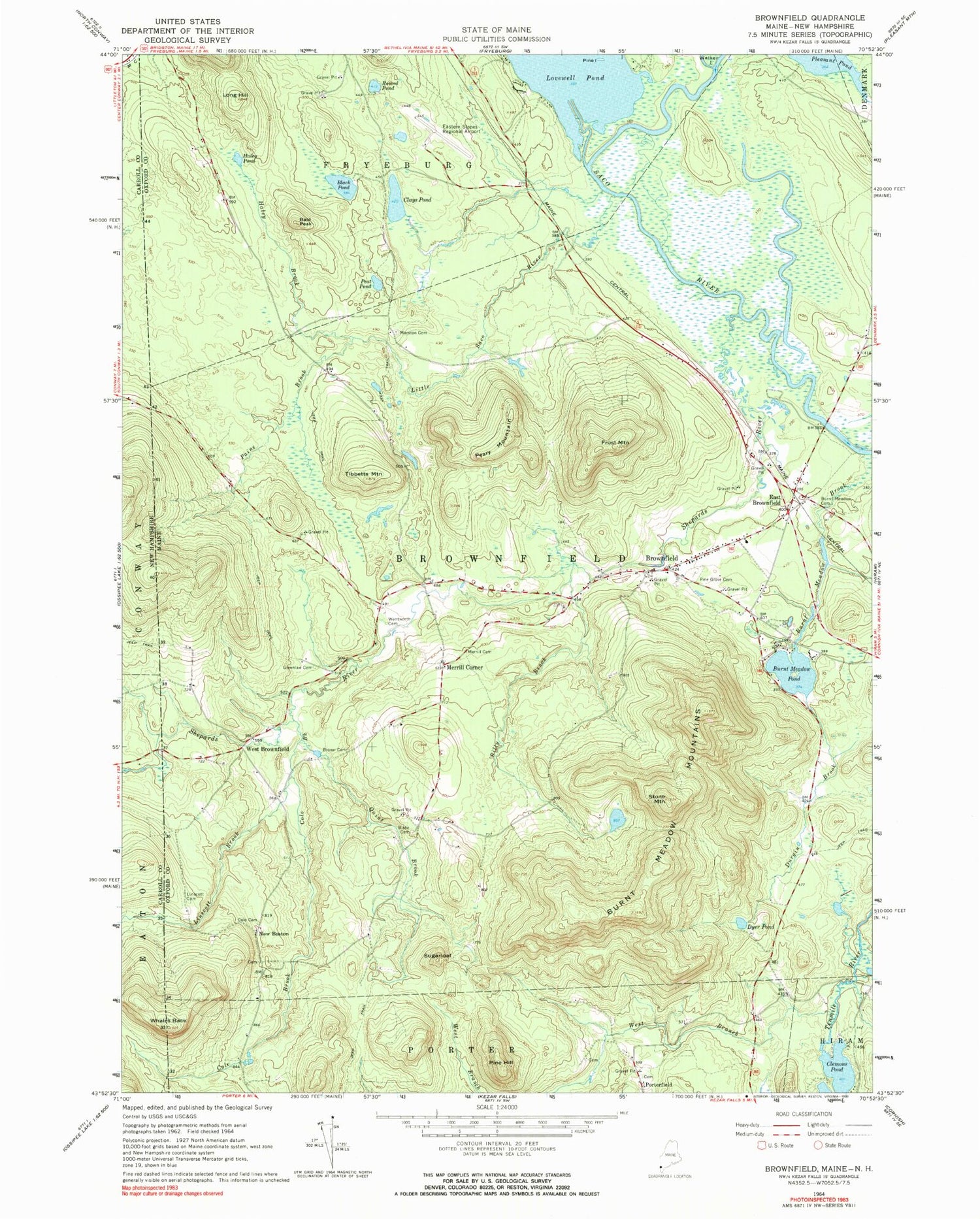
Classic USGS Brownfield Maine 7.5'x7.5' Topo Map
Couldn't load pickup availability
Historical USGS topographic quad map of Brownfield in the state of Maine. Typical map scale is 1:24,000, but may vary for certain years, if available. Print size: 24" x 27"
This quadrangle is in the following counties: Carroll, Oxford.
The map contains contour lines, roads, rivers, towns, and lakes. Printed on high-quality waterproof paper with UV fade-resistant inks, and shipped rolled.
Contains the following named places: Bald Peak, Beaver Brook, Billy Brook, Black Pond, Blake Cemetery, Brown - Johnson Cemetery, Brownfield, Burnt Meadow Cemetery, Burnt Meadow Mountains, Burnt Meadow Pond, Clays Pond, Clemons Pond, Cole Brook, Cole Cemetery, Durgin Brook, Dyer Pond, East Brownfield, Frost Mountain, Greenlaw Cemetery, Haley Brook, Haley Pond, Linscott Brook, Linscott Cemetery, Little Saco River, Long Hill, Marston Cemetery, Merrill Cemetery, Paine Brook, Peary Mountain, Peat Pond, Pine Grove Cemetery, Pine Hill, Pine Island, Quint Brook, Round Pond, Shepards River, Stone Mountain, Sugarloaf, Tibbetts Mountain, Wentworth - Brown Cemetery, West Branch Tenmile River, Whales Back, Merrill Corner, New Boston, Porterfield, West Brownfield, Eastern Slopes Regional Airport, Town of Brownfield, Burnt Meadow Pond Dam, Brownfield Community Church, Brownfield Consolidated School, Brownfield Post Office, Brownfield Public Library, Brownfield Volunteer Fire Station, Walker - Rounds Cemetery, Brownfield Mennonite School


