MyTopo
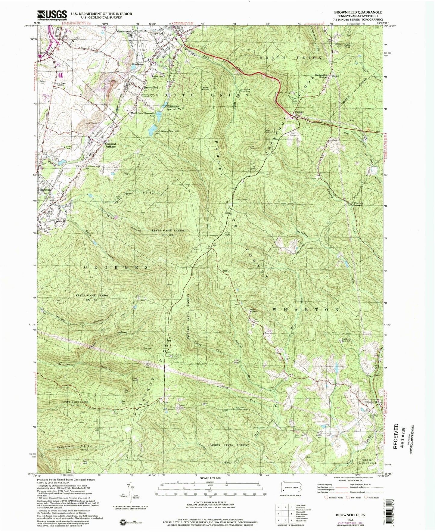
Classic USGS Brownfield Pennsylvania 7.5'x7.5' Topo Map
Couldn't load pickup availability
Historical USGS topographic quad map of Brownfield in the state of Pennsylvania. Typical map scale is 1:24,000, but may vary for certain years, if available. Print size: 24" x 27"
This quadrangle is in the following counties: Fayette.
The map contains contour lines, roads, rivers, towns, and lakes. Printed on high-quality waterproof paper with UV fade-resistant inks, and shipped rolled.
Contains the following named places: Askon Hollow, Brethren Summit, Brownfield, Brown Cemetery, Cave Hollow, Elliottsville, Forbes State Forest, Fulton Knob, Gallatin School, Victor Hollow, Hutchinson, Hutchinson Reservoir Number One, Hutchinson Reservoir Number Two, Hutchinson Reservoir Number Three, Laurel Run, Lick Hollow Picnic Area, Little White Rock Cemetery, Long Run, Hardin Hollow, Mill Run, Oliphant Furnace, Pine Knob, Piney Run, South Union School, State Game Lands Number 138, Summit, Visitation Cemetery, Washington Springs, White Rock Hollow, Meadowbrook, Mountain View Memorial Park, Fairchance Reservoir, Fairchance Reservoir, Askon Hollow Dam, Hutchinson Reservoir Number Three Dam, Hutchinson Reservoir Dam Number Two, Hutchinson Reservoir Dam Number One, WMBS-AM (Uniontown), Seven County Scenic View, Cabin Rocks, Quebec Run Wild Area, Point Breeze, Wharton Furnace, Dearmond School (historical), Sulfur Springs School (historical), High Point School, Mill Run School, Mile Trail, Pond View Firetower, Hull Cemetery, Grist Mill, Pondfield 2 Lookout Tower, East Fairchance, Township of South Union, Hopwood Volunteer Fire Department Station 20, Hopwood Post Office, Brownfield Post Office