
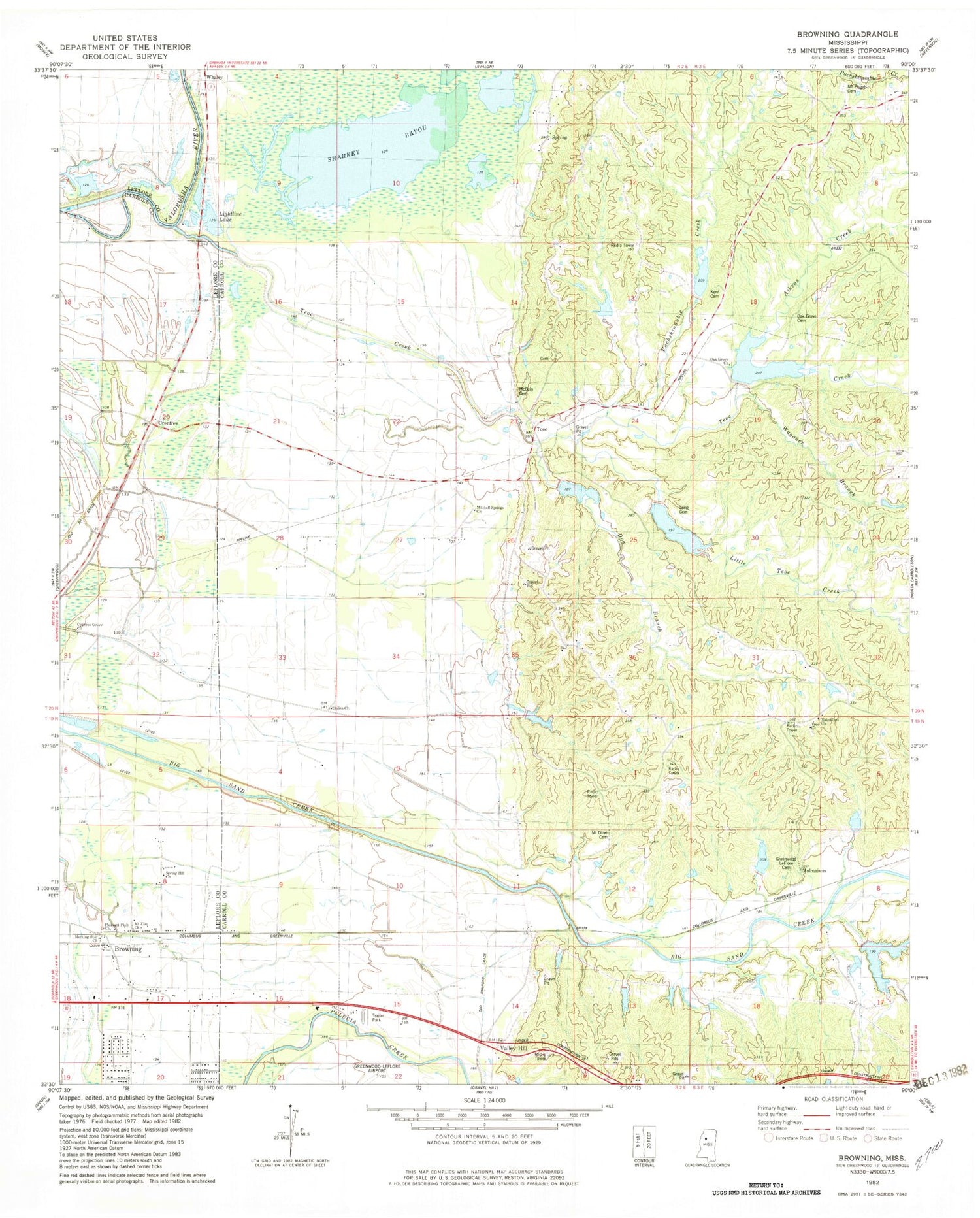
MyTopo
Classic USGS Browning Mississippi 7.5'x7.5' Topo Map
Couldn't load pickup availability
Historical USGS topographic quad map of Browning in the state of Mississippi. Map scale may vary for some years, but is generally around 1:24,000. Print size is approximately 24" x 27"
This quadrangle is in the following counties: Carroll, Leflore.
The map contains contour lines, roads, rivers, towns, and lakes. Printed on high-quality waterproof paper with UV fade-resistant inks, and shipped rolled.
Contains the following named places: Aikens Creek, Big Sand Creek Structure Y-32-25 Dam, Big Sand Creek Structure Y-32-27 Dam, Big Sand Watershed Y-32-14 Dam, Big Sand Watershed Y-32-15 Dam, Big Sand Watershed Y-32-16 Dam, Big Sand Watershed Y-32-17 Dam, Big Sand Watershed Y-32-18 Dam, Big Sand Watershed Y-32-19 Dam, Big Sand Watershed Y-32-29 Dam, Big Sand Watershed Y-32-7 Dam, Bright Corner, Browning, Bucksnubby Branch, Church of God, Crenfree, Cypress Grove Cemetery, Cypress Grove Church, Dog Branch, Greenwood LeFlore Cemetery, Henderson Airport, Kent Cemetery, Lightline Lake, Little Teoc Creek, Long Cemetery, Long Lake, Malmaison, Malmaison Church, McCain Cemetery, Mitchell Springs Church, Morning Star Church, Mount Olive Cemetery, Mount Pisgah Cemetery, Mount Zion Church, Oak Grove Cemetery, Oak Grove Church, Pleasant Plain Church, Puchshinnubie Creek, Sharkey Bayou, Shiloh Church, Spring Hill Church, Supervisor District 2, Teoc, Teoc Cemetery, Teoc Church, Teoc Creek, Valley Hill, Wagoner Branch, Whaley, ZIP Code: 38917


