MyTopo
Classic USGS Brownlee Flats Nebraska 7.5'x7.5' Topo Map
Couldn't load pickup availability
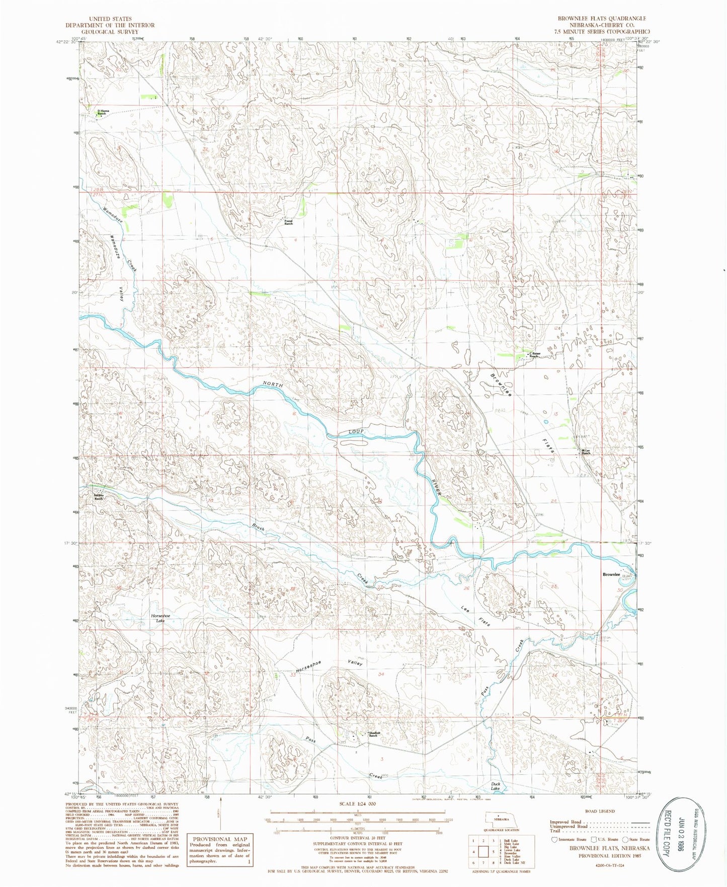
Historical USGS topographic quad map of Brownlee Flats in the state of Nebraska. Map scale may vary for some years, but is generally around 1:24,000. Print size is approximately 24" x 27"
This quadrangle is in the following counties: Cherry.
The map contains contour lines, roads, rivers, towns, and lakes. Printed on high-quality waterproof paper with UV fade-resistant inks, and shipped rolled.
Contains the following named places: Box T Ranch, Brownlee, Brownlee Flats, Brush Creek, C Pound Ranch, C Reiser Ranch, D Hanna Ranch, F Hanna Ranch, Horseshoe Lake, Horseshoe Valley, Lee Flats, M Lee Ranch, Maahs Ranch, Pass Creek, School Number 108, School Number 179, Shadbolt Ranch, Shanley Ranch, Stichka Ranch, Wamaduze Creek, Wamaduze Valley