MyTopo
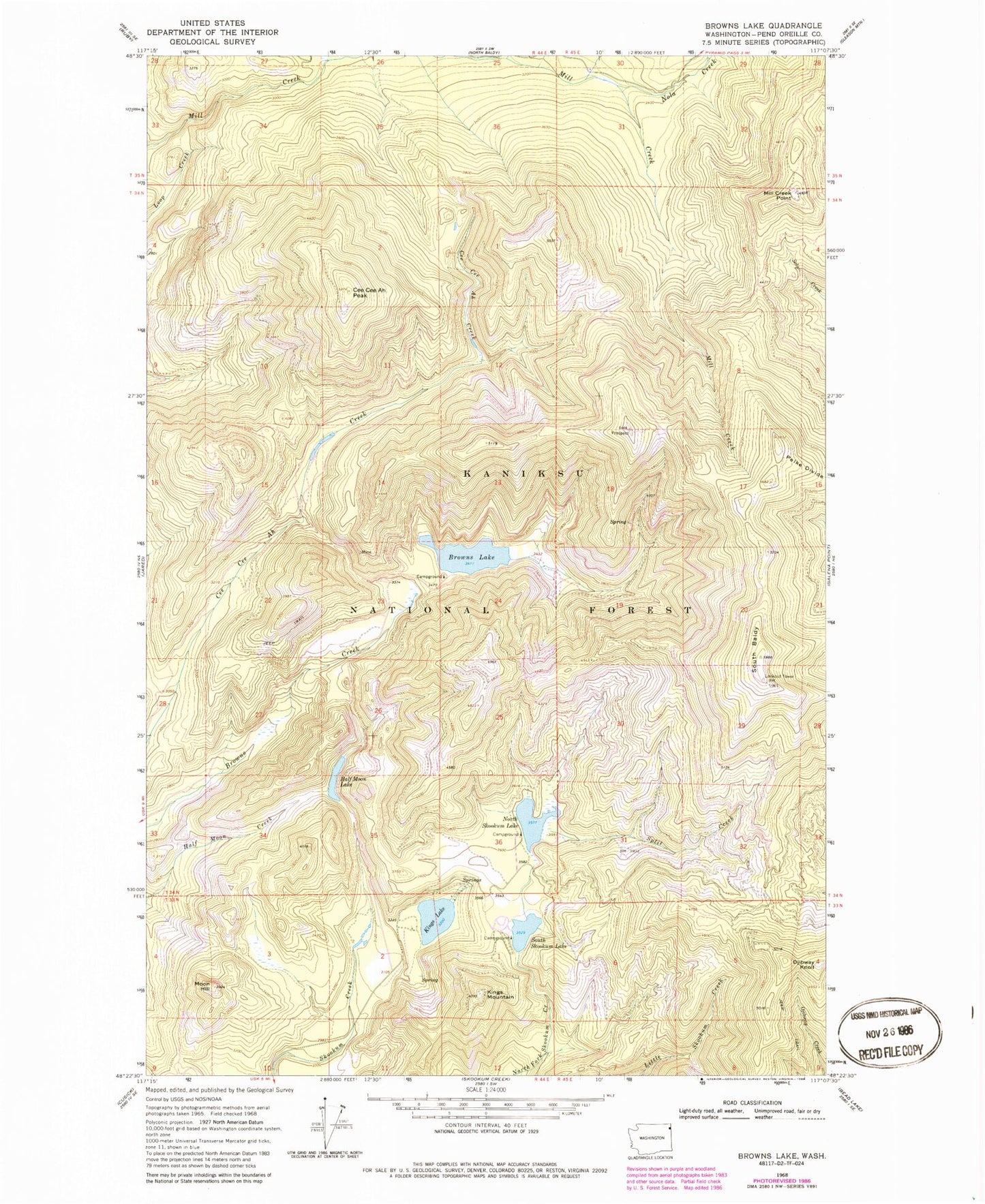
Classic USGS Browns Lake Washington 7.5'x7.5' Topo Map
Couldn't load pickup availability
Historical USGS topographic quad map of Browns Lake in the state of Washington. Map scale is 1:24000. Print size is approximately 24" x 27"
This quadrangle is in the following counties: Pend Oreille.
The map contains contour lines, roads, rivers, towns, and lakes. Printed on high-quality waterproof paper with UV fade-resistant inks, and shipped rolled.
Contains the following named places: Browns Lake, Browns Lake Campground, Browns Lake Recreational Site, Cee Cee Ah Peak, Half Moon Lake, Kings Lake, Kings Mountain, Kings Mountain Lookout, Mill Creek Mountain Lookout, Mill Creek Point, Moon Hill, Moon Hill Lookout, Nola Creek, North Skookum Campground, North Skookum Lake, North Skookum Lake Recreational Site, Ojibway Knoll, Ojibway Knoll Lookout, Pelke Divide, South Baldy, South Baldy Lookout, South Skookum Lake, South Skookum Lake Campground, South Skookum Lake Recreational Site, Split Creek, Sylvis Creek, Vista Lookout