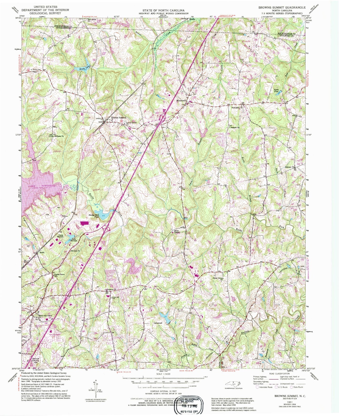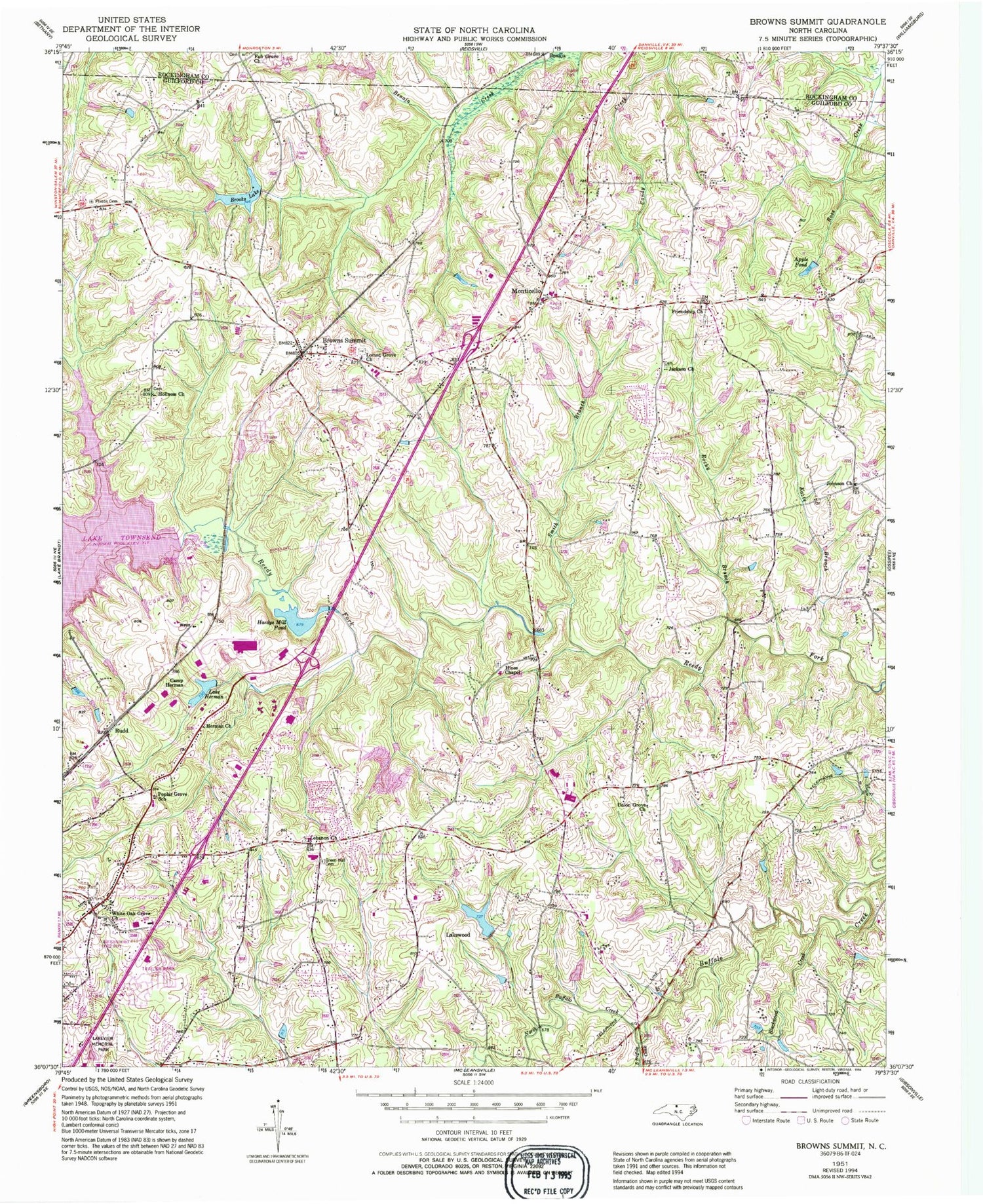
MyTopo
Classic USGS Browns Summit North Carolina 7.5'x7.5' Topo Map
Couldn't load pickup availability
Historical USGS topographic quad map of Browns Summit in the state of North Carolina. Map scale is 1:24000. Print size is approximately 24" x 27"
This quadrangle is in the following counties: Guilford, Rockingham.
The map contains contour lines, roads, rivers, towns, and lakes. Printed on high-quality waterproof paper with UV fade-resistant inks, and shipped rolled.
Contains the following named places: Ames Lake, Ames Lake Dam, Apple Pond, Benaja, Blackwood Creek, Brooks Lake, Browns Summit, Browns Summit Post Office, Browns Summit School, Camp Herman, Fair Grove Church, Fellowship Hall, Fire District 13 Station 55 Greensboro, Friendship Church, Green Hall Cemetery, Hardys Mill Pond, Hardys Mill Pond Dam, Herman Church, Hines Chapel, Holiness Church, Jackson Church, Johnson Church, Katie Branch, Lake Brooks Dam, Lake Herman, Lake Herman Dam, Lakeview Memorial Park, Lakewood, Lakewood Lake, Lakewood Lake Dam, Lebanon Church, Locust Grove Church, Madison Elementary School, Monticello, Monticello Elementary School, North Buffalo Creek, Northeast Guilford Volunteer Fire Department Station 32, Northeast Junior High School, Northeast Senior High School, Phibbs Cemetery, Poplar Grove School, Rocky Branch, Rudd, Smith Branch, Smothers Lake, Smothers Lake Dam, South Buffalo Creek, Squirrel Creek, Townsend Dam, Township of Madison, Township of Monroe, Union Grove Church, White Oak Grove Church, WRDG-TV (Burlington), WWMO-FM (Reidsville)