MyTopo
Classic USGS Browns Alabama 7.5'x7.5' Topo Map
Couldn't load pickup availability
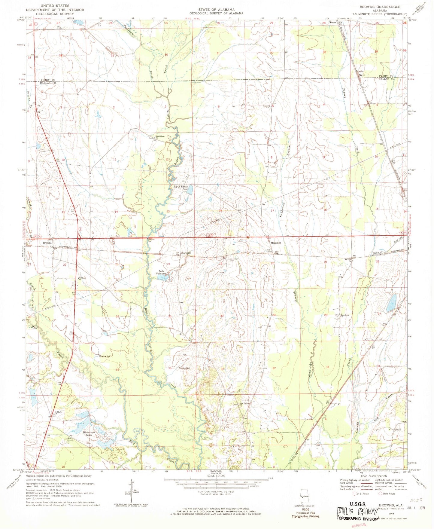
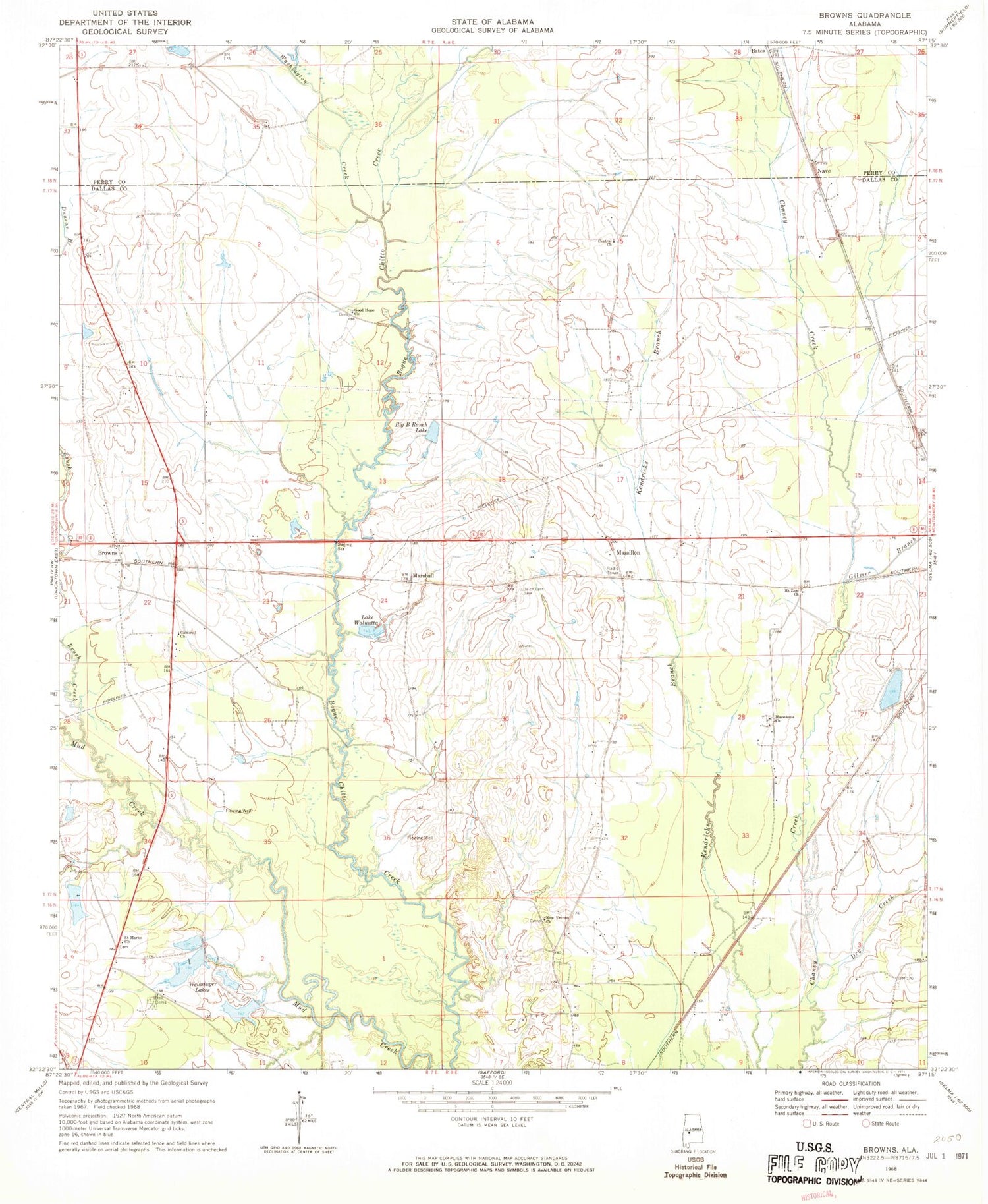
Historical USGS topographic quad map of Browns in the state of Alabama. Map scale may vary for some years, but is generally around 1:24,000. Print size is approximately 24" x 27"
This quadrangle is in the following counties: Dallas, Perry.
The map contains contour lines, roads, rivers, towns, and lakes. Printed on high-quality waterproof paper with UV fade-resistant inks, and shipped rolled.
Contains the following named places: Bell Cemetery, Bells Church, Big B Ranch Lake, Browns, Brush Creek, C A Caines Lake, C A Caines Lake Dam, Caldwell Church, Central Baptist Church, Dry Creek, E F Randell Dam, E F Randell Lake, F W Pierce Lake Dam Number 2, F W Pierce Lake Number 2, Gary School, Gilmer Branch, Good Hope Church, Lake Walnutta, Macedonia Church, Marion Weissinger Lake Dam Number 2, Marion Weissinger Lake Number 2, Marshall, Massillon, Mount Zion Church, Nave, New Vernon Cemetery, New Vernon Church, Saint Chapter Cemetery, Saint Chapter Primitive Baptist Church, Saint Marks Church, Vernon Cemetery, W W Weissinger Lake Number 1, W W Weissinger Number 2 Dam, W W Weissinger Number 2 Lake, W W Weissinger Number 4 Dam, W W Weissinger Number 4 Lake, W W Wesssinger Number 1 Dam, Washington Creek, Weissinger Lakes, ZIP Code: 36759