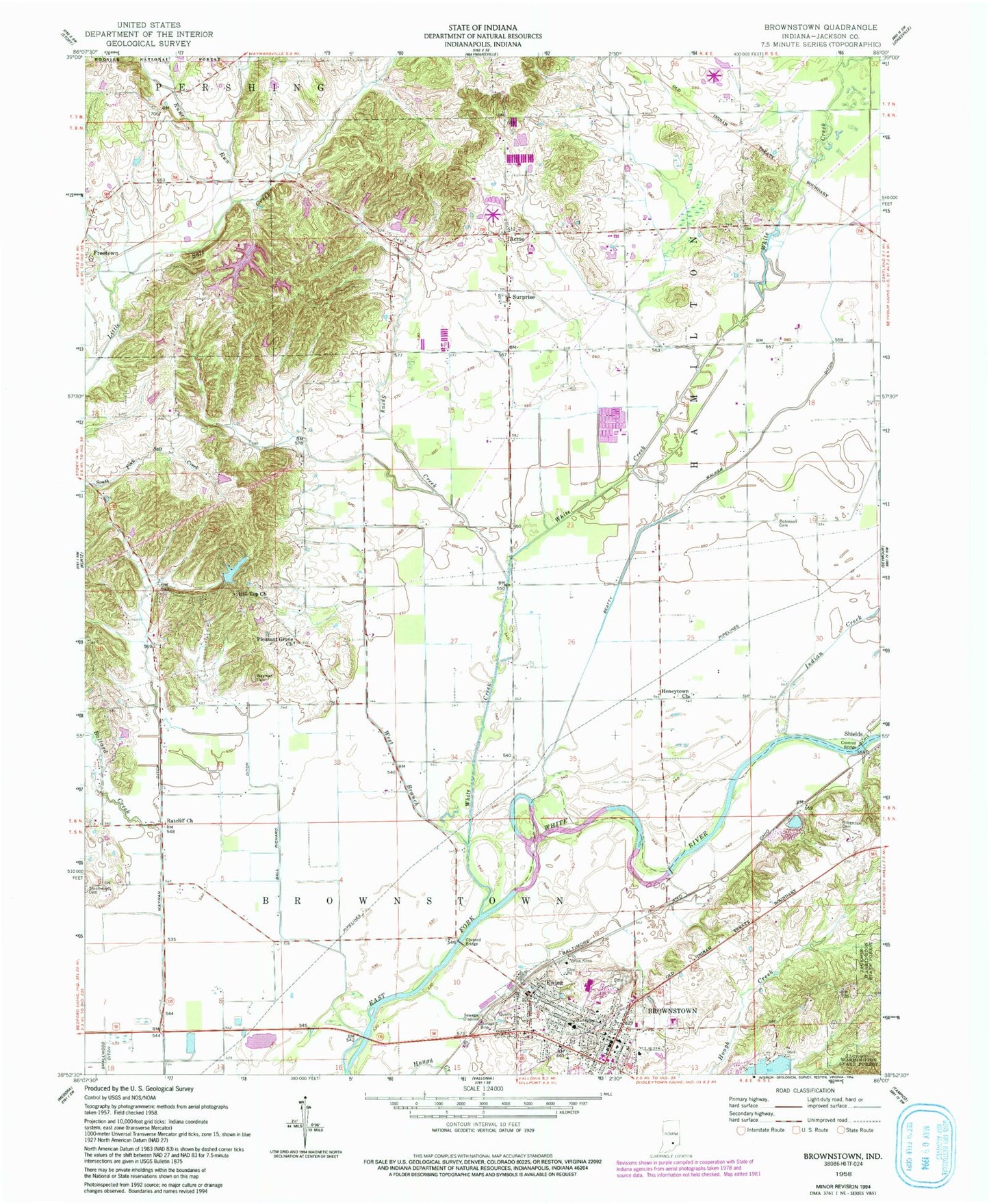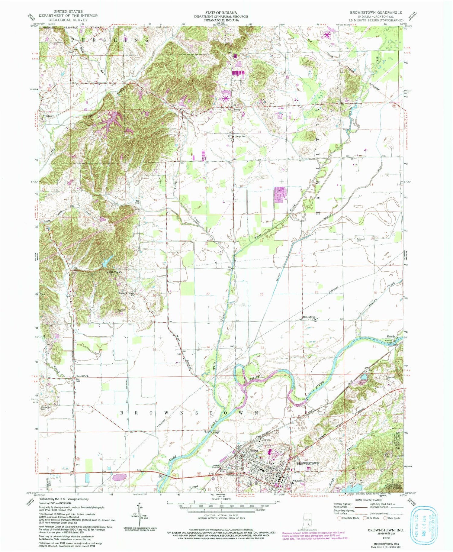
MyTopo
Classic USGS Brownstown Indiana 7.5'x7.5' Topo Map
Couldn't load pickup availability
Historical USGS topographic quad map of Brownstown in the state of Indiana. Map scale may vary for some years, but is generally around 1:24,000. Print size is approximately 24" x 27"
This quadrangle is in the following counties: Jackson.
The map contains contour lines, roads, rivers, towns, and lakes. Printed on high-quality waterproof paper with UV fade-resistant inks, and shipped rolled.
Contains the following named places: Acme, Ball Richard Ditch, Ballard Creek, Beatty Walker Ditch, Brownstown, Brownstown Police Department, Brownstown Post Office, Brownstown Volunteer Fire Department, Ewing, Green Acres Airport, Hill Top Church, Honeytown Church, Indian Creek, Jackson County, Jackson County Courthouse, Jackson County Emergency Medical Services Brownstown, Lake and Forest Club Dam, Oathout Ditch, Pleasant Grove Church, Ratcliff Church, Robertson Cemetery, Robinson Cemetery, Shields, Spray Creek, Surprise, Timber Lake, Timber Lake Dam, Town of Brownstown, Township of Brownstown, Wayman Cemetery, Wayman Ditch, West Branch White Creek, White Creek, ZIP Code: 47220