MyTopo
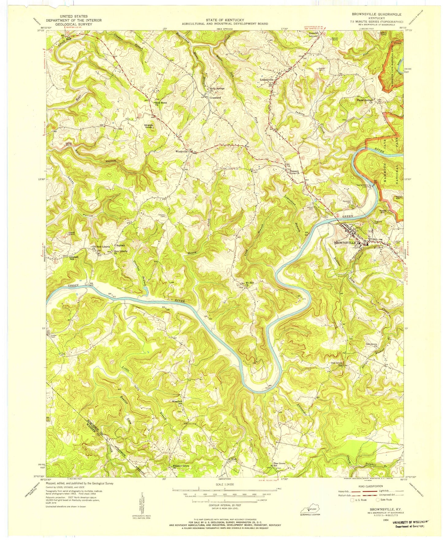
Classic USGS Brownsville Kentucky 7.5'x7.5' Topo Map
Couldn't load pickup availability
Historical USGS topographic quad map of Brownsville in the state of Kentucky. Typical map scale is 1:24,000, but may vary for certain years, if available. Print size: 24" x 27"
This quadrangle is in the following counties: Edmonson, Warren.
The map contains contour lines, roads, rivers, towns, and lakes. Printed on high-quality waterproof paper with UV fade-resistant inks, and shipped rolled.
Contains the following named places: Alexander Creek, Beaverdam Creek, Brownsville, Camp Joy, Crooked Branch, Cub Creek, Grassland, Gulf Hollow, Hawks Cemetery, Holly Springs Cemetery, Holly Springs Church, Honey Creek, Indian Hill, Laurel Branch, Limestone Branch, Indian Creek, Lindseyville, Little Beaverdam Creek, Long Branch, Mount Zion Church, Music Branch, New Home Church, New Liberty Church, Oak Grove Cemetery, Oak Grove Church, Oak Hill Church, Old New Liberty Church, Pine Grove Church, Pleasant Grove Church, Pleasant Union Church, Poplar Springs Church, Potato Hill, Sally Branch, Shingle Machine Branch, Shipley Knob, Sulphur Branch, White Oak Fork, Wingfield Church, Asphalt, Huff, Nick, Windyville, Alexander Cemetery, Green River Lock Number 6 (historical), Brownsville North Division, City of Brownsville, Brownsville Fire Department, Wingfield Fire Department, Bear Creek Fire Department, Kyrock Fire Department, Edmonson County Ambulance Service, Lovers Leap, Sulphur Spring, Edmonson County Sheriff's Office, Brownsville Post Office