MyTopo
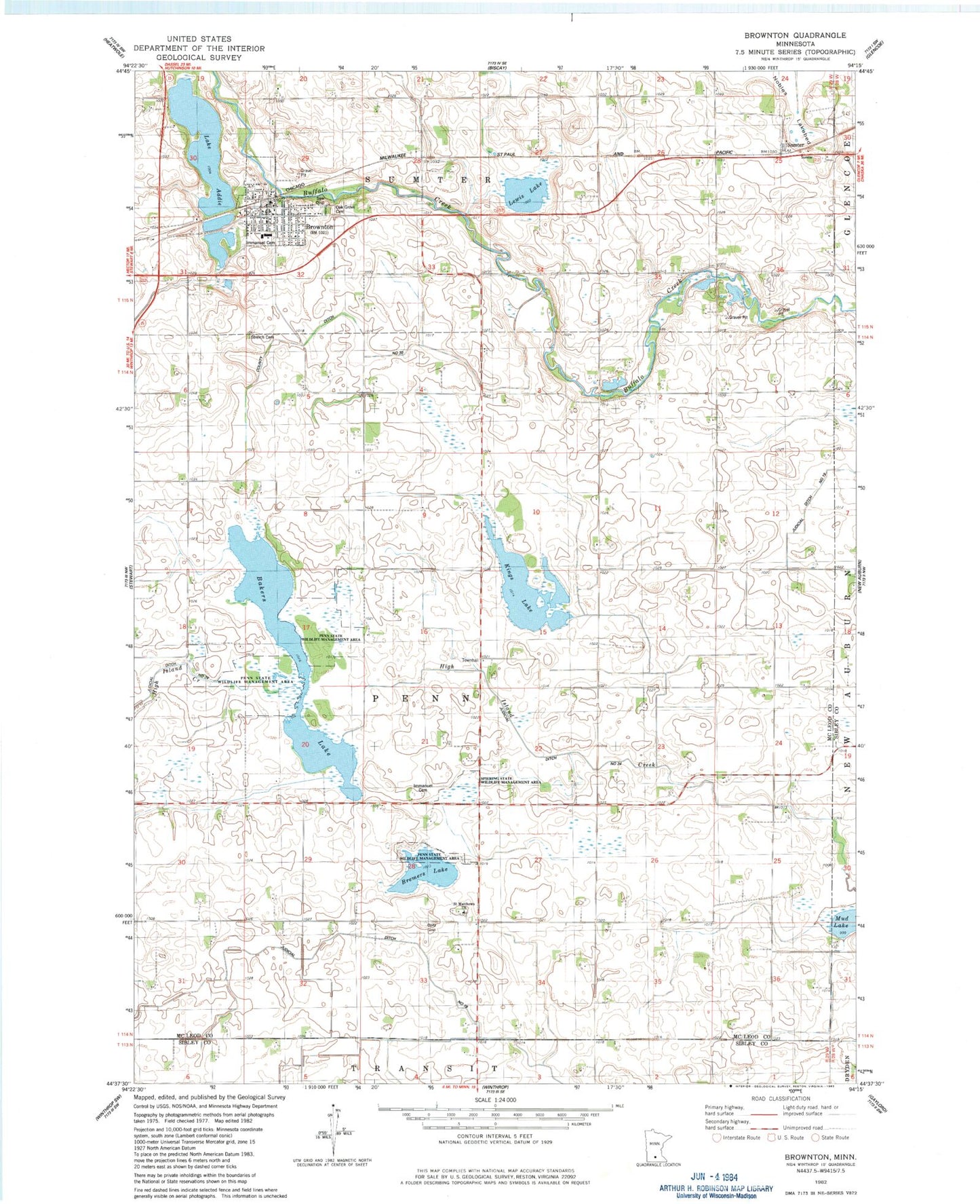
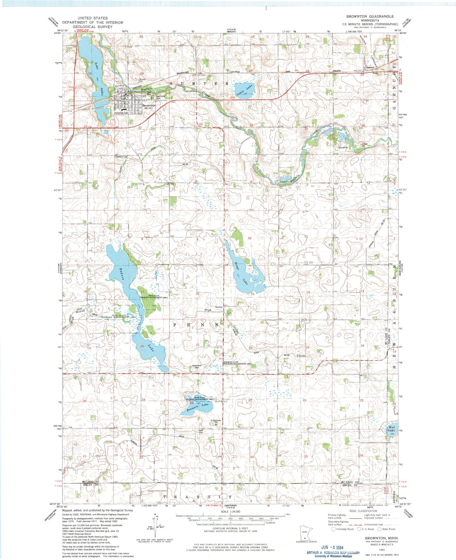
Classic USGS Brownton Minnesota 7.5'x7.5' Topo Map
Couldn't load pickup availability
Historical USGS topographic quad map of Brownton in the state of Minnesota. Map scale may vary for some years, but is generally around 1:24,000. Print size is approximately 24" x 27"
This quadrangle is in the following counties: McLeod, Sibley.
The map contains contour lines, roads, rivers, towns, and lakes. Printed on high-quality waterproof paper with UV fade-resistant inks, and shipped rolled.
Contains the following named places: Bakers Lake, Bremers Lake, Brownton, Brownton Police Department, Brownton Post Office, Brownton Public Library, Brownton Volunteer Fire Department, City of Brownton, County Ditch Number Thirty, Grace Lutheran Church, Immanuel Cemetery, Immanuel Lutheran Church, Judicial Ditch Number Eighteen, Kings Lake, Lake Addie, Lewis Lake, McLeod West Senior High School, Mud Lake, Oak Grove Cemetery, Penn State Wildlife Management Area, Saint Matthew's Cemetery, Saint Matthews Church, Shade Tree Retirement Center, Spiering State Wildlife Management Area, Streich Cemetery, Sumter, Sumter Post Office, Township of Penn, ZIP Code: 55312