
MyTopo
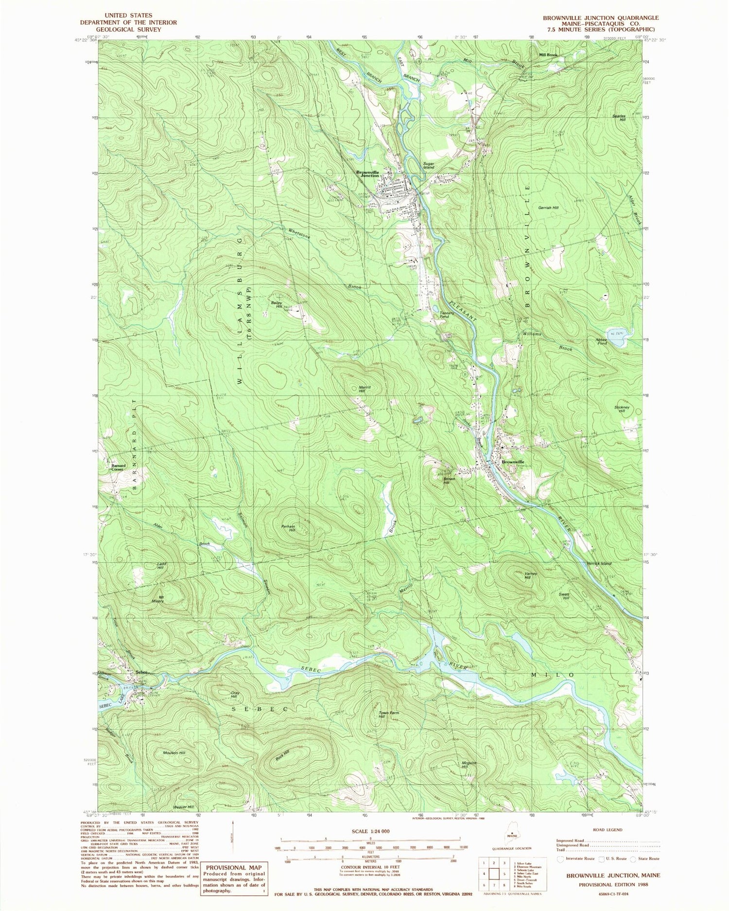
Classic USGS Brownville Junction Maine 7.5'x7.5' Topo Map
Couldn't load pickup availability
Historical USGS topographic quad map of Brownville Junction in the state of Maine. Typical map scale is 1:24,000, but may vary for certain years, if available. Print size: 24" x 27"
This quadrangle is in the following counties: Piscataquis.
The map contains contour lines, roads, rivers, towns, and lakes. Printed on high-quality waterproof paper with UV fade-resistant inks, and shipped rolled.
Contains the following named places: Abbee Pond, Alder Brook, Badger Brook, Bailey Hill, Barnard School, Brown Hill, Brownville, Brownville Junction, Buck Hill, East Branch Pleasant River, Gerrish Hill, Gillman Brook, Gray Hill, Herrick Island, Jenks Brook, Ladd Hill, Maquire Hill, Merrill Brook, Merrill Hill, Mill Brook, Mount Misery, Moulton Hill, Perham Hill, Pine Tree Cemetery, Salmon Stream, Sebec, Sugar Island, Swett Hill, Tannery Pond, Town Farm Hill, Trout Brook, Varney Hill, Weaver Hill, West Branch Pleasant River, Whetstone Brook, Williams Brook, Williamsburg School, Barnard Corner, Mill Brook, Webber Jones Airport, Town of Brownville, Pleasant River Dam, Pleasant River Reservoir, Sebec Dam, Brownville Elementary School, Brownville Junction Post Office, Brownville Post Office, Brownville Public Library, Sebec Village Cemetery, Sebec Village Community Christian Church, Village Cemetery, Williamsburg Township, Brownville Fire Department Junction Fire Station, Brownville Fire Department Village Station, Sebec Fire Department, Sebec Village Cemetery Cowan Extension, Brownville Police Department, Barnard Cemetery, Downs Cemetery, Hoxie Cemetery, Brownville Junction Census Designated Place


