MyTopo
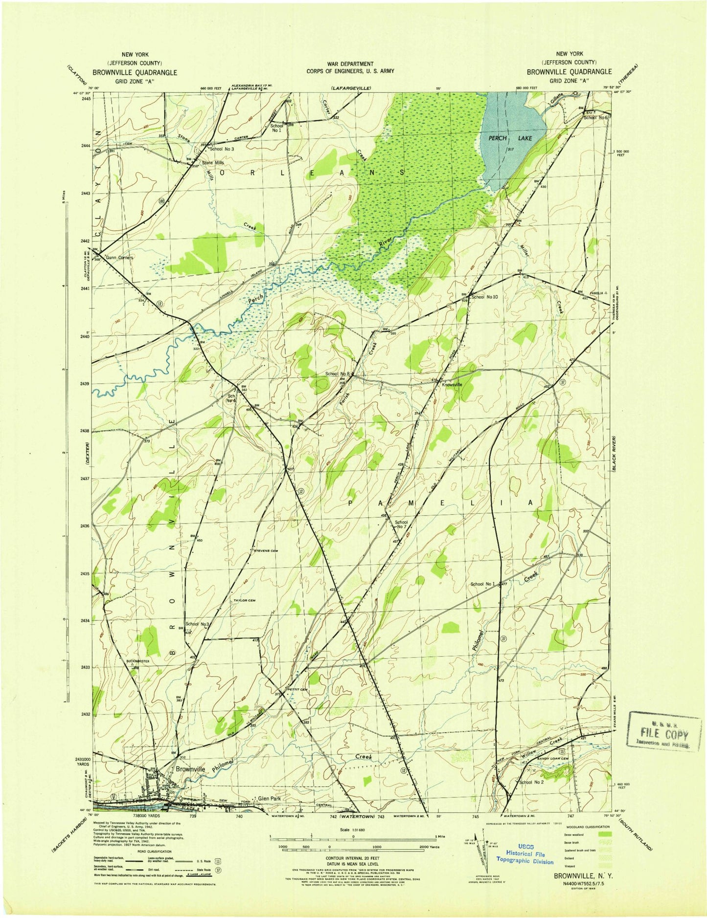
Classic USGS Brownville New York 7.5'x7.5' Topo Map
Couldn't load pickup availability
Historical USGS topographic quad map of Brownville in the state of New York. Map scale may vary for some years, but is generally around 1:24,000. Print size is approximately 24" x 27"
This quadrangle is in the following counties: Jefferson.
The map contains contour lines, roads, rivers, towns, and lakes. Printed on high-quality waterproof paper with UV fade-resistant inks, and shipped rolled.
Contains the following named places: Black River Bridge, Brownville, Brownville - Glen Park Library, Brownville Post Office, Brownville School, Brownville Sewage Treatment Plant, Brownville United Methodist Church, Brownville Volunteer Fire Department, Calcium Volunteer Fire Department Station 2, Carter Creek, Gillette Creek, Glen Park, Glen Park Village Fire Department, Gunns Corners, Highland Meadows Golf and Country Club, Jenkins School, Miller Creek, New York State Police Troop D Zone 3 Watertown Station, Northside Drive-In, Noseville, Pamelia Center, Pamelia Center Census Designated Place, Parrish Cemetery, Parrish Creek, Perch Lake, Perch River State Game Management Area, Pettit Cemetery, Philomel Creek, River of Life Fellowship, Rouses Cemetery, Saint Paul's Episcopal Church, Sandy Lawn Cemetery, School Number 1, School Number 2, School Number 3, School Number 4, School Number 6, Scoville Corners, Stevens Cemetery, Stone Mills, Stone Mills Creek, Summit Trailer Park, Taylor Cemetery, Town of Pamelia, Village of Brownville, Village of Glen Park, Willow Creek, Willowbrook Country Club, WTNY-FM (Watertown), ZIP Code: 13615