
MyTopo
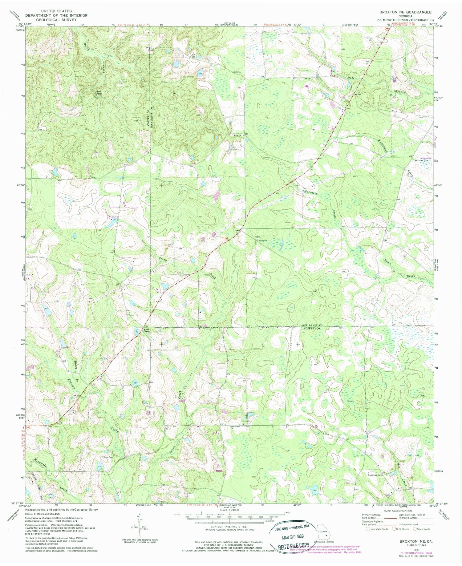
Classic USGS Broxton NE Georgia 7.5'x7.5' Topo Map
Regular price
$16.95
Regular price
Sale price
$16.95
Unit price
per
Couldn't load pickup availability
Historical USGS topographic quad map of Broxton NE in the state of Georgia. Map scale may vary for some years, but is generally around 1:24,000. Print size is approximately 24" x 27"
This quadrangle is in the following counties: Coffee, Jeff Davis.
The map contains contour lines, roads, rivers, towns, and lakes. Printed on high-quality waterproof paper with UV fade-resistant inks, and shipped rolled.
Contains the following named places: Bennie Dockery Pond, Bennie Dockery Pond Dam, Byrd Church, Carver Church, Cato Cemetery, Higgs Lake Dam, Marys Chapel, Moccasin Creek, Parish Still, Providence Church, Rock Falls, Turkey Branch, West Green Church, Williams Cemetery, Williams Chapel, ZIP Code: 31532


