MyTopo
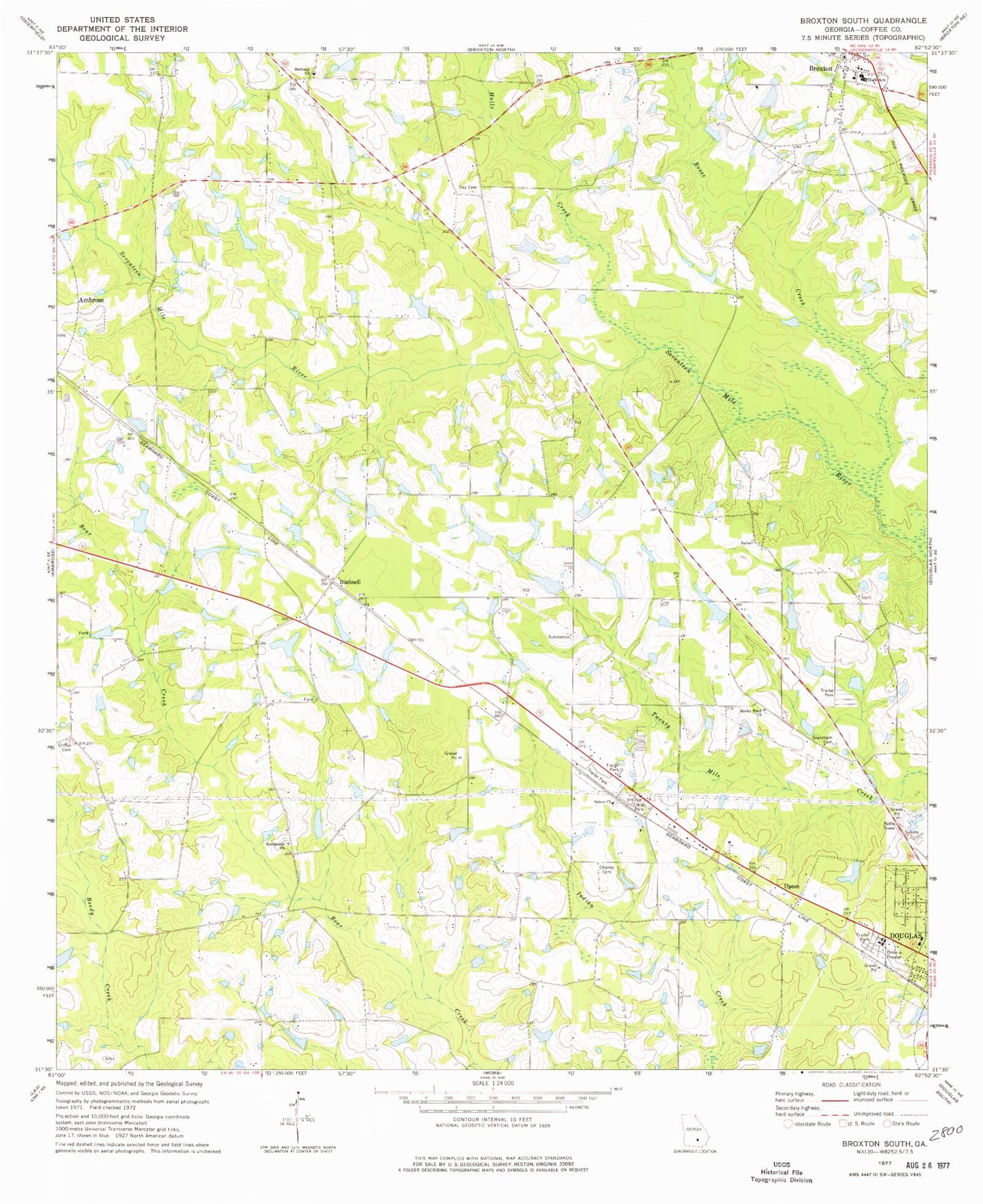
Classic USGS Broxton South Georgia 7.5'x7.5' Topo Map
Couldn't load pickup availability
Historical USGS topographic quad map of Broxton South in the state of Georgia. Map scale may vary for some years, but is generally around 1:24,000. Print size is approximately 24" x 27"
This quadrangle is in the following counties: Coffee.
The map contains contour lines, roads, rivers, towns, and lakes. Printed on high-quality waterproof paper with UV fade-resistant inks, and shipped rolled.
Contains the following named places: Bethany Cemetery, Bethany Church, Broxton Baptist Church, Broxton Library, Broxton Police Department, Bushnell, Bushnell Church, Chaney Cemetery, City of Broxton, Coffee County Fire and Rescue Department Station 10, Coffee County Fire and Rescue Department Station 14, Coffee County Jail, Coffee County Sheriff's Department, Day Cemetery, Grantham Cemetery, Griffin Cemetery, Halls Creek, Harper Lake, Harper Lake Dam, Perimeter West Industrial Park, Peterson Cemetery, Rocky Pond Cemetery, Rocky Pond Church, Roses Creek, Salem Cemetery, Salem Holiness Baptist Church, Sunnyside Church, Upton, Young Cemetery