

MyTopo
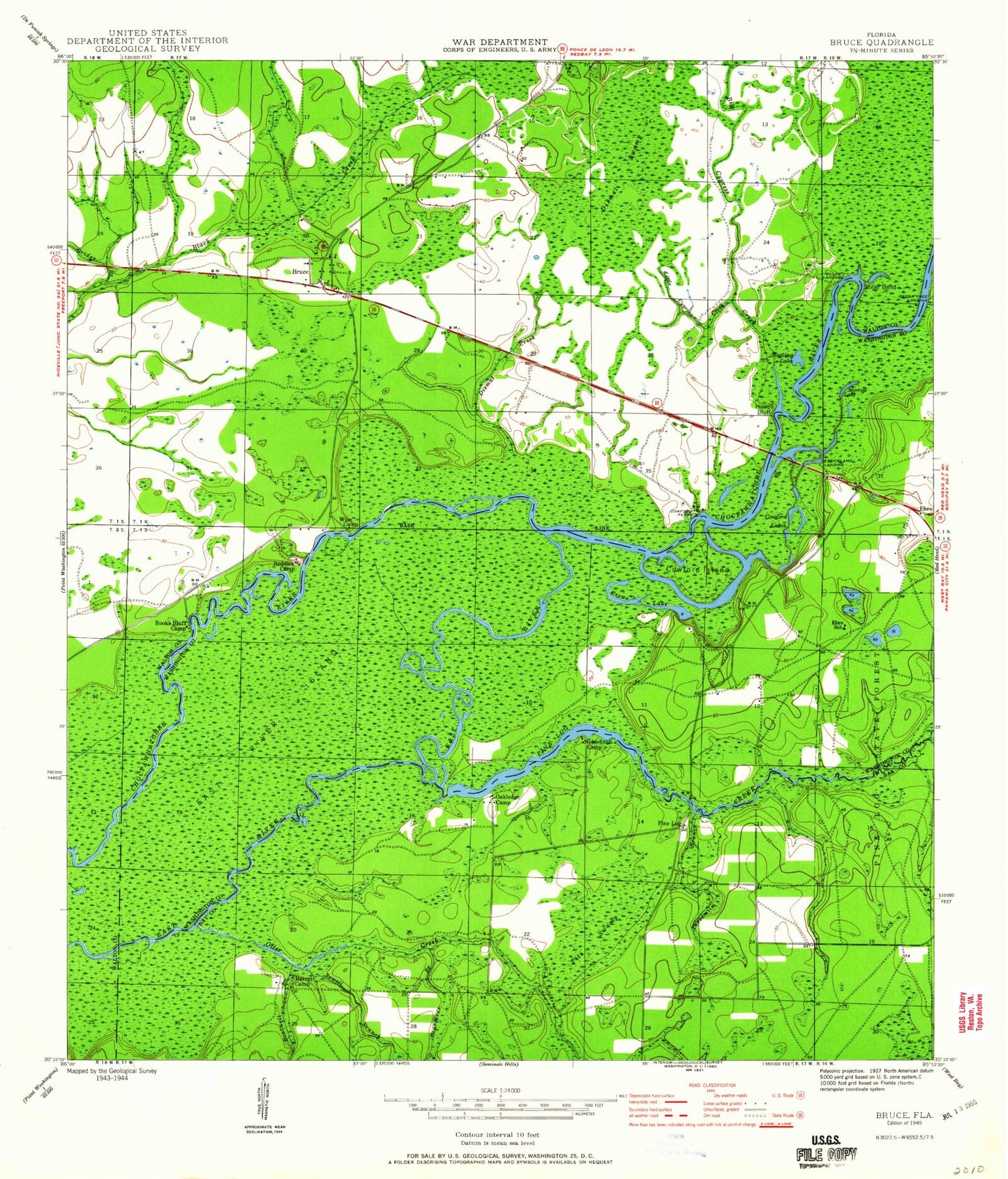
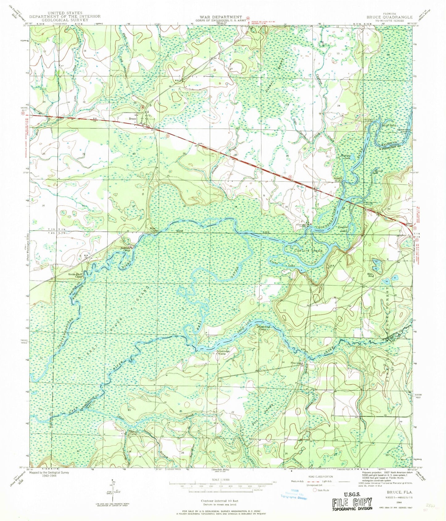
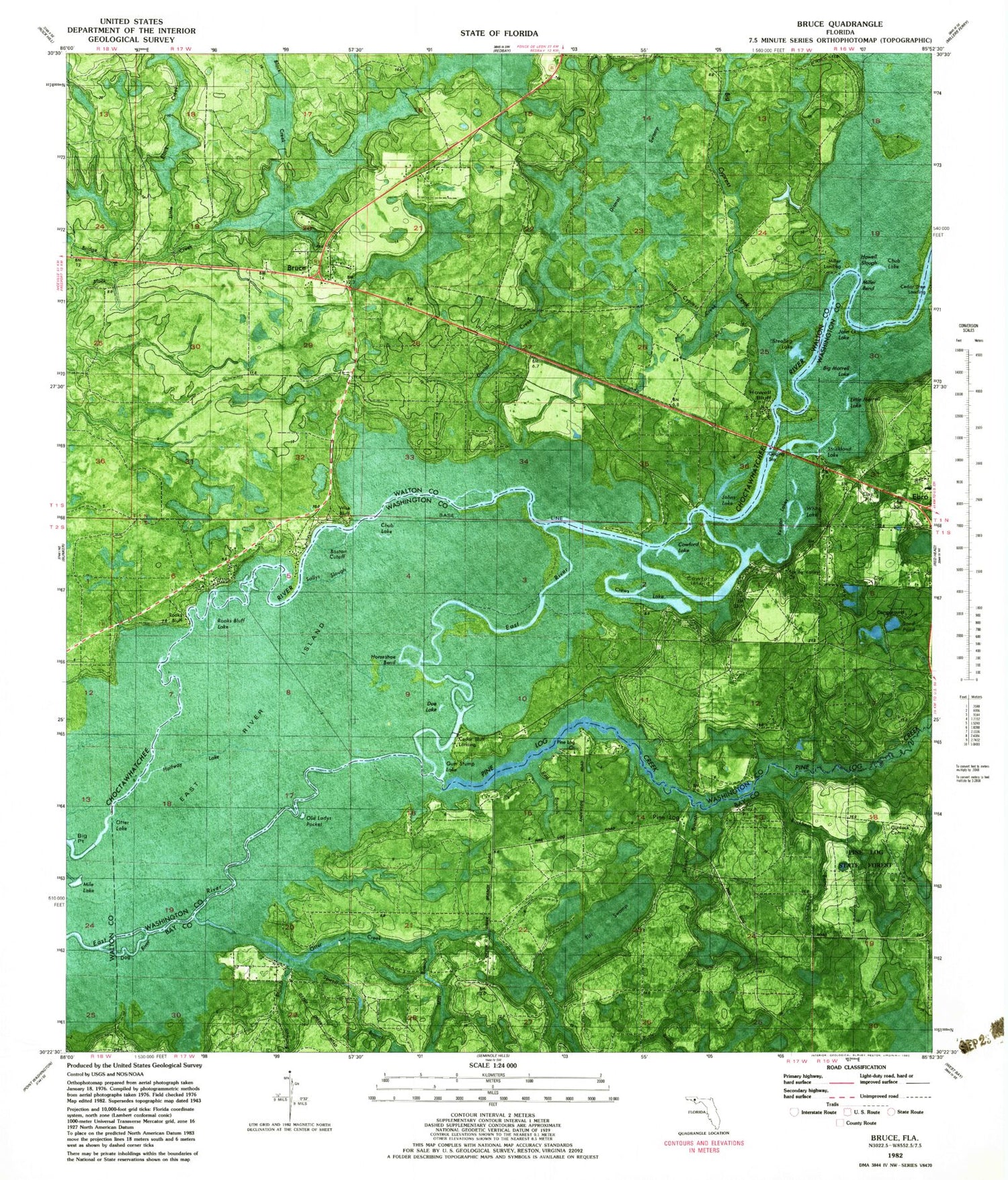
Classic USGS Bruce Florida 7.5'x7.5' Topo Map
Couldn't load pickup availability
Historical USGS topographic quad map of Bruce in the state of Florida. Map scale is 1:24000. Print size is approximately 24" x 27"
This quadrangle is in the following counties: Bay, Walton, Washington.
The map contains contour lines, roads, rivers, towns, and lakes. Printed on high-quality waterproof paper with UV fade-resistant inks, and shipped rolled.
Contains the following named places: Big Cypress Creek, Big Cypress Creek, Big Morrell Lake, Big Morrell Lake, Boston Cutoff, Boston Cutoff, Boutwell Branch, Boutwell Branch, Bridge Branch, Bridge Branch, Bruce, Bruce, Cedar Tree Landing, Cedar Tree Landing, Cowford Ferry, Cowford Ferry, Cowford Island, Cowford Island, Crews Lake, Crews Lake, Dismal Creek, Dismal Creek, Dismal Swamp, Dismal Swamp, East River Island, East River Island, Ebro School, Ebro School, Howell Bluff, Howell Bluff, Little Black Creek, Little Black Creek, Little Cypress Creek, Little Cypress Creek, Little Morrell Lake, Little Morrell Lake, Mill Branch, Mill Branch, Miller Bend, Miller Bend, Miller Landing, Miller Landing, Morrow Lake, Morrow Lake, Nobleknob Camp, Nobleknob Camp, Oakledge Camp, Oakledge Camp, Olan Ferguson Bridge, Olan Ferguson Bridge, Otter Creek, Otter Creek, Pine Log, Pine Log, Pine Log Creek, Pine Log Creek, R B Spires Pond, R B Spires Pond, Reason Lakes, Reason Lakes, Reddick Camp, Reddick Camp, Rooks Bluff Camp, Rooks Bluff Camp, Sewell Branch, Sewell Branch, Stealing Lake, Stealing Lake, Strickland Landing, Strickland Landing, Threemile Branch, Threemile Branch, Titi Swamp, Titi Swamp, Town of Ebro, Town of Ebro, Wise Bluff, Wise Bluff, Wise Camp, Wise Camp