MyTopo
Classic USGS Bruceton Tennessee 7.5'x7.5' Topo Map
Couldn't load pickup availability
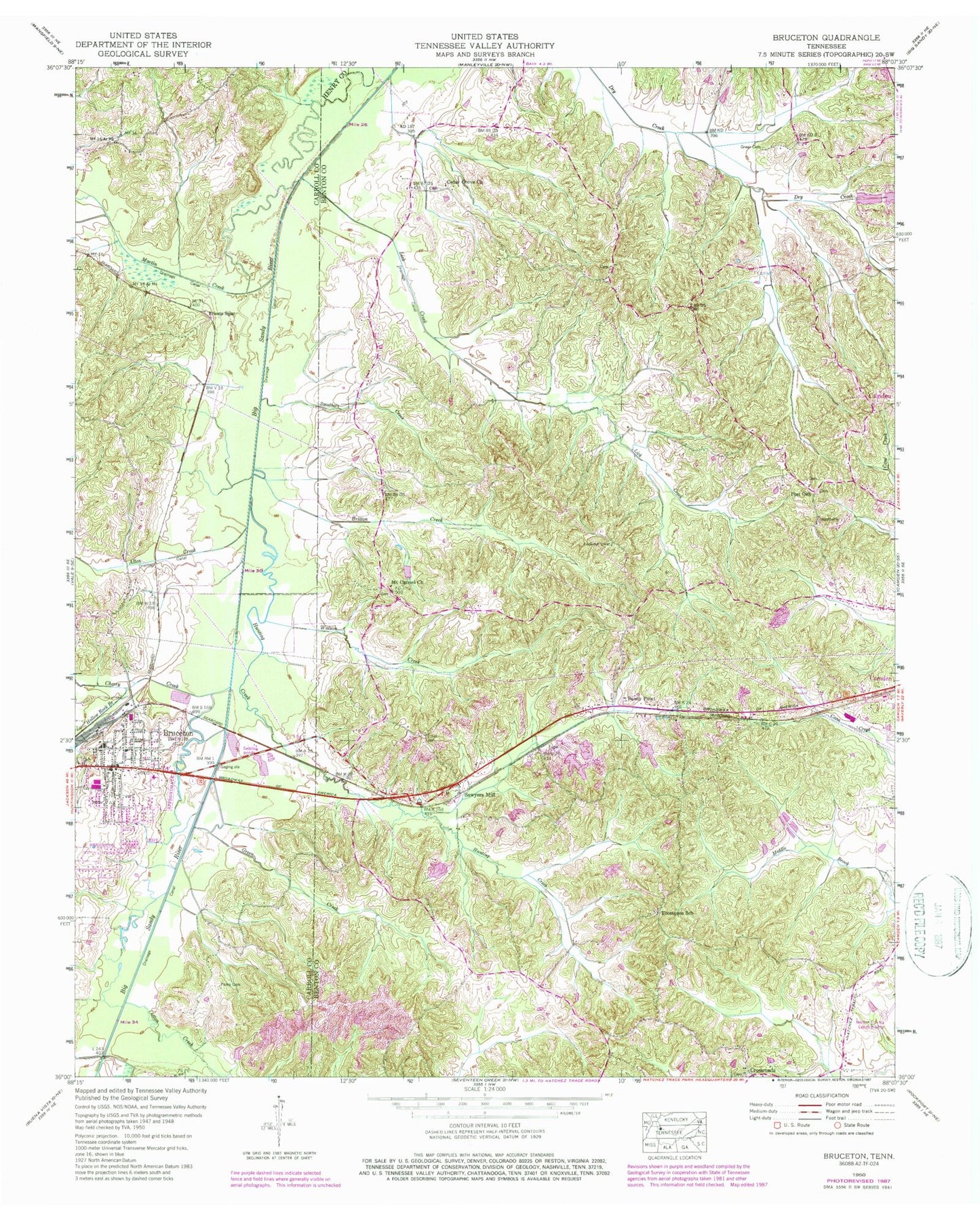
Historical USGS topographic quad map of Bruceton in the state of Tennessee. Map scale is 1:24000. Print size is approximately 24" x 27"
This quadrangle is in the following counties: Benton, Carroll, Henry.
The map contains contour lines, roads, rivers, towns, and lakes. Printed on high-quality waterproof paper with UV fade-resistant inks, and shipped rolled.
Contains the following named places: Allen Creek, Britton Creek, Bruceton, Bruceton Police Department, Bruceton Post Office, Bruceton Volunteer Fire Department, C H Sullins Dam, C H Sullins Lake, Cedar Grove Cemetery, Cedar Grove Church, Cedar Lake Dam Number One, Cedar Lake Dam Number Two, Cedar Lake Number Two, Cherry Creek, Cole Lake, Cole Lake Dam, Commissioner District 2, Cotton Creek, Cotton Creek School (historical), Cross Roads School (historical), Crossroads, Crossroads Baptist Church, Crossroads Cemetery, District 16 (historical), District 17 (historical), Garfield School (historical), Green Creek, Greer Cemetery, Hardy Sand Company Dam, Hardy Sand Company Lake, Hollow Rock Branch, Hunting Creek, Lick Creek, Lipe, Martin Creek, Mount Carmel Cemetery, Mount Carmel Church, Parks Cemetery, Pea Ridge, Pleasant Grove Church (historical), Post Oak, Post Oak Cemetery, Post Oak Methodist Church, Post Oak School (historical), Priests Spur, Prospect, Prospect Baptist Church, Prospect School (historical), Sandy Point, Sandy Point Cemetery, Sandy Point Church, Sandy Point School (historical), Sawyers Mill, Smuthers Creek, Snider (historical), Sunnyview School (historical), Thompson School, Town of Bruceton, Watson Creek, West Camden Sanitary Landfill, Zach School (historical)