MyTopo
Classic USGS Brumley Missouri 7.5'x7.5' Topo Map
Couldn't load pickup availability
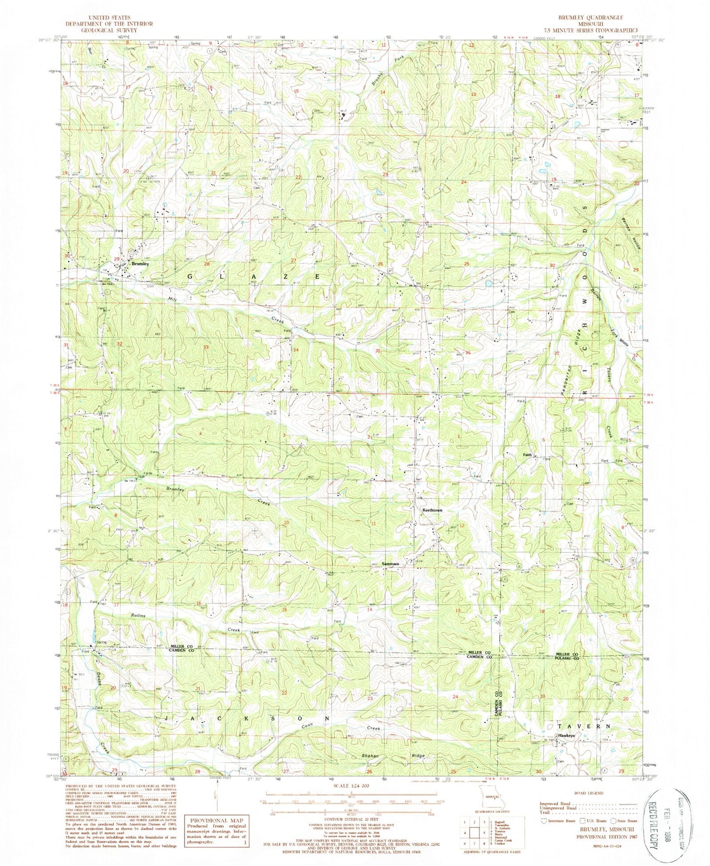
Historical USGS topographic quad map of Brumley in the state of Missouri. Map scale is 1:24000. Print size is approximately 24" x 27"
This quadrangle is in the following counties: Camden, Miller, Pulaski.
The map contains contour lines, roads, rivers, towns, and lakes. Printed on high-quality waterproof paper with UV fade-resistant inks, and shipped rolled.
Contains the following named places: Barnes Hollow, Barton School (historical), Brumley, Brumley Fire Protection District, Brumley Post Office, Coon Creek, Curry Chapel (historical), Curry School (historical), Faith, George School, Glover Chapel, Gott Church, Gott School, Hawkeye, Hawkins Cemetery, Hickory Point Baptist Church (historical), Hickory Point Christian Church (historical), Honey Spring School, Keethtown, Mount Union Church, Pemberton Ridge, Rollins Creek, Ross School, Samtown, Shahan Ridge, Skin Heel School (historical), Town of Brumley, Twelve Corners Church (historical), Watkins, Whittle Creek