
MyTopo
Classic USGS Bruneau Creek Michigan 7.5'x7.5' Topo Map
Couldn't load pickup availability
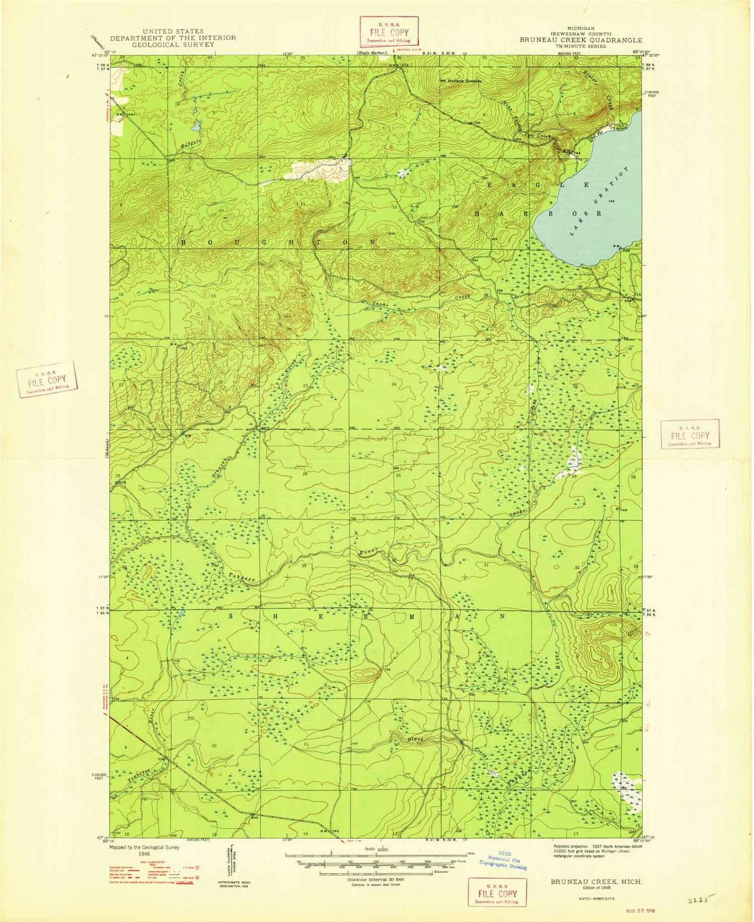
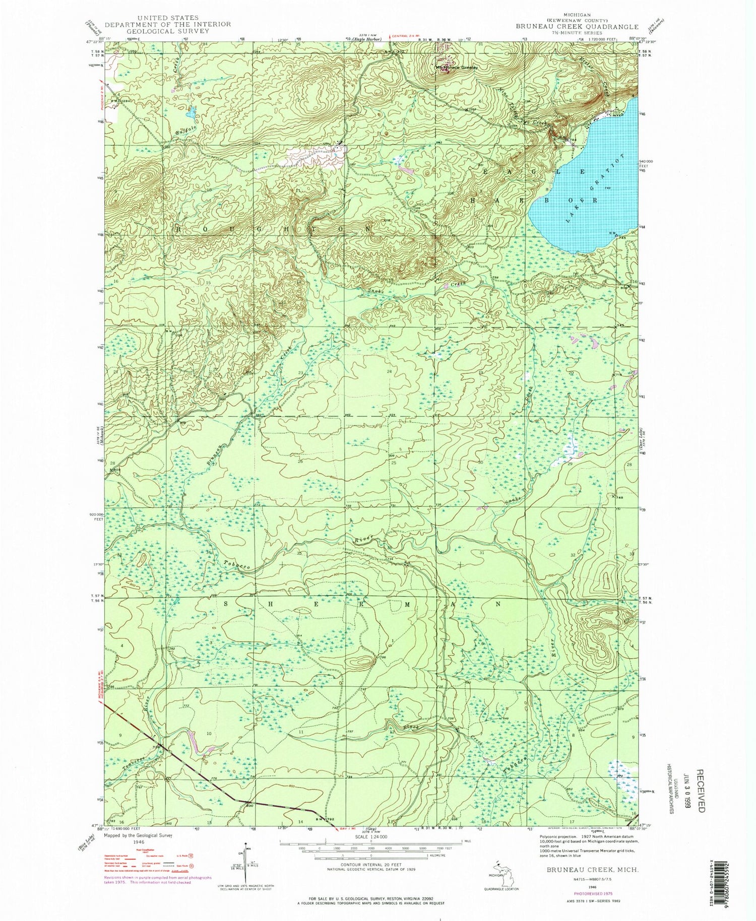
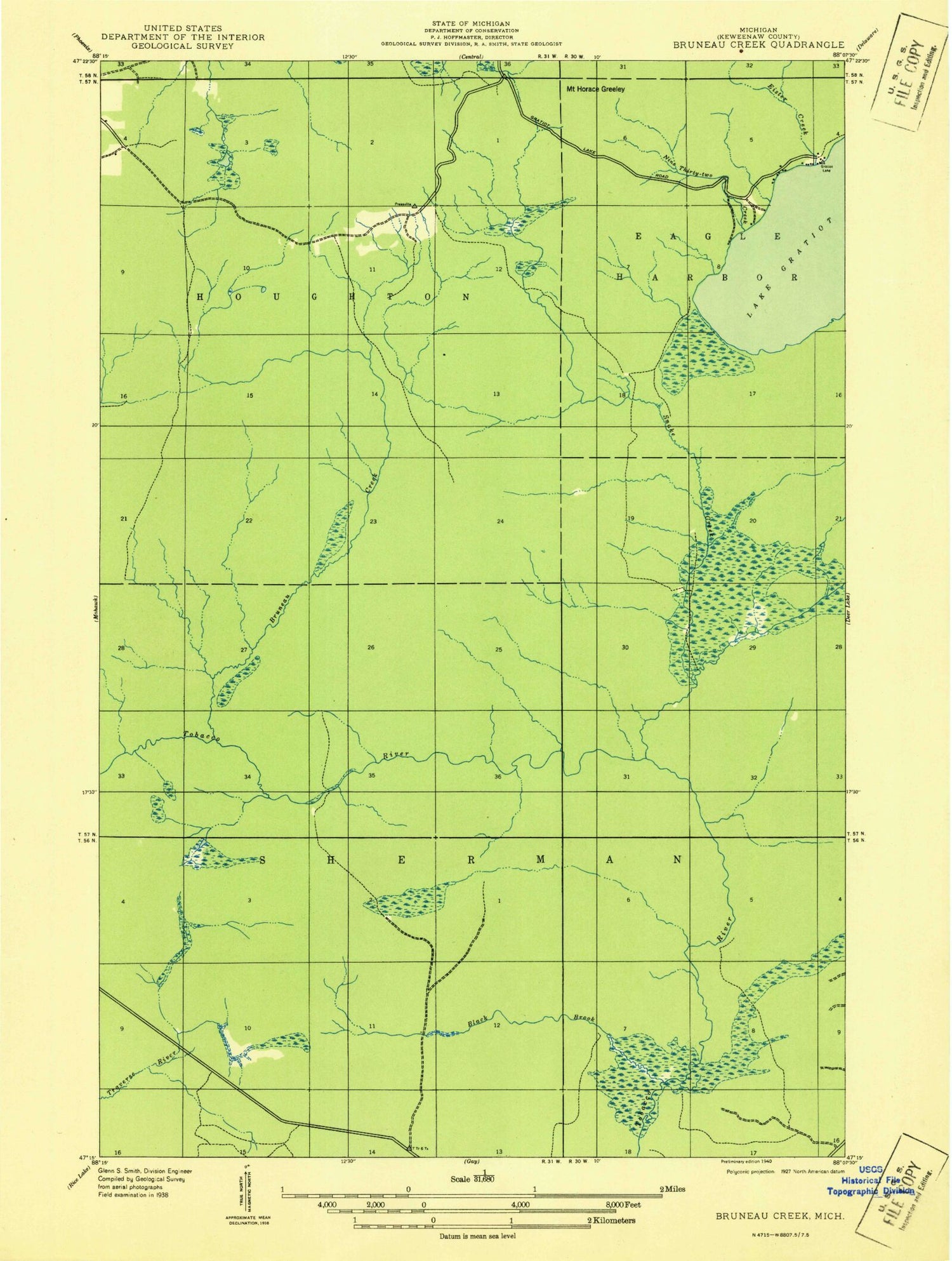
Historical USGS topographic quad map of Bruneau Creek in the state of Michigan. Map scale is 1:24000. Print size is approximately 24" x 27"
This quadrangle is in the following counties: Keweenaw.
The map contains contour lines, roads, rivers, towns, and lakes. Printed on high-quality waterproof paper with UV fade-resistant inks, and shipped rolled.
Contains the following named places: Black Creek, Black Creek, Bruneau Creek, Bruneau Creek, Calumet Air Force Station (historical), Calumet Air Force Station (historical), Eagle Harbor Township Volunteer Fire Department Station 2, Eagle Harbor Township Volunteer Fire Department Station 2, Eister Creek, Eister Creek, Lake Gratiot, Lake Gratiot, Mount Horace Greeley, Mount Horace Greeley, Nine Thirty Two Creek, Nine Thirty Two Creek, Snake Creek, Snake Creek, Township of Sherman, Township of Sherman


