
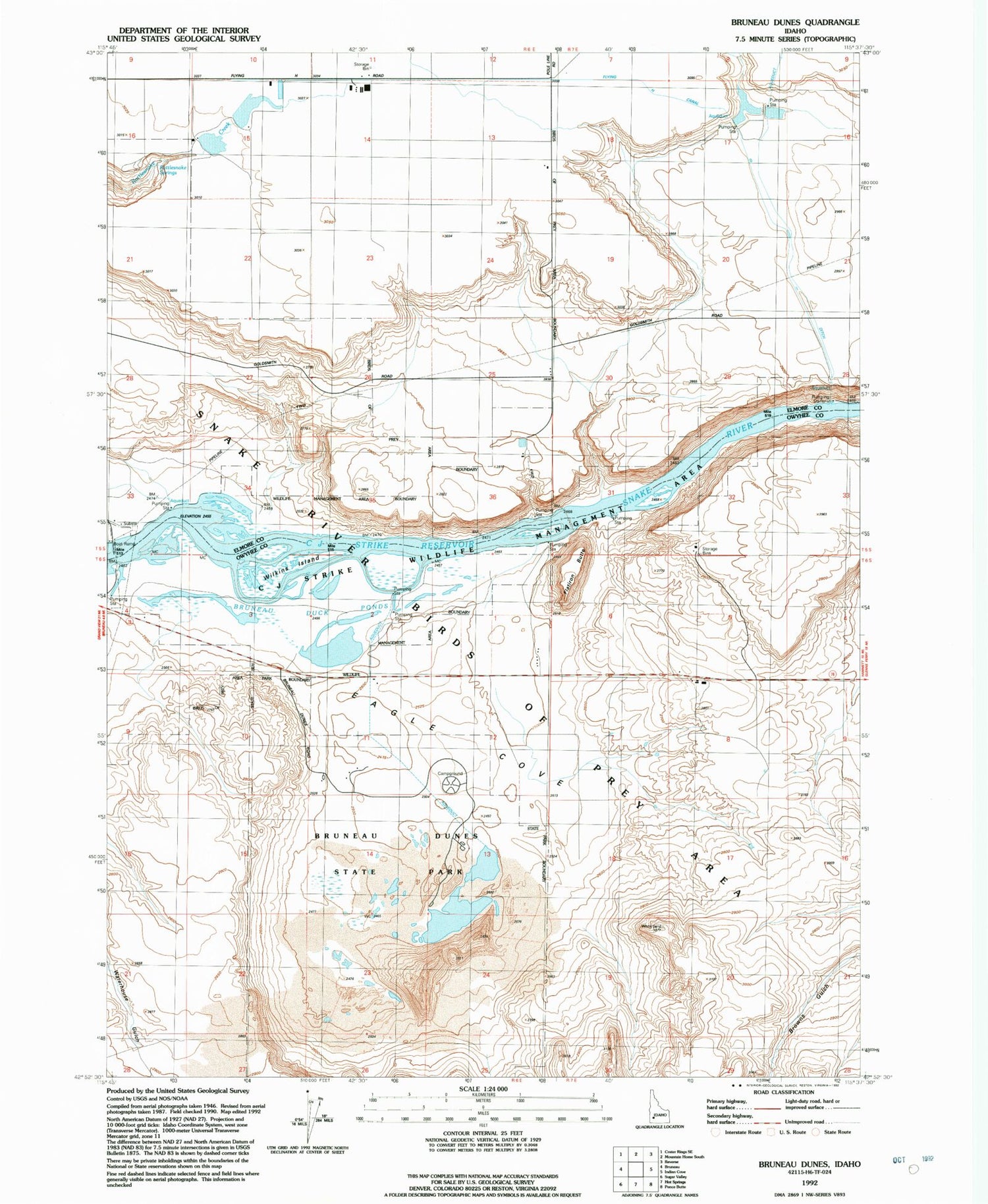
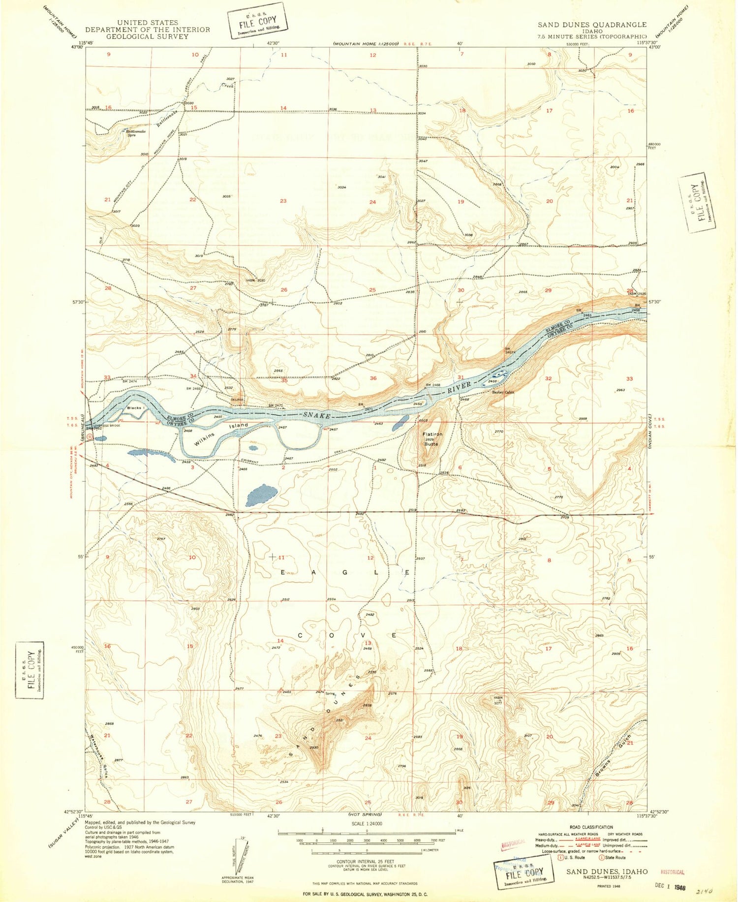
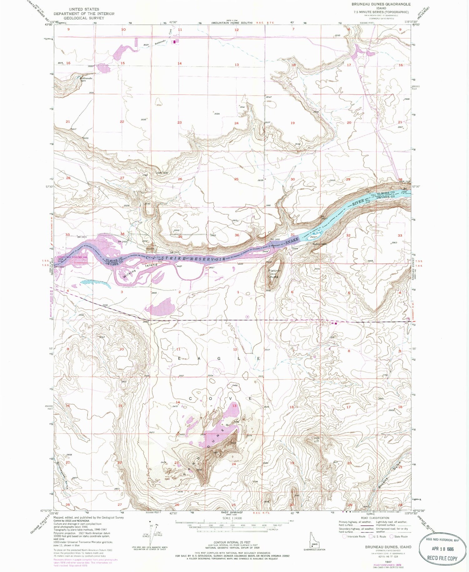
MyTopo
Classic USGS Bruneau Dunes Idaho 7.5'x7.5' Topo Map
Regular price
$16.95
Regular price
Sale price
$16.95
Unit price
per
Couldn't load pickup availability
Historical USGS topographic quad map of Bruneau Dunes in the state of Idaho. Map scale may vary for some years, but is generally around 1:24,000. Print size is approximately 24" x 27"
This quadrangle is in the following counties: Elmore, Owyhee.
The map contains contour lines, roads, rivers, towns, and lakes. Printed on high-quality waterproof paper with UV fade-resistant inks, and shipped rolled.
Contains the following named places: Barber Cabin, Blacks Island, Bruneau Duck Ponds, Bruneau Dunes, Bruneau Dunes State Park, C J Strike Wildlife Management Area, Dunes Lake, Eagle Cove, Flatiron Butte, Flying H Canal, Rattlesnake Springs, Snake River Birds of Prey Area, Watson Dam, Wilkins Island


