MyTopo
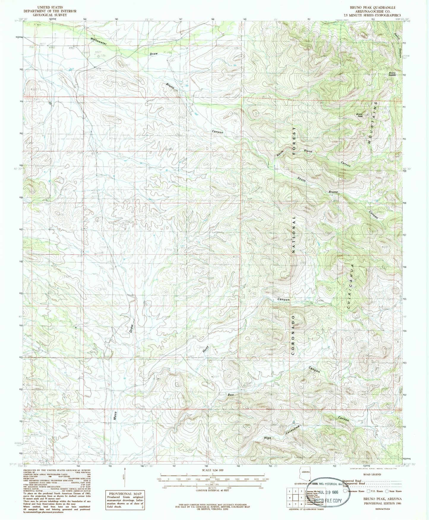
Classic USGS Bruno Peak Arizona 7.5'x7.5' Topo Map
Couldn't load pickup availability
Historical USGS topographic quad map of Bruno Peak in the state of Arizona. Map scale may vary for some years, but is generally around 1:24,000. Print size is approximately 24" x 27"
This quadrangle is in the following counties: Cochise.
The map contains contour lines, roads, rivers, towns, and lakes. Printed on high-quality waterproof paper with UV fade-resistant inks, and shipped rolled.
Contains the following named places: Bar Boot Ranch, Boot Stock Tank, Bower Tank, Bruno Canyon, Bruno Peak, Bruno Saddle, Bruno Tank, Devils Canyon 237, Devils Canyon Tank, Elfrida Division, Glenn Tank, Hunt Canyon, J Bar A Ranch, Leslie Canyon National Wildlife Refuge, Lower Bruno Tank, North Bruno Canyon, OK Ranch, Rucker Cemetery, Rucker School, South Bruno Canyon, Warner Tank, Willcox Tank, Winkler Tank