MyTopo
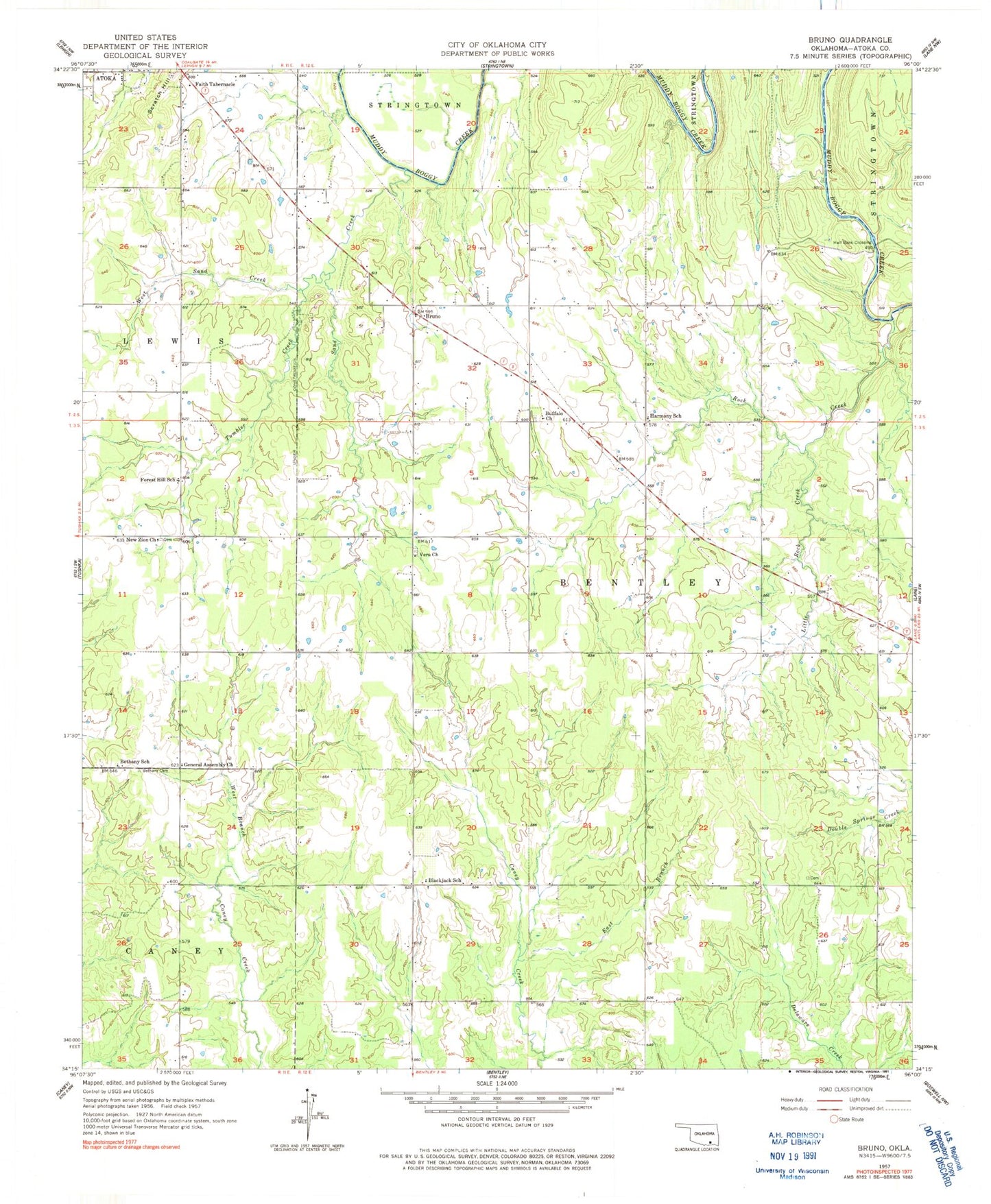
Classic USGS Bruno Oklahoma 7.5'x7.5' Topo Map
Couldn't load pickup availability
Historical USGS topographic quad map of Bruno in the state of Oklahoma. Map scale may vary for some years, but is generally around 1:24,000. Print size is approximately 24" x 27"
This quadrangle is in the following counties: Atoka.
The map contains contour lines, roads, rivers, towns, and lakes. Printed on high-quality waterproof paper with UV fade-resistant inks, and shipped rolled.
Contains the following named places: Atoka County, Bera Cemetery, Bethany Cemetery, Bethany School, Blackjack School, Bruno, Buffalo Church, Buffalo Creek Cemetery, East Branch Caney Creek, Faith Tabernacle, Farris Volunteer Fire Department, Forest Hill School, General Assembly Church, Half Bank Crossing, Harmony Cemetery, Harmony Elementary School, Harmony Fire Department, Lane Fire District, Little Rock Creek, New Zion Cemetery, New Zion Church, Rock Creek, Sand Creek, Scratch Hill, Tumbler Creek, Vera Church, West Sand Creek, ZIP Code: 74525