MyTopo
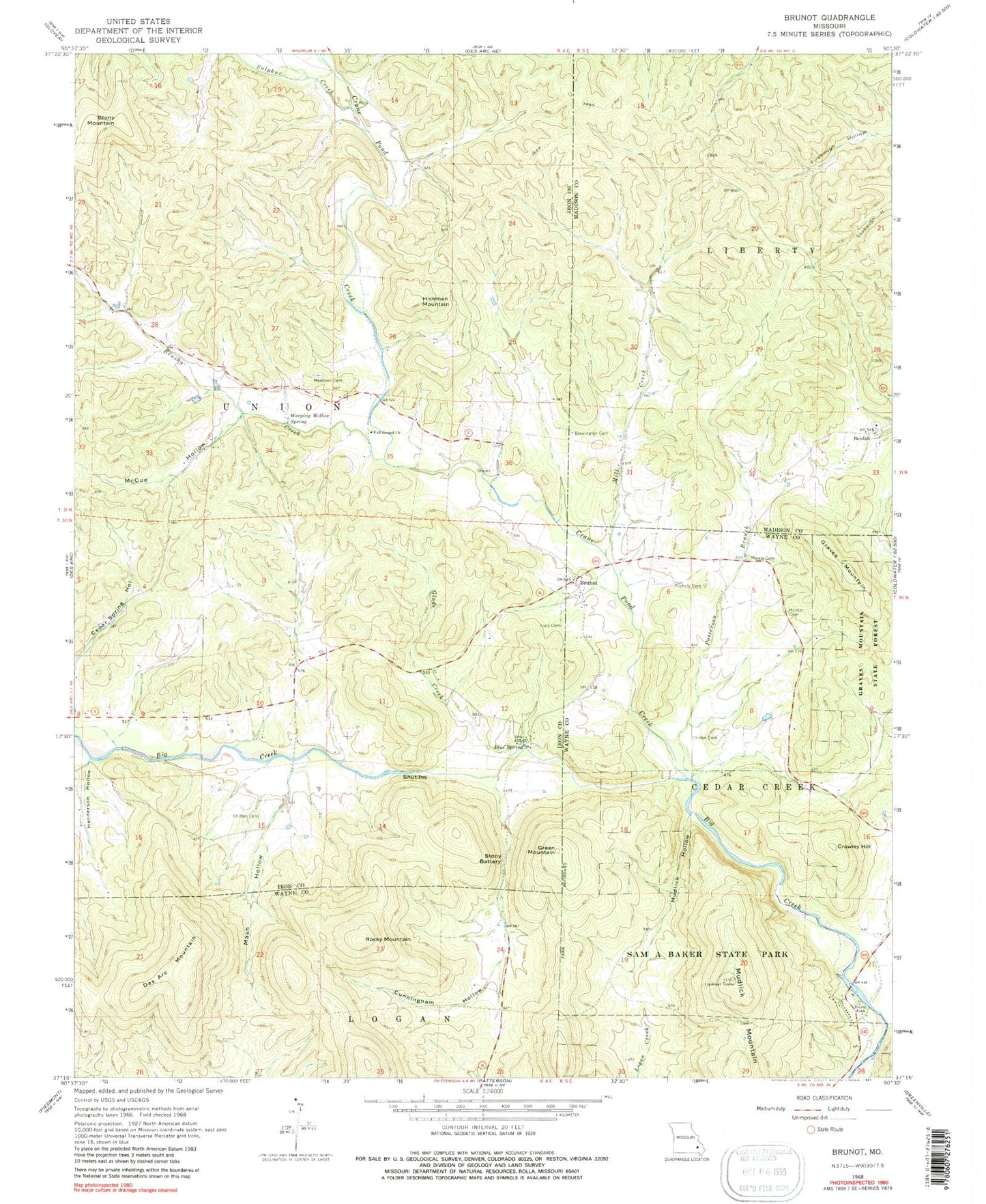
Classic USGS Brunot Missouri 7.5'x7.5' Topo Map
Couldn't load pickup availability
Historical USGS topographic quad map of Brunot in the state of Missouri. Map scale is 1:24000. Print size is approximately 24" x 27"
This quadrangle is in the following counties: Iron, Madison, Wayne.
The map contains contour lines, roads, rivers, towns, and lakes. Printed on high-quality waterproof paper with UV fade-resistant inks, and shipped rolled.
Contains the following named places: Beulah, Beulah Church, Beulah School (historical), Blue Spring, Brewington Cemetery, Brunot, Brunot Creek, Brunot School, Brushy Creek, Chilton Cemetery, Chilton Cemetery, Collins Lake Section 16 Dam, Crane Pond Creek, Crowley Hill, Cunningham Hollow, Des Arc Mountain, E W Graves Porphyry Quarry, Full Gospel Church, Glade Creek, Graves Mountain, Graves Mountain State Forest, Green Mountain, Henderson Hollow, Hickman Mountain, Hunter Cemetery, J.S. Benson Porphyry Quarry, King School, Lindsey Iron Bank, Lucy Cemetery, Mash Hollow, McCue Hollow, Meadows Cemetery, Mill Creek, Morris Cemetery, Mudlick Hollow, Mudlick Mountain, Nichols Cemetery, Patterson Branch, Roberts School, Rocky Mountain, Sam A Baker State Park, Schultz Lake Dam, Shut-Ins, Shy Dam, Shy Lake Dam, Sulphur Creek, Weeping Willow Spring