MyTopo
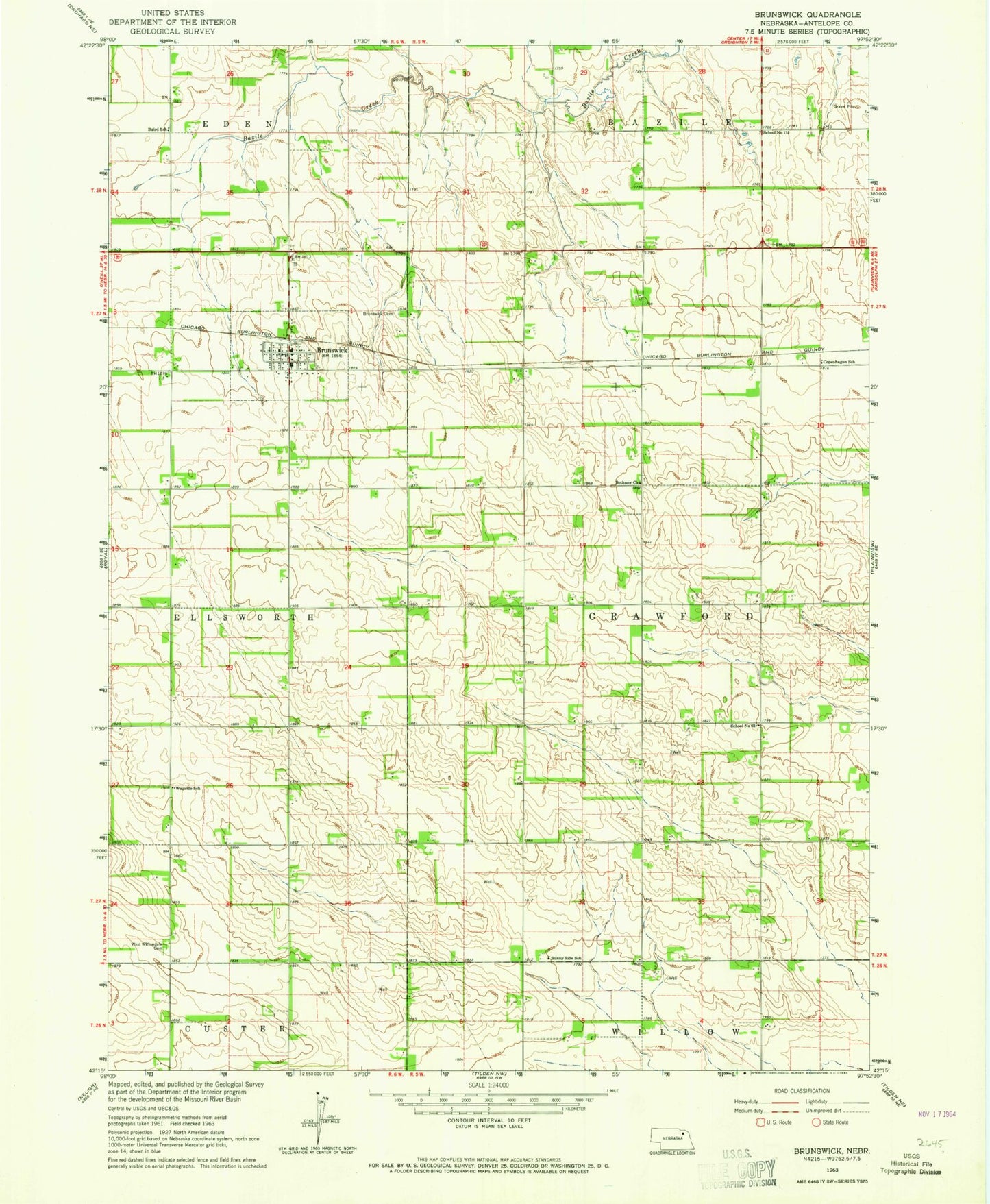
Classic USGS Brunswick Nebraska 7.5'x7.5' Topo Map
Couldn't load pickup availability
Historical USGS topographic quad map of Brunswick in the state of Nebraska. Map scale may vary for some years, but is generally around 1:24,000. Print size is approximately 24" x 27"
This quadrangle is in the following counties: Antelope.
The map contains contour lines, roads, rivers, towns, and lakes. Printed on high-quality waterproof paper with UV fade-resistant inks, and shipped rolled.
Contains the following named places: Baird School, Bethany Church, Brunswick, Brunswick Cemetery, Brunswick Community Church, Brunswick Elementary School, Brunswick Post Office, Brunswick Public Library, Brunswick Volunteer Fire Department, Copenhagen, Copenhagen School, J E Meuret Grain Company Elevator, Saint Ignatius Catholic Church, School Number 115, School Number 62, Sunny Side School, Township of Crawford, Village of Brunswick, Wayside School, West Willowdale Cemetery