MyTopo
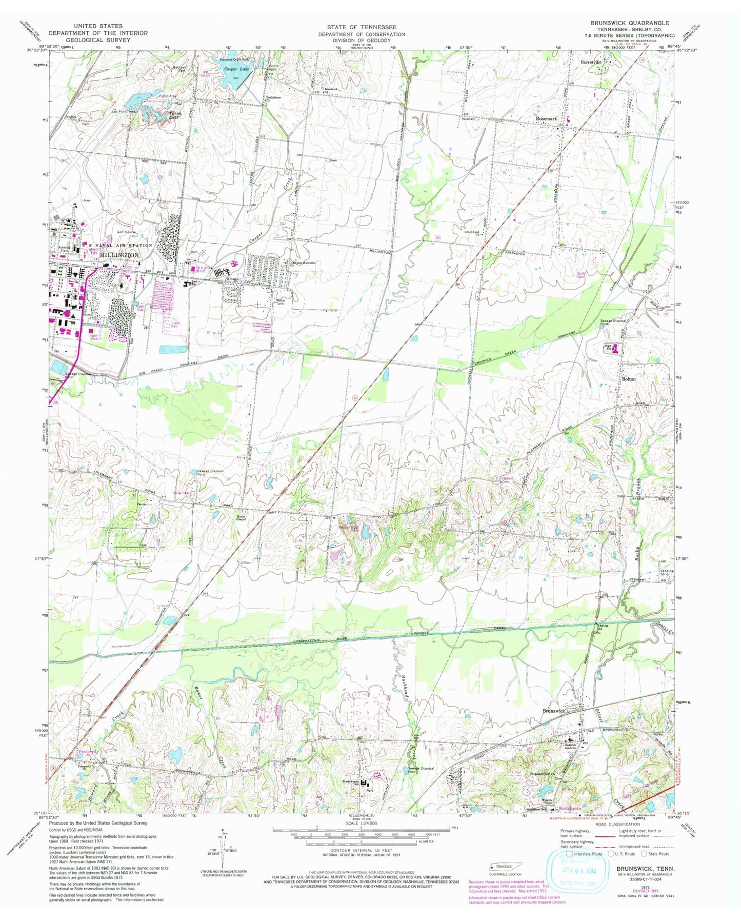
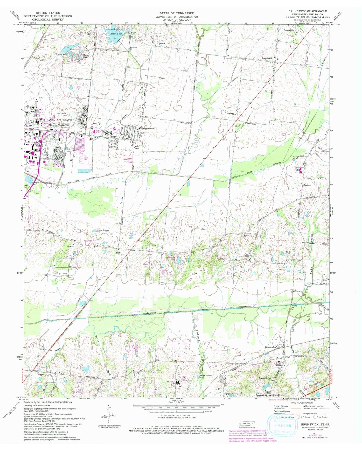
Classic USGS Brunswick Tennessee 7.5'x7.5' Topo Map
Couldn't load pickup availability
Historical USGS topographic quad map of Brunswick in the state of Tennessee. Map scale may vary for some years, but is generally around 1:24,000. Print size is approximately 24" x 27"
This quadrangle is in the following counties: Shelby.
The map contains contour lines, roads, rivers, towns, and lakes. Printed on high-quality waterproof paper with UV fade-resistant inks, and shipped rolled.
Contains the following named places: Barretville, Bartlett Sewage Treatment Plant, Bethel Church, Bethlehem Church, Bethlehem School, Bethuel Cemetery, Bolton, Bolton Bottom School, Bolton High School, Bolton Methodist Church, Brunswick, Brunswick Baptist Church, Brunswick Post Office, Buckhead Creek, Bush Grove, Bush Grove Church Number One, Casper Creek, Casper Lake, Casper Lake Dam, Crooked Creek, Crooked Creek Drainage Canal, Cumberland Church, Downing Dam, Downing Lake, East School, Eastdale Academy, Edmund Orgill Park, Friendship School, Gildfield, Gildfield Cemetery, Gildfield Church, Gilfield School, Greenwood Church, Hampton Memorial Church, Headstart School, Howard Creek, J D Williams Lake Dam, Loosahatchie River Drainage Canal, Millington Airport Fire Station, Millington Police Department, Millington Regional Jetport, Naval Air Station Memphis Post Office, Naval Support Activity Mid-South, Noah Chapel Cemetery, Noahs Chapel, Noahs Chapel School, Oliver Creek, Pearley, Pleasant Ridge Church, Pleasant Ridge Methodist Church Cemetery, Pleasant View Cemetery, Pleasant View Church, Prosperity, Prosperity Church, Prosperity School, Raner Creek, Ray Airport, Richland Church, Rivercrest Baptist Church, Rivercrest Elementary School, Rocky Branch, Rosemark, Rosemark Baptist Church, Rosemark Church, Rosemark Division, Rosemark First Presbyterian Church, Rosemark School, Saint James Christian Methodist Episcopal Church Cemetery, Saint James Church, Scotts Creek, Shadowlawn Middle School, Shady Grove School, Shelby County Fire Department Station 64, Shelby County Fire Department Station 69, Smith Cemetery, Solid Rock Baptist Church, T L Farms, Tanya Lake, Tipton-Rosemark Academy, Williams Chapel, Williams Chapel Cemetery, Williams Chapel School, Williams Church, Wrights Chapel, ZIP Code: 38054